Mountains in Antofagasta
200 mountains and 105 routes in Antofagasta, Chile, each with its own page: heights, seasons, and every way to the top we have mapped.
Mountains
 Cerro Púlar20,449 ft · Antofagasta, ChilePhoto: Image taken by Steve Ross and modified by WeHaKa, CC BY-SA 2.0 (via Wikimedia Commons)
 Volcán Pular20,407 ft · Antofagasta, ChilePhoto: Steve Ross, CC BY-SA 2.0 (via Wikimedia Commons)
 Volcán Aucanquilcha20,256 ft · Antofagasta, ChilePhoto: Barryalanwalker, CC BY-SA 3.0 (via Wikimedia Commons)
 Volcán San Pedro20,079 ft · Antofagasta, ChilePhoto: Diego Delso, CC BY-SA 4.0 (via Wikimedia Commons)
 Volcán San Pablo19,987 ft · Antofagasta, ChilePhoto: Gerard Prins, CC BY-SA 3.0 (via Wikimedia Commons)
 Volcán Acamarachi19,836 ft · Antofagasta, ChilePhoto: Valerio Pillar from -, CC BY-SA 2.0 (via Wikimedia Commons)
 Volcán Palpana19,760 ft · Antofagasta, ChilePhoto: Albert Backer, CC BY-SA 3.0 (via Wikimedia Commons)
- Cerro Pajonales19,547 ft · Antofagasta, Chile
- Cerro Polapi19,518 ft · Antofagasta, Chile
 Volcán Paniri19,508 ft · Antofagasta, ChilePhoto: Diego Delso, CC BY-SA 4.0 (via Wikimedia Commons)
 Volcán Aguas Calientes19,436 ft · Antofagasta, ChilePhoto: Silvio Rossi, Archive link, CC BY 3.0 (via Wikimedia Commons)
 Volcán Miñiques19,390 ft · Antofagasta, ChilePhoto: Gerard Prins, CC BY-SA 3.0 (via Wikimedia Commons)
 Volcán Puntas Negras19,199 ft · Antofagasta, ChilePhoto: Gerard Prins, CC BY-SA 3.0 (via Wikimedia Commons)
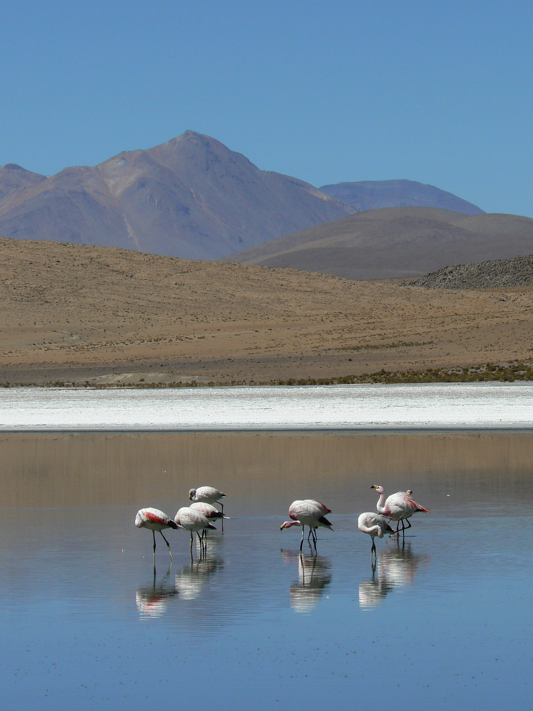 Cerro del Azufre19,180 ft · Antofagasta, ChilePhoto: Iain and Sarah from London, UK, CC BY 2.0 (via Wikimedia Commons)
 Cerro Lejía19,006 ft · Antofagasta, ChilePhoto: Juan Manuel Fluxà from Barcelona, Spain, CC BY 2.0 (via Wikimedia Commons)
 Cerro Chiliques18,957 ft · Antofagasta, ChilePhoto: Gerard Prins, CC BY-SA 3.0 (via Wikimedia Commons)
 Volcán Escalante18,930 ft · Antofagasta, ChilePhoto: Gerard Prins, CC BY-SA 3.0 (via Wikimedia Commons)
- Volcán Ojos del Toro18,898 ft · Antofagasta, Chile
 Nevados de Poquis18,885 ft · Antofagasta, ChilePhoto: Carlos Urzua, CC BY 2.0 (via Wikimedia Commons)
 Volcán Colorado18,858 ft · Antofagasta, ChilePhoto: Bachelot Pierre J-P, CC BY-SA 3.0 (via Wikimedia Commons)
 Cerro del León18,799 ft · Antofagasta, ChilePhoto: Robin Fernandes, CC BY-SA 2.0 (via Wikimedia Commons)
- Cerro Curiquinca18,773 ft · Antofagasta, Chile
- Cerro Cebollar18,753 ft · Antofagasta, Chile
- Cerro El Chascón18,711 ft · Antofagasta, Chile
- Tuyajto Grande o Norte18,684 ft · Antofagasta, Chile
- Volcán Azufre o Lastarria18,635 ft · Antofagasta, Chile
 Cerro Tumisa18,563 ft · Antofagasta, ChilePhoto: Pablo Garcia Saldaña pagsa_, CC0 (via Wikimedia Commons)
- Cerro Chela18,517 ft · Antofagasta, Chile
 Cerro Chajnantor18,504 ft · Antofagasta, ChilePhoto: ESO, CC BY 4.0 (via Wikimedia Commons)
 Cerros de Incahuasi18,501 ft · Antofagasta, ChilePhoto: Luca Galuzzi (Lucag), CC BY-SA 2.5 (via Wikimedia Commons)
- Volcán Miño18,474 ft · Antofagasta, Chile
 Volcán Colachi18,474 ft · Antofagasta, ChilePhoto: Danielle Pereira, CC BY 2.0 (via Wikimedia Commons)
- Cerro Cumbre Negra18,461 ft · Antofagasta, Chile
 Cerro Guayaques18,458 ft · Antofagasta, ChilePhoto: Gerard Prins, CC BY-SA 3.0 (via Wikimedia Commons)
 Cerro Miscanti18,445 ft · Antofagasta, ChilePhoto: Gerard Prins, CC BY-SA 3.0 (via Wikimedia Commons)
- Cerro Inca18,438 ft · Antofagasta, Chile
- Cerro Deslinde18,412 ft · Antofagasta, Chile
 Cerro Toco18,386 ft · Antofagasta, ChilePhoto: Gerard Prins, CC BY-SA 3.0 (via Wikimedia Commons)
 Volcán Láscar18,346 ft · Antofagasta, ChilePhoto: Gerard Prins, CC BY-SA 3.0 (via Wikimedia Commons)
- Cerro Aguilucho18,310 ft · Antofagasta, Chile
- Cerro Leoncito18,268 ft · Antofagasta, Chile
- Cerro Cenizas18,140 ft · Antofagasta, Chile
- Cerro Negro18,110 ft · Antofagasta, Chile
- Cerro Rayado18,022 ft · Antofagasta, Chile
- Cerro Tuyajto17,986 ft · Antofagasta, Chile
- Cerro Abra del Gallo17,979 ft · Antofagasta, Chile
- Cerro Laguna Escondida17,969 ft · Antofagasta, Chile
- Cerro Azufrera Yacimiento17,959 ft · Antofagasta, Chile
- Cerro Punas17,920 ft · Antofagasta, Chile
- Cerro Cenizas17,917 ft · Antofagasta, Chile
- Cerro Chascón17,907 ft · Antofagasta, Chile
- Cerro Polán17,818 ft · Antofagasta, Chile
 Volcán Laguna Verde17,815 ft · Antofagasta, ChilePhoto: Gerard Prins, CC BY-SA 3.0 (via Wikimedia Commons)
- Cerro Candelaria17,808 ft · Antofagasta, Chile
- Cerro Las Chinchillas17,785 ft · Antofagasta, Chile
 Volcán Olca17,740 ft · Antofagasta, ChilePhoto: Diego Delso, CC BY-SA 4.0 (via Wikimedia Commons)
- Cerro Santo Domingo17,720 ft · Antofagasta, Chile
- Cerro Tres Rayas17,701 ft · Antofagasta, Chile
- Cerro Moños17,690 ft · Antofagasta, Chile
- Cerro Azufrera Aguas Calientes17,680 ft · Antofagasta, Chile
 Cerro Toconce17,651 ft · Antofagasta, ChilePhoto: Gerard Prins, CC BY-SA 3.0 (via Wikimedia Commons)
 Cerro Purico17,635 ft · Antofagasta, ChilePhoto: Silvio Rossi, CC BY 3.0 (via Wikimedia Commons)
- Cerro Azufrera Perro Muerto17,631 ft · Antofagasta, Chile
- Cerro Losloyo17,618 ft · Antofagasta, Chile
- Cerro Overo17,615 ft · Antofagasta, Chile
 Lastarria17,605 ft · Antofagasta, ChilePhoto: Gerhard Haubold, CC BY-SA 3.0 (via Wikimedia Commons)
- Cerro Lagunita17,592 ft · Antofagasta, Chile
- Cumbre Blanca17,582 ft · Antofagasta, Chile
 Cerro Chao17,564 ft · Antofagasta, ChilePhoto: NASA Earth Observatory images by Robert Simmon, using Landsat 8 data from the USGS Earth Explorer, Public domain (via Wikimedia Commons)
- Cerro Alitar17,539 ft · Antofagasta, Chile
- Cerro Tecar17,523 ft · Antofagasta, Chile
- Cerro Agua Delgada17,487 ft · Antofagasta, Chile
 Pico El Laco17,470 ft · Antofagasta, ChilePhoto: Daniel P. Gauer from Porto Alegre, Brasil, CC BY 2.0 (via Wikimedia Commons)
- Cerro de Potor17,448 ft · Antofagasta, Chile
- Cerro Incahuasi17,405 ft · Antofagasta, Chile
- Cerro Minchincha17,405 ft · Antofagasta, Chile
- Cerro Corona17,359 ft · Antofagasta, Chile
- Cerro Purifican17,339 ft · Antofagasta, Chile
- Cerro Apacheta17,329 ft · Antofagasta, Chile
- Cerro de las Cuevas17,323 ft · Antofagasta, Chile
- Cerro Áspero17,264 ft · Antofagasta, Chile
- Cerro Negro17,224 ft · Antofagasta, Chile
- Cerro Laco17,175 ft · Antofagasta, Chile
- Rocas Negras17,156 ft · Antofagasta, Chile
- Cerro Casliri17,136 ft · Antofagasta, Chile
- Cerro de La Pena17,126 ft · Antofagasta, Chile
- Cerro Aguas Delgadas17,126 ft · Antofagasta, Chile
- Cerro Peña Negra17,123 ft · Antofagasta, Chile
- Cerro Tanque17,119 ft · Antofagasta, Chile
- Cerro Cosca17,110 ft · Antofagasta, Chile
- Monte Rodado17,110 ft · Antofagasta, Chile
- Cerro Bola17,106 ft · Antofagasta, Chile
- Cerro Pocaumo17,077 ft · Antofagasta, Chile
- Cerro Capur17,073 ft · Antofagasta, Chile
- Cerro Lámpara17,054 ft · Antofagasta, Chile
- Cerro Quebrado17,037 ft · Antofagasta, Chile
- Cerro Gordo17,008 ft · Antofagasta, Chile
- Volcán Tátio16,991 ft · Antofagasta, Chile
- Cerro Blanco16,988 ft · Antofagasta, Chile
- Cerro Aguas Calientes16,978 ft · Antofagasta, Chile
- Cerro del Tatio16,962 ft · Antofagasta, Chile
- Cerro Olca Sur16,959 ft · Antofagasta, Chile
- Cerro Corralito16,929 ft · Antofagasta, Chile
- Cerro Negro16,929 ft · Antofagasta, Chile
- Cerro Yalquis16,864 ft · Antofagasta, Chile
- Cerro Negro de Pujsa16,847 ft · Antofagasta, Chile
- Cerro Palpana16,844 ft · Antofagasta, Chile
- Cerro Talar16,841 ft · Antofagasta, Chile
- Cerro Guanaquero16,837 ft · Antofagasta, Chile
 Cerros de Macón16,831 ft · Antofagasta, ChilePhoto: Gerard Prins, CC BY-SA 3.0 (via Wikimedia Commons)
- Cerro Puquios16,831 ft · Antofagasta, Chile
- Cerro Chico16,811 ft · Antofagasta, Chile
- Cerro Coquena16,762 ft · Antofagasta, Chile
- Cerro Colorado16,683 ft · Antofagasta, Chile
- Cerro La Torta16,667 ft · Antofagasta, Chile
- Cerro Challhuiri16,641 ft · Antofagasta, Chile
- Cerro Chac-Inca16,640 ft · Antofagasta, Chile
- Cerro Aguas Calientes16,637 ft · Antofagasta, Chile
- Cerro de Jeche16,604 ft · Antofagasta, Chile
- Cerro Arenoso16,601 ft · Antofagasta, Chile
- Cerro Agua Amarga16,594 ft · Antofagasta, Chile
- Cerro Santa Bárbara16,581 ft · Antofagasta, Chile
- Cerro El Chaco16,552 ft · Antofagasta, Chile
- Cerro Carasilla16,535 ft · Antofagasta, Chile
- Cerro Carasilla16,535 ft · Antofagasta, Chile
- Cerro Pabellón16,503 ft · Antofagasta, Chile
- Cerro Negro16,503 ft · Antofagasta, Chile
- Cerro Negro16,486 ft · Antofagasta, Chile
- Cerro Peineta16,434 ft · Antofagasta, Chile
- Volcán Hecar16,421 ft · Antofagasta, Chile
- Cerro Pinchal16,407 ft · Antofagasta, Chile
- Cerro Puripica16,394 ft · Antofagasta, Chile
- Monte Las Tinas16,365 ft · Antofagasta, Chile
- Cerro Lailay16,286 ft · Antofagasta, Chile
- Monte Blanco16,243 ft · Antofagasta, Chile
 Cerro Jorquencal16,240 ft · Antofagasta, ChilePhoto: WeHaKa, CC BY-SA 4.0 (via Wikimedia Commons)
- Cerro Colorado16,227 ft · Antofagasta, Chile
- Cerro Sico16,224 ft · Antofagasta, Chile
- Cerro El Chivato Muerto16,220 ft · Antofagasta, Chile
- Cerro de Río Negro16,188 ft · Antofagasta, Chile
- Cerro del Pajonal16,175 ft · Antofagasta, Chile
- Cerro Silaguala16,168 ft · Antofagasta, Chile
- Cerro Campana16,165 ft · Antofagasta, Chile
- Cerro Peineta16,161 ft · Antofagasta, Chile
- Lay lay16,158 ft · Antofagasta, Chile
- Cerro Bayo o Pelado16,099 ft · Antofagasta, Chile
- Cerro Carcanal16,014 ft · Antofagasta, Chile
- Cerros de Macón15,961 ft · Antofagasta, Chile
- Cerro Pabelloncito15,948 ft · Antofagasta, Chile
- Cerro Negro15,945 ft · Antofagasta, Chile
- Cerro Las Cotas15,938 ft · Antofagasta, Chile
- Cerro Cupo15,879 ft · Antofagasta, Chile
- Cerro Alconcha15,850 ft · Antofagasta, Chile
- Cerro Moño15,846 ft · Antofagasta, Chile
- Cerro Bayo Sur15,833 ft · Antofagasta, Chile
- Cerro Laco Norte15,833 ft · Antofagasta, Chile
- Cerro Pabellón15,832 ft · Antofagasta, Chile
- Cerro La Cantera15,830 ft · Antofagasta, Chile
- Cerro Hojalar15,827 ft · Antofagasta, Chile
- Cerro Puruchare15,807 ft · Antofagasta, Chile
- Cerro La Chinchilla15,797 ft · Antofagasta, Chile
- Cerro Agua Rica15,787 ft · Antofagasta, Chile
 Cerro Cosor15,702 ft · Antofagasta, ChilePhoto: WeHaKa, CC BY-SA 4.0 (via Wikimedia Commons)
- Cerro Copacoya15,692 ft · Antofagasta, Chile
- Cerro Jarellón15,630 ft · Antofagasta, Chile
- Cerro Morado15,587 ft · Antofagasta, Chile
- Cerro Las Tecas15,574 ft · Antofagasta, Chile
- Cerro Laco Sur15,548 ft · Antofagasta, Chile
- Cerro Gordo15,531 ft · Antofagasta, Chile
- Cerro La Campana15,492 ft · Antofagasta, Chile
- Cerro Pabellón15,463 ft · Antofagasta, Chile
- Cerro Mellizos15,436 ft · Antofagasta, Chile
- Cerro Aycina15,371 ft · Antofagasta, Chile
- Alto Ojo de Cáblor15,358 ft · Antofagasta, Chile
- Cerro Chamaca15,344 ft · Antofagasta, Chile
- Cerro Médano15,328 ft · Antofagasta, Chile
- Cerro Bolitas15,325 ft · Antofagasta, Chile
- Cerro Negro de Barriales15,305 ft · Antofagasta, Chile
- Cerro Bayo15,292 ft · Antofagasta, Chile
- Cerro Inca15,289 ft · Antofagasta, Chile
- Cerro Negro15,249 ft · Antofagasta, Chile
- Cerro Tenco15,223 ft · Antofagasta, Chile
- Cerro Cueva Blanca15,220 ft · Antofagasta, Chile
- Pabellón15,200 ft · Antofagasta, Chile
- Cerro Tocomar15,187 ft · Antofagasta, Chile
- Cerro Totoral15,161 ft · Antofagasta, Chile
- Cerro Dos Hermanas15,141 ft · Antofagasta, Chile
- Cerro Partido15,108 ft · Antofagasta, Chile
- Cerro Yuma15,082 ft · Antofagasta, Chile
- Cerro Cabeza de León15,066 ft · Antofagasta, Chile
- Cerro Colorado15,059 ft · Antofagasta, Chile
- Cerro Cabo15,059 ft · Antofagasta, Chile
- Cerro de Paqui15,056 ft · Antofagasta, Chile
- Cerro San Rosendo15,039 ft · Antofagasta, Chile
- Cerro Negro15,020 ft · Antofagasta, Chile
- Cerro Bayo15,000 ft · Antofagasta, Chile
 Cerro Murchota14,997 ft · Antofagasta, ChilePhoto: Image taken by Diego Delso, delso.photo and modified by WeHaKa, CC BY-SA 4.0 (via Wikimedia Commons)
- Cerro Pereda14,994 ft · Antofagasta, Chile
- Alto de Puripica14,987 ft · Antofagasta, Chile
- Domo Falda Grande14,961 ft · Antofagasta, Chile
Routes that start here
- Alta de Quitor
- Ascenso Ruta Mirador (774 M)Moderate · 0.5 mi · 572 ft gain
- Atacama Large Millimeter Array Science Preserve
- Auto Club
- Balneareo El Trocadero
- Balneario Municipal
- Balneario Municipal de Mejillones
- BARRIO CIVICO VP
- BARRIO CIVICO VP
- Bien Nacional Protegido Isla Santa María
- Bien Nacional Protegido Laguna Lejía
- Bien Nacional Protegido Península de Mejillones
- Blanco Encalada
- Budeo
- Buenas Peras
- Caleta Botija
- Camino a La Cumbre Del LicancaburExpert · 1.9 mi · 60 ft gain
- Camino Hacia Ex Estación De Ferrocarriles0.6 mi round trip · 29 ft gain
- Camp site Laguna Lejia
- Camping Chacance
- Camping Comdes Calama
- Camping Extraccion Calama
- Camping Mejillones Codelco Norte
- Camping Rucamóvil
- Camping San Lorenzo
- Casas de Valle
- Casino Sub Oficiales Ejército
- Cúpula
- Eco Camping Waira
- El Huáscar
- El Lenguado
- El Sendero Que No Cuesta NadaModerate · 1.4 mi · 508 ft gain
- Esencia del Desierto
- Historic Inca Trail0.6 mi · 40 ft gain
- Hornitos
- Humedal Urbano Río Loa
- Humedal Urbano Salar del Carmen
- Inicio laberinto de las brujas
- La Casa del Sol Naciente
- La Chimba
- La Rinconada
- La Ruta Del Guanaco2.8 mi round trip · 2,015 ft gain
- Las Garumas
- Los Chañares
- Los Perales
- Monumento Natural La Portada
- Monumento Natural Paposo Norte
- Muelle de piedra
- Nilda Point
- Parque Astronómico Atacama
- Parque Nacional Llullaillaco
- Parque Nacional Morro Moreno
- Parque Pozo 3
- PLATAFORMA CPMSH
- Plataforma VP
- Playa Amarilla
- Playa Antofagasta
- Playa Antofagasta
- Playa Artificial Covadonga
- playa Atacama
- playa bonita
- Playa Cachinales
- Playa Chacaya
- Playa Cifuncho
- Playa Escondida
- Playa Juan Lopez
- Playa Las Almejas
- Playa Las Losas
- Playa Las Tórtolas
- Playa Los Choros
- Playa Matancillas
- Playa Mejillones
- Playa Paraíso
- Playa Ramaditas
- Playa Santo Domingo
- Playa Taltal
- Playa Tierra del Moro
- PMCHS
- Poza de los Gringos
- Punta Rieles
- Puritama
- Quilarcay
- Reserva Elemental Puri Beter
- Reserva Marina La Rinconada
- Reserva Nacional La Chimba
- Reserva Nacional Los Flamencos
- Reserva Natural Puritama
- Retorno Ruta Mirador (1075 M)Moderate · 0.7 mi · 701 ft gain
- Río Grande - Machuca5.9 mi round trip · 2,443 ft gain
- Ruta De Trekking Quebrada La ChimbaModerate · 4.6 mi · 2,293 ft gain
- Santuario de la Naturaleza Itata - Gualaguala
- Santuario de la Naturaleza Laguna Tebenquiche
- Santuario de la Naturaleza Quebrada Ojo de Opache
- Santuario de la Naturaleza Valle de la Luna y Sierra de Orbate
- Sendero Al Alero De Taira1.9 mi round trip · 930 ft gain
- Sendero Quimal2.4 mi round trip · 2,467 ft gain
- Sitio Ramsar Salar de Aguas Calientes IV
- Sitio Ramsar Salar de Pujsa
- Sitio Ramsar Salar de Tara
- Sitio Ramsar Sistema Hidrológico de Soncor del Salar de Atacama
- Star TrackModerate · 2.2 mi · 1,262 ft gain
- Talabre codelco
- Tribu de LoreVilca
- Valle De Los Cactus3.7 mi round trip · 1,256 ft gain
- Viejo Griego
