Treutsebo
 Photo: Rémih, CC BY-SA 4.0 (via Wikimedia Commons)
- 9,570 ft
- summit
Treutsebo is a mountain in Valais, Switzerland, with its summit at about 9,570 ft (2,917 m) above sea level. No mapped trail reaches the top in OpenStreetMap, so plan the approach with local maps or a guide. The nearest town is La Fouly, about 1.8 miles north of the summit. Peaks within about 3 miles include Crête Sèche, Grande Pointe des Planereuses and Tita Naire. Cascade du Dolent is within about 3 miles. For camping, Camping des Glaciers and Relais d'Arpette are within about 6 miles. It is part of the Mont Blanc massif. These details come from Wikidata. The location and elevation come from OpenStreetMap and the Copernicus 90 m elevation model. Check local access rules and conditions before you go.
Conditions and forecast
Daily highs and lows, wind and the chance of precipitation at the summit for the next 7 days, from the Open-Meteo model.
- Summit elevation
- 9,570 ft
We don't know of a mapped trail or route to the summit of Treutsebo. Plan the approach with local maps, a guidebook or a local guide, and check conditions before you go.
Questions about Treutsebo
How tall is Treutsebo?
9,570 ft (2,917 m).
Is there a trail to the top of Treutsebo?
We don't know of a mapped trail or route to the summit. Plan the approach with local maps, a guidebook or a local guide.
 Grandes Jorasses13,806 ft · Aosta Valley, Italy1 route7.7 mi awayPhoto: Ferrand, Henri (1853-1926). Photographe, Public domain (via Wikimedia Commons)
 Grand Combin14,137 ft · Valais, Switzerland1 route10 mi awayPhoto: Carsten Steger, CC BY-SA 4.0 (via Wikimedia Commons)
 Mont Blanc15,768 ft · Auvergne-Rhône-Alpes, France1 route14 mi awayPhoto: Christian David, CC BY-SA 4.0 (via Wikimedia Commons)
 Dent Blanche14,295 ft · Valais, Switzerland1 route26 mi awayPhoto: Carsten Steger, CC BY-SA 4.0 (via Wikimedia Commons)
 Matterhorn14,692 ft · Aosta Valley, Italy1 route28 mi awayPhoto: Gianluca Miscione, CC BY-SA 4.0 (via Wikimedia Commons)
 Gran Paradiso13,323 ft · Aosta Valley, Italy1 route32 mi awayPhoto: Marie-Lan Taÿ Pamart, CC BY 4.0 (via Wikimedia Commons)
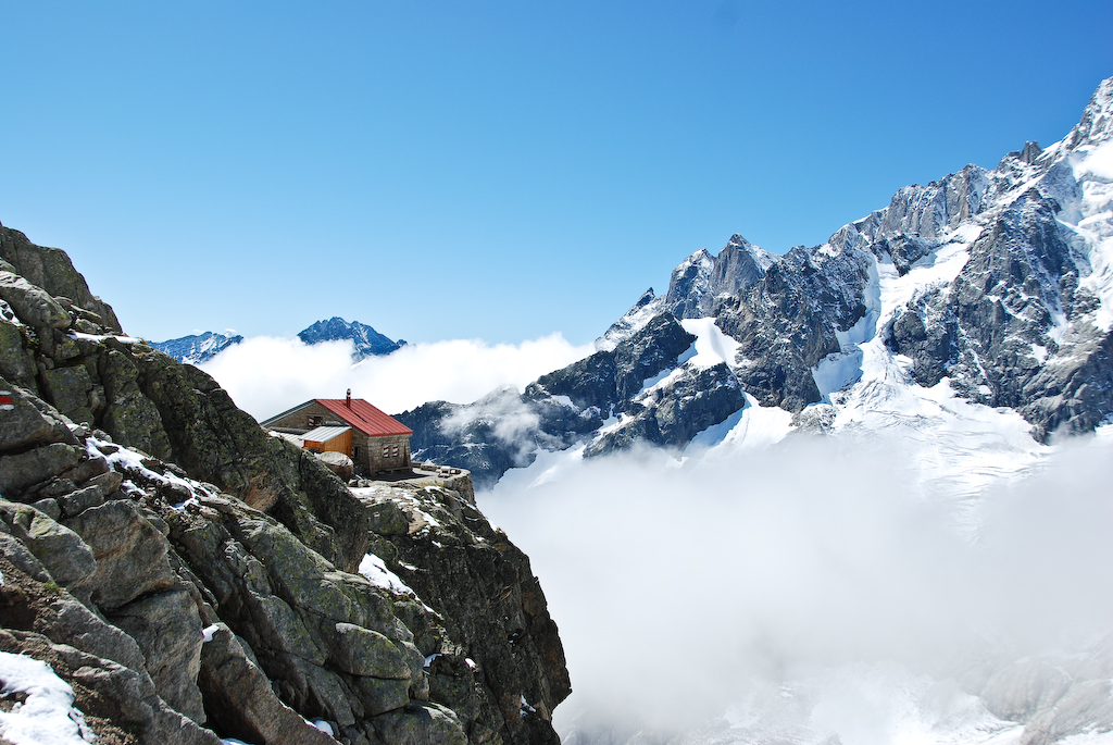 Cabane de l'A Neuve CASHut campingPhoto: Poschi, CC BY-SA 3.0 (via Wikimedia Commons)1.1 mi
 Grand DarraySummitPhoto: Christian, CC BY-SA 1.0 (via Wikimedia Commons)1.2 mi
- Cabane de Saleinaz CASHut camping1.5 mi
 Sentier de la cabane de l'A NeuveHikingPhoto: Rémih, CC BY-SA 4.0 (via Wikimedia Commons)1.7 mi
- Camping des GlaciersCamping1.7 mi
 Chemin des cols alpinsHikingPhoto: Rémih, CC BY-SA 4.0 (via Wikimedia Commons)1.9 mi
 La MayeSummitPhoto: Rémih, CC BY-SA 4.0 (via Wikimedia Commons)2.1 mi
 Cascade de BérardWaterfallPhoto: Rémih, CC BY-SA 4.0 (via Wikimedia Commons)9.4 mi
Source: Roamze catalog (indexable pages within 10 miles, PostGIS distance)
- Grand DarraySummit · ~2 min drivePhoto: Christian, CC BY-SA 1.0 (via Wikimedia Commons)
- La MayeSummit · ~4 min drivePhoto: Rémih, CC BY-SA 4.0 (via Wikimedia Commons)
 Pointe des PlinesSummit · ~4 min drivePhoto: SergeDeto, CC BY-SA 4.0 (via Wikimedia Commons)
 Aiguille de l'A NeuveSummit · ~4 min drivePhoto: Terra3, CC BY-SA 3.0 (via Wikimedia Commons)
 Tour NoirSummit · ~4 min drivePhoto: Björn S..., CC BY-SA 2.0 (via Wikimedia Commons)
 Clochers du PortaletSummit · ~4 min drivePhoto: Joris Egger, CC BY-SA 3.0 (via Wikimedia Commons)
 Mont de la FoulySummit · ~5 min drivePhoto: Rémih, CC BY-SA 4.0 (via Wikimedia Commons)
 PortaletSummit · ~5 min drivePhoto: François Bianco, CC BY-SA 2.0 (via Wikimedia Commons)
 Aiguilles Rouges du Dolent - Pointe KurzSummit · ~5 min drivePhoto: Pmau, CC BY-SA 4.0 (via Wikimedia Commons)
 Crêtet de la GouilleSummit · ~5 min drivePhoto: Rémih, CC BY-SA 4.0 (via Wikimedia Commons)
Also worth it near here
- Sentier de la cabane de l'A NeuveHiking · ~3 min drivePhoto: Rémih, CC BY-SA 4.0 (via Wikimedia Commons)
- Cascade du DolentWaterfall · ~4 min drive
 Cabane d'OrnyHut camping · ~6 min drivePhoto: François Bianco, CC BY-SA 2.0 (via Wikimedia Commons)
- Bisse de la TourMountain biking · ~7 min drive
- Col du Passon RouteSki touring · ~8 min drive
Map and trail data © OpenStreetMap contributors
