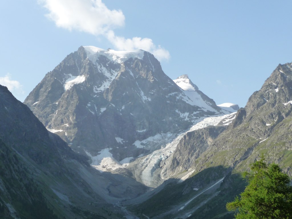
La Maya
 Photo: Whgler, CC BY-SA 4.0 (via Wikimedia Commons)
- 9,406 ft
- summit
La Maya is a mountain in Valais, Switzerland, with its summit at about 9,410 ft (2,867 m) above sea level. Mapped trails that come within about half a mile of the top include Sentier de Bricola and Sentier de la Dent-Blanche. The nearest town is La Forclaz VS, about 3.4 miles southeast of the summit. Peaks within about 3 miles include Pointe de Bricolla, Dent des Rosses and Pointe du Mourti Occidentale. For camping, Camping d'Evolène and Relais de la Tzoucdana are within about 6 miles. Administratively, it is in Hérens District. These details come from Wikidata. The location and elevation come from OpenStreetMap and the Copernicus 90 m elevation model. Check local access rules and conditions before you go.
Conditions and forecast
Daily highs and lows, wind and the chance of precipitation at the summit for the next 7 days, from the Open-Meteo model.
- Summit elevation
- 9,406 ft
We don't know of a mapped trail or route to the summit of La Maya. Plan the approach with local maps, a guidebook or a local guide, and check conditions before you go.
Questions about La Maya
How tall is La Maya?
9,406 ft (2,867 m).
Is there a trail to the top of La Maya?
We don't know of a mapped trail or route to the summit. Plan the approach with local maps, a guidebook or a local guide.
 Dent Blanche14,295 ft · Valais, Switzerland1 route2.4 mi awayPhoto: Carsten Steger, CC BY-SA 4.0 (via Wikimedia Commons)
 Matterhorn14,692 ft · Aosta Valley, Italy1 route6.8 mi awayPhoto: Gianluca Miscione, CC BY-SA 4.0 (via Wikimedia Commons)
 Weisshorn14,780 ft · Valais, Switzerland1 route7.7 mi awayPhoto: Christian David, CC BY-SA 4.0 (via Wikimedia Commons)
 Dom14,915 ft · Valais, Switzerland1 route14 mi awayPhoto: Zacharie Grossen, CC BY-SA 3.0 (via Wikimedia Commons)
 Grand Combin14,137 ft · Valais, Switzerland1 route15 mi awayPhoto: Carsten Steger, CC BY-SA 4.0 (via Wikimedia Commons)
 Dufourspitze15,203 ft · Valais, Switzerland1 route16 mi awayPhoto: TobiasBender, CC BY-SA 3.0 (via Wikimedia Commons)
 Sentier de BricolaHikingPhoto: Henk Monster, CC BY 3.0 (via Wikimedia Commons)0.5 mi
 Sentier de la Dent-BlancheHikingPhoto: Henk Monster, CC BY 3.0 (via Wikimedia Commons)0.5 mi
- Dent Blanche: Wandfluegrat (from Ferpècle (Le Salay))MountaineeringPhoto: Carsten Steger, CC BY-SA 4.0 (via Wikimedia Commons)1.1 mi
 Pointe de BricollaSummitPhoto: Pmau, CC BY-SA 4.0 (via Wikimedia Commons)1.2 mi
- Col de la Dent Blanche CAS BivouacHut camping1.9 mi
 Cabane de la Dent Blanche CASHut campingPhoto: Jean-Louis Pitteloud, CC BY-SA 3.0 (via Wikimedia Commons)2.7 mi
 Cascades d'ArollaWaterfallPhoto: Patrick Nouhailler from Genève, Suisse, CC BY-SA 2.0 (via Wikimedia Commons)4.7 mi
 Plat de la LéeState parkPhoto: Arkelin, CC BY 4.0 (via Wikimedia Commons)5.4 mi
Source: Roamze catalog (indexable pages within 10 miles, PostGIS distance)
- Pointe de BricollaSummit · ~2 min drivePhoto: Pmau, CC BY-SA 4.0 (via Wikimedia Commons)
 Pointe du Mourti OrientaleSummit · ~3 min drivePhoto: Grindel1, CC BY-SA 3.0 (via Wikimedia Commons)
 Mont MinéSummit · ~3 min drivePhoto: sony@100, CC BY 3.0 (via Wikimedia Commons)
 Grand CornierSummit · ~3 min drivePhoto: Alps, Public domain (via Wikimedia Commons)
 Pointe de MoirySummit · ~4 min drivePhoto: Jean Lardon, CC BY-SA 3.0 (via Wikimedia Commons)
- Dent BlancheSummit · ~4 min drivePhoto: Carsten Steger, CC BY-SA 4.0 (via Wikimedia Commons)
 Pointe des GenevoisSummit · ~4 min drivePhoto: Bertrand Semelet, CC BY-SA 1.0 (via Wikimedia Commons)
 Petite Dent de VeisiviSummit · ~4 min drivePhoto: Mallory1180, CC BY-SA 4.0 (via Wikimedia Commons)
 Pigne de la LéSummit · ~5 min drivePhoto: Christian David, CC BY-SA 4.0 (via Wikimedia Commons)
 Pointe de TsalionSummit · ~5 min drivePhoto: Capricorn4049, CC BY-SA 4.0 (via Wikimedia Commons)
Also worth it near here
- Sentier de la Dent-BlancheHiking · Next doorPhoto: Henk Monster, CC BY 3.0 (via Wikimedia Commons)
- Dent Blanche: Wandfluegrat (from Ferpècle (Le Salay))Mountaineering · ~2 min drivePhoto: Carsten Steger, CC BY-SA 4.0 (via Wikimedia Commons)
- Cabane de la Dent Blanche CASHut camping · ~5 min drivePhoto: Jean-Louis Pitteloud, CC BY-SA 3.0 (via Wikimedia Commons)
 Prés des HaudèresCross-country skiing · ~6 min drivePhoto: Vaquins, CC BY-SA 3.0 (via Wikimedia Commons)
- Cascades d'ArollaWaterfall · ~8 min drivePhoto: Patrick Nouhailler from Genève, Suisse, CC BY-SA 2.0 (via Wikimedia Commons)
Map and trail data © OpenStreetMap contributors
