Mountains in St. Gallen
200 mountains and 200 routes in St. Gallen, Switzerland, each with its own page: heights, seasons, and every way to the top we have mapped.
Mountains
- Piz Sardona10,026 ft · St. Gallen, Switzerland
- Gross Schiben9,636 ft · St. Gallen, Switzerland
 Pizol9,331 ft · St. Gallen, SwitzerlandPhoto: Chogori01, CC BY-SA 3.0 (via Wikimedia Commons)
- Sazmartinshorn9,275 ft · St. Gallen, Switzerland
- Zanaihorn9,255 ft · St. Gallen, Switzerland
- Chli Zanaihorn9,065 ft · St. Gallen, Switzerland
- Egghorn8,940 ft · St. Gallen, Switzerland
- Gilbistock8,786 ft · St. Gallen, Switzerland
- Hochwart8,757 ft · St. Gallen, Switzerland
- Chli Schiben8,707 ft · St. Gallen, Switzerland
- Älplichopf8,661 ft · St. Gallen, Switzerland
 Hangsackgrat8,638 ft · St. Gallen, SwitzerlandPhoto: Caumasee, CC BY-SA 4.0 (via Wikimedia Commons)
- Gspaltengrat8,612 ft · St. Gallen, Switzerland
- Vättnerchopf8,589 ft · St. Gallen, Switzerland
- Marchegghorn8,576 ft · St. Gallen, Switzerland
- Heubützler8,570 ft · St. Gallen, Switzerland
- Fahnenstock8,566 ft · St. Gallen, Switzerland
 Foostock8,566 ft · St. Gallen, SwitzerlandPhoto: Plattens, CC BY-SA 3.0 (via Wikimedia Commons)
 Drachenberg8,547 ft · St. Gallen, SwitzerlandPhoto: Zacharie Grossen, CC BY-SA 4.0 (via Wikimedia Commons)
- Plattenspitz8,461 ft · St. Gallen, Switzerland
- Luegichopf8,458 ft · St. Gallen, Switzerland
 Plattenfirst8,327 ft · St. Gallen, SwitzerlandPhoto: Oliylkaeng, CC BY-SA 4.0 (via Wikimedia Commons)
 Foostöckli8,320 ft · St. Gallen, SwitzerlandPhoto: Oliylkaeng, CC BY-SA 4.0 (via Wikimedia Commons)
 Magerrain8,278 ft · St. Gallen, SwitzerlandPhoto: Albinfo, CC BY-SA 3.0 (via Wikimedia Commons)
- Zinerspitz8,225 ft · St. Gallen, Switzerland
 Spitzmeilen8,207 ft · St. Gallen, SwitzerlandPhoto: Engie at German Wikipedia (Original text: Engie 23:34, 5. Jul. 2007 (CEST)), CC BY-SA 3.0 (via Wikimedia Commons)
- Laritschchopf8,196 ft · St. Gallen, Switzerland
- Wissgandstöckli8,163 ft · St. Gallen, Switzerland
- Seezberg8,159 ft · St. Gallen, Switzerland
 Wissmeilen8,146 ft · St. Gallen, SwitzerlandPhoto: Ramessos, CC BY-SA 3.0 (via Wikimedia Commons)
- Grauspitz8,127 ft · St. Gallen, Switzerland
- Rotrüfner8,087 ft · St. Gallen, Switzerland
- Rossstall8,058 ft · St. Gallen, Switzerland
- Altmann7,989 ft · St. Gallen, Switzerland
- Heidelspitz7,963 ft · St. Gallen, Switzerland
- Hochfinsler7,949 ft · St. Gallen, Switzerland
- Muntaluna7,946 ft · St. Gallen, Switzerland
- Chrazerispitz7,927 ft · St. Gallen, Switzerland
 Fulen7,923 ft · St. Gallen, SwitzerlandPhoto: Oliylkaeng, CC BY-SA 4.0 (via Wikimedia Commons)
- Schmidstöck7,902 ft · St. Gallen, Switzerland
- Ofen7,900 ft · St. Gallen, Switzerland
- Stock7,877 ft · St. Gallen, Switzerland
- Oxni7,851 ft · St. Gallen, Switzerland
 Schwarzstöckli7,825 ft · St. Gallen, SwitzerlandPhoto: David86, CC BY-SA 3.0 (via Wikimedia Commons)
 Gamsberg7,825 ft · St. Gallen, SwitzerlandPhoto: Carsten Steger, CC BY-SA 4.0 (via Wikimedia Commons)
- Gross Fulfirst7,822 ft · St. Gallen, Switzerland
 Wildhauser Schafberg7,785 ft · St. Gallen, SwitzerlandPhoto: Paebi, CC BY-SA 4.0 (via Wikimedia Commons)
- Chli Fulfirst7,782 ft · St. Gallen, Switzerland
- Horni7,769 ft · St. Gallen, Switzerland
- Hochgamatsch7,766 ft · St. Gallen, Switzerland
- Hüenerspitz7,766 ft · St. Gallen, Switzerland
- Wildhauser Schafberg (Vorgipfel)7,753 ft · St. Gallen, Switzerland
- Risetenhoren7,733 ft · St. Gallen, Switzerland
- Simel7,720 ft · St. Gallen, Switzerland
- Parisbüchel7,710 ft · St. Gallen, Switzerland
- Augstberg7,703 ft · St. Gallen, Switzerland
- Girenspitz7,697 ft · St. Gallen, Switzerland
- Alvier7,687 ft · St. Gallen, Switzerland
- Moor7,684 ft · St. Gallen, Switzerland
- Guli7,680 ft · St. Gallen, Switzerland
- Jöchliturm7,664 ft · St. Gallen, Switzerland
- Isisizer Rosswis7,657 ft · St. Gallen, Switzerland
- Fulegg / Hüendri7,618 ft · St. Gallen, Switzerland
- Nädliger7,615 ft · St. Gallen, Switzerland
- Sichli7,612 ft · St. Gallen, Switzerland
 Mütschüelergulmen7,595 ft · St. Gallen, SwitzerlandPhoto: Ramessos, CC BY-SA 3.0 (via Wikimedia Commons)
 Gauschla7,579 ft · St. Gallen, SwitzerlandPhoto: Rémih, CC BY-SA 4.0 (via Wikimedia Commons)
- Gamidaurspitz7,575 ft · St. Gallen, Switzerland
- Hinterrugg7,566 ft · St. Gallen, Switzerland
- Twärchamm7,552 ft · St. Gallen, Switzerland
- Gloggtelstöggli7,539 ft · St. Gallen, Switzerland
- Gärtlichopf7,533 ft · St. Gallen, Switzerland
- Gigerwaldspitz7,516 ft · St. Gallen, Switzerland
- Erdisgulmen7,516 ft · St. Gallen, Switzerland
- Bölli7,507 ft · St. Gallen, Switzerland
- Jägerichopf7,490 ft · St. Gallen, Switzerland
- Chli Alvier7,487 ft · St. Gallen, Switzerland
- Hanen7,484 ft · St. Gallen, Switzerland
 Brisi7,477 ft · St. Gallen, SwitzerlandPhoto: Sunna, CC BY-SA 3.0 (via Wikimedia Commons)
 Frümsel7,425 ft · St. Gallen, SwitzerlandPhoto: Hansueli Krapf This file was uploaded with Commonist., CC BY-SA 3.0 (via Wikimedia Commons)
- Chrummenstein7,421 ft · St. Gallen, Switzerland
 Chäserrugg7,421 ft · St. Gallen, SwitzerlandPhoto: DidiWeidmann, CC BY-SA 3.0 (via Wikimedia Commons)
- Rinderhoren7,415 ft · St. Gallen, Switzerland
 Sichelchamm7,411 ft · St. Gallen, SwitzerlandPhoto: böhringer friedrich, CC BY-SA 2.5 (via Wikimedia Commons)
- Tagweidlichopf7,408 ft · St. Gallen, Switzerland
 Rainissalts7,408 ft · St. Gallen, SwitzerlandPhoto: Ramessos, CC BY-SA 3.0 (via Wikimedia Commons)
- Girenspitz7,388 ft · St. Gallen, Switzerland
 Hochmättli7,388 ft · St. Gallen, SwitzerlandPhoto: Tobler123, CC BY-SA 4.0 (via Wikimedia Commons)
- Rotchopf7,382 ft · St. Gallen, Switzerland
- Steingässler7,379 ft · St. Gallen, Switzerland
- Silberspitz7,336 ft · St. Gallen, Switzerland
- Hoch Camatsch7,336 ft · St. Gallen, Switzerland
- Madchopf7,336 ft · St. Gallen, Switzerland
 Zuestoll7,333 ft · St. Gallen, SwitzerlandPhoto: Ramessos, CC BY-SA 4.0 (via Wikimedia Commons)
 Schibenstoll7,329 ft · St. Gallen, SwitzerlandPhoto: Ramessos, CC BY-SA 4.0 (via Wikimedia Commons)
- Etscherzapfen7,323 ft · St. Gallen, Switzerland
- Glannachopf7,323 ft · St. Gallen, Switzerland
- Canälstöckli7,316 ft · St. Gallen, Switzerland
- Spalt7,313 ft · St. Gallen, Switzerland
- Rot Stein7,300 ft · St. Gallen, Switzerland
- Schlösslichopf7,300 ft · St. Gallen, Switzerland
 Leist7,290 ft · St. Gallen, SwitzerlandPhoto: Ramessos, CC BY-SA 3.0 (via Wikimedia Commons)
- Grauchopf7,270 ft · St. Gallen, Switzerland
 Selun7,234 ft · St. Gallen, SwitzerlandPhoto: Adrian Michael, CC BY-SA 3.0 (via Wikimedia Commons)
- Wannenchopf7,234 ft · St. Gallen, Switzerland
 Sächsmoor7,205 ft · St. Gallen, SwitzerlandPhoto: Andreas Aschwanden, CC BY-SA 3.0 (via Wikimedia Commons)
- Schiffberg7,201 ft · St. Gallen, Switzerland
 Grenzchopf7,195 ft · St. Gallen, SwitzerlandPhoto: 1-Byte, CC BY-SA 4.0 (via Wikimedia Commons)
- Schären7,195 ft · St. Gallen, Switzerland
- Klein Hochmättli7,195 ft · St. Gallen, Switzerland
- Chemmi7,169 ft · St. Gallen, Switzerland
- Tschermänner Stöckli7,149 ft · St. Gallen, Switzerland
- Munzchopf7,129 ft · St. Gallen, Switzerland
- Hüenerchopf7,123 ft · St. Gallen, Switzerland
- Oberzehe7,119 ft · St. Gallen, Switzerland
- Gir7,113 ft · St. Gallen, Switzerland
- Breitmantel7,106 ft · St. Gallen, Switzerland
- Nägeliberg7,096 ft · St. Gallen, Switzerland
- Margelchopf7,096 ft · St. Gallen, Switzerland
- Girenspitz7,096 ft · St. Gallen, Switzerland
- Rundchopf7,090 ft · St. Gallen, Switzerland
- Tristencholben7,083 ft · St. Gallen, Switzerland
 Silberplatten7,077 ft · St. Gallen, SwitzerlandPhoto: Orion666, CC BY-SA 3.0 (via Wikimedia Commons)
- Roslen-Saxer First7,057 ft · St. Gallen, Switzerland
- Gross Sächser7,028 ft · St. Gallen, Switzerland
- Grüehorn7,024 ft · St. Gallen, Switzerland
- Guscha7,021 ft · St. Gallen, Switzerland
- Chreialpfirst6,978 ft · St. Gallen, Switzerland
 Mutschen6,962 ft · St. Gallen, SwitzerlandPhoto: Reto Beer, Public domain (via Wikimedia Commons)
- Spitzbergli6,952 ft · St. Gallen, Switzerland
- Stoss6,929 ft · St. Gallen, Switzerland
- Ruchbüel6,909 ft · St. Gallen, Switzerland
- Chli Sächser6,896 ft · St. Gallen, Switzerland
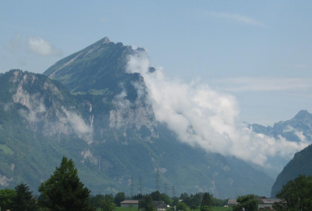 Leistchamm6,893 ft · St. Gallen, SwitzerlandPhoto: Caumasee at de.wikipedia, Public domain (via Wikimedia Commons)
- Vasanachopf6,890 ft · St. Gallen, Switzerland
 Gätterifirst6,886 ft · St. Gallen, SwitzerlandPhoto: Caumasee at de.wikipedia, CC BY-SA 3.0 (via Wikimedia Commons)
- Chreialpfirst (West)6,886 ft · St. Gallen, Switzerland
- Kleiner Gir6,873 ft · St. Gallen, Switzerland
- Glattchamm6,837 ft · St. Gallen, Switzerland
- Marchstein6,821 ft · St. Gallen, Switzerland
- Glattchamm6,821 ft · St. Gallen, Switzerland
- Goldichopf6,811 ft · St. Gallen, Switzerland
 Gamserrugg6,811 ft · St. Gallen, SwitzerlandPhoto: Ramessos, CC BY-SA 3.0 (via Wikimedia Commons)
 Ziger6,804 ft · St. Gallen, SwitzerlandPhoto: Ramessos, CC BY-SA 3.0 (via Wikimedia Commons)
- Wart6,781 ft · St. Gallen, Switzerland
- Graseggchopf6,778 ft · St. Gallen, Switzerland
- Kreuzberg VII6,772 ft · St. Gallen, Switzerland
- Kreuzberg IV6,749 ft · St. Gallen, Switzerland
- First6,742 ft · St. Gallen, Switzerland
- Kreuzberg VIII6,739 ft · St. Gallen, Switzerland
- Kreuzberg V6,736 ft · St. Gallen, Switzerland
- Fetschenchöpf6,736 ft · St. Gallen, Switzerland
- Schwarzchopf6,729 ft · St. Gallen, Switzerland
- Chapf6,703 ft · St. Gallen, Switzerland
- Kreuzberg VI6,699 ft · St. Gallen, Switzerland
- Höchst6,640 ft · St. Gallen, Switzerland
- Silberplattenchöpf6,637 ft · St. Gallen, Switzerland
- Kreuzberg III6,624 ft · St. Gallen, Switzerland
- Mittelberg6,611 ft · St. Gallen, Switzerland
- Zwingler6,608 ft · St. Gallen, Switzerland
 Maschgenkamm6,581 ft · St. Gallen, SwitzerlandPhoto: Patrick Nouhailler's…, CC BY-SA 3.0 (via Wikimedia Commons)
 Prodkamm6,578 ft · St. Gallen, SwitzerlandPhoto: Patrick Nouhailler's…, CC BY-SA 3.0 (via Wikimedia Commons)
- Garmil6,572 ft · St. Gallen, Switzerland
- Schönbüel6,558 ft · St. Gallen, Switzerland
- Gulme6,555 ft · St. Gallen, Switzerland
- Chopf6,552 ft · St. Gallen, Switzerland
- Stellisatz6,539 ft · St. Gallen, Switzerland
- Schofwisspitz6,526 ft · St. Gallen, Switzerland
 Lütispitz6,516 ft · St. Gallen, SwitzerlandPhoto: Ramessos, CC BY-SA 3.0 (via Wikimedia Commons)
- Hurst6,467 ft · St. Gallen, Switzerland
- Kreuzberg II6,460 ft · St. Gallen, Switzerland
- Stöllen6,453 ft · St. Gallen, Switzerland
- Glännlichopf6,440 ft · St. Gallen, Switzerland
- Gams-Chopf6,434 ft · St. Gallen, Switzerland
- Zehespitz6,424 ft · St. Gallen, Switzerland
- Alpbigligenstöckli6,424 ft · St. Gallen, Switzerland
 Hüser6,401 ft · St. Gallen, SwitzerlandPhoto: Caumasee at de.wikipedia, CC BY-SA 3.0 (via Wikimedia Commons)
 Speer6,398 ft · St. Gallen, SwitzerlandPhoto: Adrian Michael, CC BY 2.5 (via Wikimedia Commons)
- Schwarzchopf6,398 ft · St. Gallen, Switzerland
- Schafchopf6,388 ft · St. Gallen, Switzerland
- Cuncels6,355 ft · St. Gallen, Switzerland
 Mattstock6,352 ft · St. Gallen, SwitzerlandPhoto: Adrian Michael, CC BY 2.5 (via Wikimedia Commons)
 Hochhus6,319 ft · St. Gallen, SwitzerlandPhoto: Caumasee at de.wikipedia, Public domain (via Wikimedia Commons)
- Scherenspitzen6,319 ft · St. Gallen, Switzerland
- Schwarzchopf6,286 ft · St. Gallen, Switzerland
- Scherenturm6,257 ft · St. Gallen, Switzerland
- Guflenplanggen6,240 ft · St. Gallen, Switzerland
- Uschafetta6,220 ft · St. Gallen, Switzerland
- Oberwis-Chopf6,214 ft · St. Gallen, Switzerland
- Kreuzberg I6,181 ft · St. Gallen, Switzerland
- Tschugga6,168 ft · St. Gallen, Switzerland
- Stelligrat6,152 ft · St. Gallen, Switzerland
- Chli Güslen6,129 ft · St. Gallen, Switzerland
 Federispitz6,119 ft · St. Gallen, SwitzerlandPhoto: Adrian Michael, CC BY 2.5 (via Wikimedia Commons)
 Staubernkanzel6,102 ft · St. Gallen, SwitzerlandPhoto: ANKAWÜ, CC BY-SA 3.0 (via Wikimedia Commons)
- Loschopf6,099 ft · St. Gallen, Switzerland
- Chrüzchopf6,089 ft · St. Gallen, Switzerland
- Horn6,040 ft · St. Gallen, Switzerland
- Gross Güslen6,014 ft · St. Gallen, Switzerland
- Narggenchopf6,010 ft · St. Gallen, Switzerland
Routes that start here
- [E40.4 mi · 22 ft gain
- Alp Oberchäseren
- Alp Rohr
- Alp Schrina
- Alp Tschingla
- Alp Wisliboda
- Alp- und Waldwege ViltersExpert · 2.5 mi round trip · 2,090 ft gain
- Älpli
- Alpstrasse UnterchäserenEasy · 1.5 mi round trip · 833 ft gain
- AlpwegEasy · 1.0 mi · 73 ft gain
- Alpwirtschaft Leser
- Alter Weg zur SardonahütteHard · 0.9 mi round trip · 953 ft gain
- Altsäss-ObersässEasy · 2.7 mi · 2,105 ft gain
- Altschen-SchiblerwitiEasy · 0.9 mi · 891 ft gain
- AlvierwegHard · 2.4 mi · 2,821 ft gain
- Atzmännig
- Atzmännig Lodge
- Bächli
- Badestrand Lago Mio
- BalmenwandHard · 0.9 mi round trip · 3,209 ft gain
- BaltzugHard · 1.4 mi round trip · 1,583 ft gain
- Bannriet
- Batöni
- BeggetwilerwegEasy · 1.0 mi round trip · 98 ft gain
- BergerlauiwegEasy · 1.3 mi · 486 ft gain
- Berggasthaus Lüsis
- Berggasthaus Plattenbödeli
- Berggasthaus Schafboden Alpstein
- Berggasthaus Tierwies
- Bergrestaurant Farneralp
- Berschnerfall
- BettlerwegModerate · 1.3 mi round trip · 1,746 ft gain
- BettlerwegEasy · 1.2 mi · 1,229 ft gain
- BodeneggModerate · 1.0 mi · 833 ft gain
- Bödmeli-Rueboden-WegModerate · 1.4 mi round trip · 759 ft gain
- Brittertannen-AltschenExpert · 1.2 mi round trip · 591 ft gain
- BruderschwendiwegEasy · 0.3 mi · 111 ft gain
- Buelfall
- BüelwiswegEasy · 0.4 mi · 391 ft gain
- Bützel-KastensattelExpert · 2.3 mi round trip · 2,342 ft gain
- Camping Adlerwiese Ricken
- Camping Bad Ragaz
- Camping Drei Eidgenossen
- Camping Grünenfelder Ricken
- Camping Insel Lützelau
- Camping Murg
- Camping St. Gallen-Wittenbach Leebrücke
- Camping Träumli
- Camping Werdenberg
- Campingplatz Stampf
- Campingplatz Thur
- ChapfwegHard · 1.8 mi · 736 ft gain
- ChatzenlochwegModerate · 1.0 mi round trip · 556 ft gain
- ChatzenlochwegEasy · 0.7 mi round trip · 282 ft gain
- ChatzenlochwegModerate · 0.6 mi round trip · 240 ft gain
- Chileweg1.8 mi · 223 ft gain
- ChirnenbergwegModerate · 3.8 mi round trip · 1,365 ft gain
- ChirnenbergwegEasy · 0.5 mi · 736 ft gain
- ChnorrenExpert · 2.4 mi round trip · 2,401 ft gain
- ChnübiswegEasy · 0.8 mi round trip · 541 ft gain
- CholwaldwegModerate · 0.7 mi · 52 ft gain
- CholwaldwegModerate · 0.6 mi · 587 ft gain
- ChopfbergwegModerate · 2.0 mi · 2,126 ft gain
- ChrämmenwegModerate · 1.4 mi round trip · 1,158 ft gain
- ChriesisteiwegEasy · 0.6 mi round trip · 678 ft gain
- ChrutlauiwegEasy · 0.4 mi · 173 ft gain
- ChrutzugModerate · 0.7 mi · 1,190 ft gain
- Chüessäss GlasürModerate · 2.7 mi round trip · 1,597 ft gain
- ChuewegHard · 3.6 mi round trip · 2,180 ft gain
- ChupferhammerwegEasy · 0.9 mi · 197 ft gain
- Churfirsten PanoramabikeExpert · 14.6 mi · 7,599 ft gain
- Diepoldsauer Schwamm
- Dunkla Stei
- Egg Rundkurs22.2 mi · 3,602 ft gain
- Eichenwieser Schwamm
- EigentobelHard · 1.5 mi round trip · 1,494 ft gain
- Einstiegsstelle SUP
- Einstiegsstelle SUP Buriet
- Erdisgulmen SpaltrouteHard · 2.7 mi round trip · 1,610 ft gain
- ErdiswegModerate · 2.6 mi round trip · 3,027 ft gain
- ErzwegModerate · 1.8 mi round trip · 2,699 ft gain
- EselwegExpert · 1.6 mi round trip · 2,398 ft gain
- Espel-SelamattModerate · 1.7 mi round trip · 1,586 ft gain
- ex. Heidiland Bike Etappe 2Moderate · 34.9 mi · 8,794 ft gain
- FalggensteinwegHard · 1.8 mi round trip · 1,561 ft gain
- FanswegModerate · 2.6 mi round trip · 1,217 ft gain
- Fausler-FlüretobelModerate · 0.4 mi · 491 ft gain
- Federihütte
- Feldbachfall
- FeldbachwegEasy · 0.8 mi round trip · 298 ft gain
- Flumserberg-Panoramabike7.3 mi · 1,441 ft gain
- Flüretobel-Fros TeselModerate · 0.8 mi · 28 ft gain
- Folla-GonzenModerate · 0.5 mi · 400 ft gain
- ForsttobelModerate · 1.7 mi round trip · 626 ft gain
- Fros-Jöchli-RotsteinpassHard · 2.9 mi · 3,816 ft gain
- Fuchslochbach Wasserfall I
- FurgglenModerate · 1.5 mi round trip · 1,317 ft gain
- Furgglenalp
- GafröawegEasy · 1.4 mi round trip · 980 ft gain
- GamidaurwegeModerate · 1.7 mi · 2,166 ft gain
- Gamplüt-SäntisHard · 1.3 mi round trip · 816 ft gain
- Gamserälpli-PlattenEasy · 1.2 mi · 387 ft gain
- Gerli-Leser-WegModerate · 0.8 mi round trip · 374 ft gain
- Giessenfall
- Giessenfall I
- Giessenfall II
- Giessenfall III
- Gipfelhütte Alvier
- GochtwegHard · 1.4 mi · 1,628 ft gain
- GoggeienwegHard · 1.4 mi round trip · 1,005 ft gain
- GonzenleiterwegHard · 0.4 mi · 1,137 ft gain
- Grashalden-OberkamorHard · 3.8 mi round trip · 2,833 ft gain
- GratwegHard · 2.1 mi round trip · 721 ft gain
- Grossbachfall
- GrossrotsteinHard · 1.7 mi round trip · 777 ft gain
- Grossrüti-OberdorfModerate · 1.0 mi round trip · 467 ft gain
- GrossweierwegEasy · 1.2 mi round trip · 263 ft gain
- GrubenwegEasy · 2.1 mi round trip · 1,986 ft gain
- Gsponbachfall
- GsponwegModerate · 3.7 mi · 1,727 ft gain
- Gugen-Lee-WegEasy · 0.7 mi round trip · 408 ft gain
- HagenbuchwaldwegEasy · 1.6 mi round trip · 938 ft gain
- HeilramwegEasy · 0.9 mi round trip · 123 ft gain
- HienenbodenwegModerate · 1.0 mi round trip · 912 ft gain
- HinteraltschwandEasy · 1.2 mi · 586 ft gain
- HintereggwegEasy · 1.6 mi round trip · 2,213 ft gain
- HinterhöhgwegEasy · 0.4 mi · 41 ft gain
- HinterspinawegExpert · 3.5 mi round trip · 4,213 ft gain
- Höchstern
- HöchstwegHard · 3.0 mi · 1,097 ft gain
- Höfli
- Hofstatt-Alp SelunEasy · 1.5 mi · 452 ft gain
- Hohbachfall
- HöhenwegModerate · 4.1 mi round trip · 1,612 ft gain
- Holzer-Hütte
- HoorlocherwaldEasy · 1.1 mi round trip · 450 ft gain
- Hörnli Bike - Etappe 223.0 mi · 3,784 ft gain
- Hudelmoos
- Idyll
- Iltios-ChäserruggModerate · 1.9 mi · 2,041 ft gain
- Iltios-HinterrisiModerate · 2.5 mi round trip · 1,746 ft gain
- Inneralp
- Isengrindfall
- Jakobsweg Vorarlberg0.5 mi · 41 ft gain
- JosenwegModerate · 0.9 mi · 941 ft gain
- Juggenwaldloipe1.1 mi · 77 ft gain
- Kaltbrunner Riet
- KammwegEasy · 1.2 mi round trip · 618 ft gain
- KastenwandExpert · 1.9 mi round trip · 3,284 ft gain
- Laad-Wald-WegModerate · 0.7 mi round trip · 342 ft gain
- Langebode-GulmeHard · 1.9 mi · 1,797 ft gain
- LasawegExpert · 2.0 mi round trip · 1,589 ft gain
- Laui-RüchiEasy · 0.9 mi round trip · 755 ft gain
- Laui-Schrenit-TürlisbodenExpert · 1.1 mi round trip · 940 ft gain
- LauibodenwegModerate · 1.2 mi round trip · 913 ft gain
- LeistchammwegHard · 0.7 mi · 1,167 ft gain
- Lisighus-LisigweidModerate · 0.9 mi round trip · 439 ft gain
- Loipe MunzenrietEasy · 1.7 mi · 141 ft gain
- Loipe Tannenberg6.7 mi · 495 ft gain
- LuchsbergwegEasy · 1.4 mi · 811 ft gain
- MädemswegHard · 1.3 mi round trip · 783 ft gain
- Madils1.2 mi · 352 ft gain
- MadseeliwegModerate · 1.9 mi round trip · 975 ft gain
- Marina Rheinhof
- MattwegModerate · 1.1 mi round trip · 310 ft gain
- MatugerwegModerate · 1.3 mi round trip · 1,521 ft gain
- MeilengratwegHard · 1.3 mi · 1,265 ft gain
- MolseralpwegEasy · 2.1 mi · 237 ft gain
- Montlinger Schwamm
- MoorwegEasy · 0.9 mi · 136 ft gain
- Moos-SchnüerEasy · 1.5 mi · 567 ft gain
- MühlebachwegEasy · 0.7 mi · 285 ft gain
- MühltobelwegExpert · 1.2 mi round trip · 506 ft gain
- MülibachfurggelwegHard · 2.5 mi round trip · 932 ft gain
- MuntarüschwegEasy · 1.2 mi round trip · 1,079 ft gain
- MunzwegExpert · 4.5 mi round trip · 2,949 ft gain
- Murgbachfall
- MurgseefurgglenwegExpert · 1.0 mi round trip · 785 ft gain
- Murgseehütte
- MurgtalwegEasy · 4.7 mi round trip · 3,292 ft gain
- Muslenfall
- Muttenbachfall
- NässesträsschenEasy · 0.6 mi · 86 ft gain
- Naturfreundehaus Tscherwald
- Naturschutzgebiet
- NeuburgwegEasy · 1.1 mi round trip · 567 ft gain
- NeuwegEasy · 3.2 mi round trip · 2,554 ft gain
- NideriwegModerate · 1.2 mi · 121 ft gain
- NördliwegEasy · 0.6 mi · 101 ft gain
- OberburgwegEasy · 0.9 mi round trip · 204 ft gain
- Obere Bogmen
- Oberer GargumswegEasy · 1.5 mi · 730 ft gain
- Oberer Mattbachfall
- Oberer Thuwasserfall
- Oelberg Bike10.0 mi · 3,585 ft gain
- ParadiesliEasy · 0.7 mi round trip · 513 ft gain
- Piltschinabachfall
- Pro Natura Naturschutzgebiet Alp Flis
- Pro Natura Naturschutzgebiet Alp Panära
- Pro Natura Naturschutzgebiet Gamperfin
