Mountains in Obwalden
126 mountains and 52 routes in Obwalden, Switzerland, each with its own page: heights, seasons, and every way to the top we have mapped.
Mountains
 Titlis10,623 ft · Obwalden, SwitzerlandPhoto: Anuj Agarwal, CC BY-SA 4.0 (via Wikimedia Commons)
 Rotstöckli9,518 ft · Obwalden, SwitzerlandPhoto: Mussklprozz, CC BY-SA 4.0 (via Wikimedia Commons)
- Hasenstock8,953 ft · Obwalden, Switzerland
 Rotsandnollen8,858 ft · Obwalden, SwitzerlandPhoto: Alpöhi, CC BY-SA 3.0 (via Wikimedia Commons)
 Huetstock8,780 ft · Obwalden, SwitzerlandPhoto: Alpöhi, CC BY-SA 3.0 (via Wikimedia Commons)
- Barglen / Schiben8,757 ft · Obwalden, Switzerland
- Tierberg8,694 ft · Obwalden, Switzerland
 Laucherenstock8,658 ft · Obwalden, SwitzerlandPhoto: Bjferstern, CC BY-SA 3.0 (via Wikimedia Commons)
- Schwarzhorn8,655 ft · Obwalden, Switzerland
- Gross Sättelistock8,652 ft · Obwalden, Switzerland
- Henglihorn8,619 ft · Obwalden, Switzerland
- Hahnen8,550 ft · Obwalden, Switzerland
 Rigidalstock8,507 ft · Obwalden, SwitzerlandPhoto: Chris.urs-o, CC BY-SA 3.0 (via Wikimedia Commons)
 Spitz Mann8,455 ft · Obwalden, SwitzerlandPhoto: JoachimKohler-HB, CC BY-SA 4.0 (via Wikimedia Commons)
- Scheyeggstock8,425 ft · Obwalden, Switzerland
- Gross Gemsispil8,264 ft · Obwalden, Switzerland
- Zahm Geissberg8,238 ft · Obwalden, Switzerland
- Chli Hohmad8,176 ft · Obwalden, Switzerland
- Hochstollen8,140 ft · Obwalden, Switzerland
- Tannenstock8,018 ft · Obwalden, Switzerland
- Hohmad8,012 ft · Obwalden, Switzerland
 Nünalphorn7,825 ft · Obwalden, SwitzerlandPhoto: Beneaththeroses, CC BY-SA 4.0 (via Wikimedia Commons)
- Chli Gemsispil7,808 ft · Obwalden, Switzerland
- Kleiner Walenstock7,703 ft · Obwalden, Switzerland
- Haupt7,589 ft · Obwalden, Switzerland
- Gross Hohmad7,569 ft · Obwalden, Switzerland
 Rugghubel7,533 ft · Obwalden, SwitzerlandPhoto: Mussklprozz, CC BY-SA 3.0 (via Wikimedia Commons)
- Abgschütz7,421 ft · Obwalden, Switzerland
- Türmli7,408 ft · Obwalden, Switzerland
- Murmelchopf7,398 ft · Obwalden, Switzerland
- Hohbüel7,323 ft · Obwalden, Switzerland
- Arnihaggen7,270 ft · Obwalden, Switzerland
- Ruchberg7,270 ft · Obwalden, Switzerland
 Höch Gumme7,234 ft · Obwalden, SwitzerlandPhoto: upload by Adrian Michael, CC BY-SA 3.0 (via Wikimedia Commons)
- Gross Schinder7,208 ft · Obwalden, Switzerland
- Ofen7,178 ft · Obwalden, Switzerland
- Tannenschild7,156 ft · Obwalden, Switzerland
 Bonistock7,116 ft · Obwalden, SwitzerlandPhoto: Andreas Faessler, CC BY-SA 3.0 (via Wikimedia Commons)
- Chli Schinder7,087 ft · Obwalden, Switzerland
- Arnifirst7,067 ft · Obwalden, Switzerland
- Heitlistock7,041 ft · Obwalden, Switzerland
- Seefeldstock6,982 ft · Obwalden, Switzerland
 Tomlishorn6,982 ft · Obwalden, SwitzerlandPhoto: Ringrog at German Wikipedia, CC BY-SA 3.0 (via Wikimedia Commons)
 Chingstuel6,955 ft · Obwalden, SwitzerlandPhoto: Paradise Chronicle, CC BY-SA 4.0 (via Wikimedia Commons)
 Wandelen6,903 ft · Obwalden, SwitzerlandPhoto: Arkelin, CC BY 4.0 (via Wikimedia Commons)
 Wengenhorn6,883 ft · Obwalden, SwitzerlandPhoto: Arkelin, CC BY 4.0 (via Wikimedia Commons)
- Schild6,844 ft · Obwalden, Switzerland
- Astelhorn6,834 ft · Obwalden, Switzerland
- Vorstegg6,827 ft · Obwalden, Switzerland
- Rossflue6,827 ft · Obwalden, Switzerland
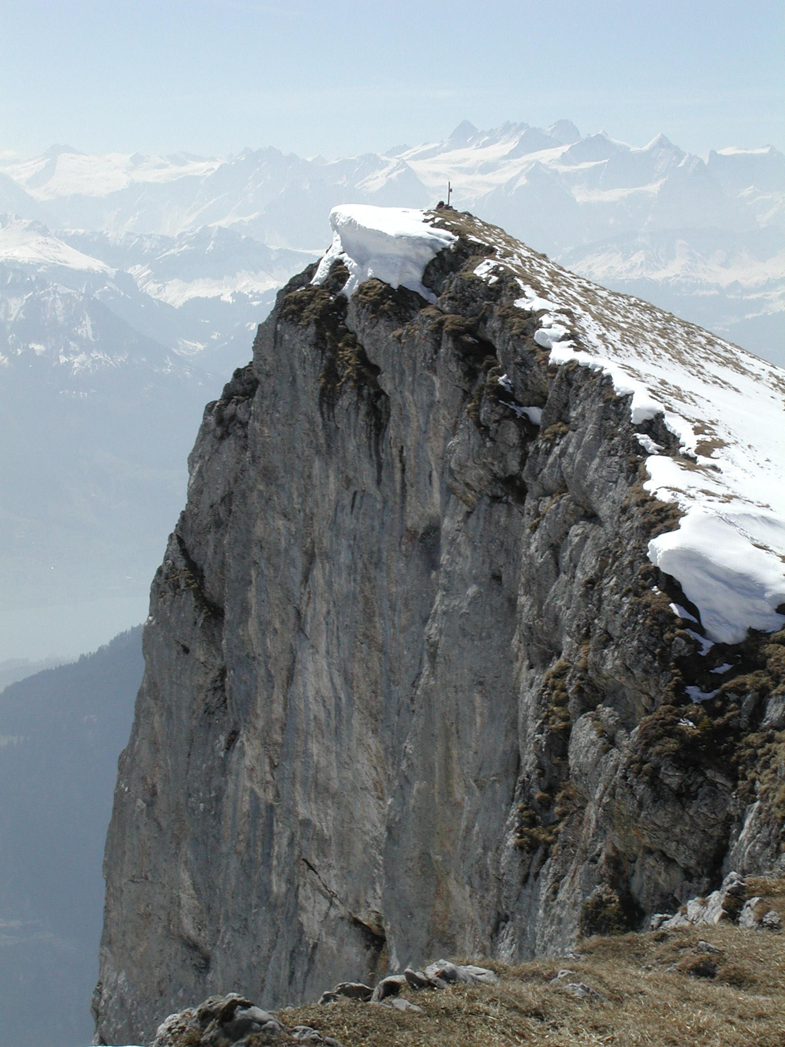 Widderfeld6,808 ft · Obwalden, SwitzerlandPhoto: Niklausschreiber2, CC BY-SA 3.0 (via Wikimedia Commons)
- Bocki6,801 ft · Obwalden, Switzerland
- Vogelbüel6,795 ft · Obwalden, Switzerland
- Mändli6,755 ft · Obwalden, Switzerland
- Güpfi6,703 ft · Obwalden, Switzerland
 Matthorn6,696 ft · Obwalden, SwitzerlandPhoto: Pentachlorphenol, CC BY-SA 4.0 (via Wikimedia Commons)
- Gibel6,679 ft · Obwalden, Switzerland
 Gräfimattnollen6,673 ft · Obwalden, SwitzerlandPhoto: Mussklprozz, CC BY-SA 3.0 (via Wikimedia Commons)
- Wangihorn6,667 ft · Obwalden, Switzerland
- Vogelbiel6,640 ft · Obwalden, Switzerland
- Höchgrat6,621 ft · Obwalden, Switzerland
- Hanen6,608 ft · Obwalden, Switzerland
- Schafnase6,598 ft · Obwalden, Switzerland
- Arnitriste6,575 ft · Obwalden, Switzerland
- Chline Gibel6,558 ft · Obwalden, Switzerland
- Steiglihorn6,516 ft · Obwalden, Switzerland
- Rickhubel6,375 ft · Obwalden, Switzerland
- Widihorn6,365 ft · Obwalden, Switzerland
- Giswilerstock6,365 ft · Obwalden, Switzerland
- Hohmad6,348 ft · Obwalden, Switzerland
- Höh Grat6,309 ft · Obwalden, Switzerland
- Stäfeliflue6,306 ft · Obwalden, Switzerland
- Stäfelihörnli6,302 ft · Obwalden, Switzerland
- Stellenen6,266 ft · Obwalden, Switzerland
 Nünalpstock6,234 ft · Obwalden, SwitzerlandPhoto: Arkelin, CC BY 4.0 (via Wikimedia Commons)
- Hüser6,220 ft · Obwalden, Switzerland
 Miesenstock6,217 ft · Obwalden, SwitzerlandPhoto: Arkelin, CC BY 4.0 (via Wikimedia Commons)
- Höch Dossen6,184 ft · Obwalden, Switzerland
- Rämisgütsch6,109 ft · Obwalden, Switzerland
- Horn6,093 ft · Obwalden, Switzerland
- Alpoglerberg6,043 ft · Obwalden, Switzerland
- Nesslenstock6,030 ft · Obwalden, Switzerland
- Sewenegg6,017 ft · Obwalden, Switzerland
- Lauistock5,974 ft · Obwalden, Switzerland
- First5,955 ft · Obwalden, Switzerland
- Nollen5,948 ft · Obwalden, Switzerland
- Arvidossen5,932 ft · Obwalden, Switzerland
- Trogenegg5,932 ft · Obwalden, Switzerland
- Blaue Tosse5,912 ft · Obwalden, Switzerland
- Juchli5,906 ft · Obwalden, Switzerland
 Bärenturm5,899 ft · Obwalden, SwitzerlandPhoto: Arkelin, CC BY 4.0 (via Wikimedia Commons)
- Haldimattstock5,879 ft · Obwalden, Switzerland
- Rotspitz5,863 ft · Obwalden, Switzerland
- Riedmattstock5,860 ft · Obwalden, Switzerland
- Rot Dossen5,830 ft · Obwalden, Switzerland
- Sattelstock5,797 ft · Obwalden, Switzerland
- Musflue5,764 ft · Obwalden, Switzerland
- Riedmattstöckli5,761 ft · Obwalden, Switzerland
 Jänzi5,702 ft · Obwalden, SwitzerlandPhoto: Pududuss, CC BY-SA 4.0 (via Wikimedia Commons)
- Lecki Dossen5,702 ft · Obwalden, Switzerland
- Meisengütsch5,702 ft · Obwalden, Switzerland
- Selispitz5,696 ft · Obwalden, Switzerland
- Hüenergütsch5,669 ft · Obwalden, Switzerland
- Hörnli5,653 ft · Obwalden, Switzerland
- Chnebelhorn5,630 ft · Obwalden, Switzerland
- Erzbiel5,614 ft · Obwalden, Switzerland
- Hohflue5,581 ft · Obwalden, Switzerland
- Glaubenstock5,541 ft · Obwalden, Switzerland
- Gütsch5,538 ft · Obwalden, Switzerland
- Finsterbüel5,538 ft · Obwalden, Switzerland
- First5,515 ft · Obwalden, Switzerland
- Windegg5,489 ft · Obwalden, Switzerland
- Sädel5,486 ft · Obwalden, Switzerland
- Chäserengütsch5,456 ft · Obwalden, Switzerland
- Heidberistöckli5,413 ft · Obwalden, Switzerland
- Bärnerstig5,407 ft · Obwalden, Switzerland
- Buck5,351 ft · Obwalden, Switzerland
- Sattelegg5,318 ft · Obwalden, Switzerland
- Heidberihubel5,302 ft · Obwalden, Switzerland
- Sagenflue5,243 ft · Obwalden, Switzerland
- Grüenengütsch5,194 ft · Obwalden, Switzerland
- Schild5,187 ft · Obwalden, Switzerland
 Turren5,125 ft · Obwalden, SwitzerlandPhoto: Pududuss, CC BY-SA 4.0 (via Wikimedia Commons)
- Ankenhubel5,082 ft · Obwalden, Switzerland
- Hüenergütsch4,937 ft · Obwalden, Switzerland
- Widerwällhubel3,284 ft · Obwalden, Switzerland
Routes that start here
- Alpnach - Ächerlipass - Gummen - Wirzweli - Dallenwil16.4 mi · 2,092 ft gain
- Alter FruttwegModerate · 3.3 mi round trip · 2,373 ft gain
- Alter TomlishornwegExpert · 1.8 mi round trip · 3,063 ft gain
- ArnigratHard · 1.3 mi · 466 ft gain
- Bettenalpbachfall
- Biwak am Grassen
- BlattenwegEasy · 0.6 mi round trip · 78 ft gain
- blau markiertExpert · 0.8 mi round trip · 1,083 ft gain
- Blockhütte
- Bödmen-FirnalpeliExpert · 0.8 mi round trip · 278 ft gain
- Bord-KilchbühlModerate · 0.9 mi round trip · 1,092 ft gain
- Brunnihütte SAC
- Brunnihütte-HolzsteinModerate · 2.2 mi round trip · 2,059 ft gain
- Camping auf dem Bauernhof
- Camping International Giswil
- Camping Seefeld
- Campingplatz Alpnachersee
- Campingplatz Eienwäldli
- Campingplatz Obsee
- Cholplatz
- Egg-Hüttli
- Firnalpeli-GrassenExpert · 4.9 mi round trip · 5,361 ft gain
- Fürenbachfall
- Hengliboden-SchaftalModerate · 1.5 mi · 895 ft gain
- Herrenrütiboden-BödmenHard · 1.2 mi round trip · 1,231 ft gain
- Holzstein-PlanggenstafelHard · 1.5 mi round trip · 2,155 ft gain
- hubelhütte
- LeiterliwegModerate · 0.3 mi · 43 ft gain
- Leiterliweg-BänklialpEasy · 0.6 mi round trip · 307 ft gain
- Melchaa-HangiModerate · 0.3 mi · 642 ft gain
- Nationale Aue Steinibach Schutzzone
- Naturschutzzone Usser Allmend - Schwerzbachried
- NidwaldenerwegHard · 2.1 mi round trip · 1,678 ft gain
- PanoramawegModerate · 2.6 mi round trip · 1,841 ft gain
- PilatuswegEasy · 0.8 mi · 583 ft gain
- Planggenstafel-RugghubelhütteHard · 2.6 mi round trip · 1,712 ft gain
- Plattenbruchfall
- ProfessorenwegEasy · 1.0 mi round trip · 222 ft gain
- ProfessorenwegEasy · 1.8 mi round trip · 630 ft gain
- Rugghubelhütte SAC
- Schletteren-HorbisModerate · 2.0 mi · 1,459 ft gain
- Schonegg-RigidalstockHard · 1.5 mi round trip · 1,306 ft gain
- Schutzzone 1
- Schutzzone 3
- Schwandkapelle-OberstutzEasy · 0.3 mi · 234 ft gain
- Skihütte Brend
- Städerried Camp
- Stock-ChruterenModerate · 0.8 mi · 444 ft gain
- Tätschbachfall
- Undrist Stafel-FürenalpModerate · 0.3 mi · 462 ft gain
- Von der Titlis-BergstationExpert · 3.0 mi round trip · 1,723 ft gain
- Zustieg CheselenflueExpert · 0.6 mi round trip · 1,556 ft gain
