Buttermilk Falls
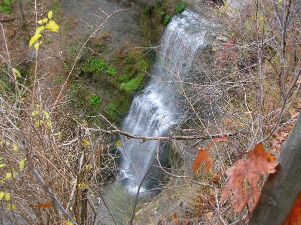 Photo: Nhl4hamilton | Chit-Chat, Public domain (via Wikimedia Commons)
- 610 ft
- elevation
- Jun–Sep
- best months
Buttermilk Falls is a waterfall in Ontario, Canada, at about 610 ft above sea level. The drop is mapped at about 80 ft (23 m). Mapped trails that pass within about a quarter mile include Bruce Trail - Iroquoia section side trails. The nearest town is Hamilton, about 4.4 miles southeast of the falls. Albion Falls and Baby Albion Falls are within about 3 miles. The location and elevation come from OpenStreetMap and the Copernicus 90 m elevation model. Check local access rules and conditions before you go.
Conditions and forecast
Daily highs and lows, wind and the chance of precipitation at Buttermilk Falls for the next 7 days, from the Open-Meteo model.
- Elevation
- 610 ft
 Albion FallsWaterfall · Next doorPhoto: Joe deSousa, CC0 (via Wikimedia Commons)
 Baby Albion FallsWaterfall · Next doorPhoto: Joe deSousa, CC0 (via Wikimedia Commons)
 Billy Monkley CascadeWaterfall · ~2 min drivePhoto: Michael Hunter from Canada, CC BY 2.0 (via Wikimedia Commons)
 Felker's FallsWaterfall · ~3 min drivePhoto: Mhsheikholeslami, CC BY-SA 4.0 (via Wikimedia Commons)
 Taro FallsWaterfall · ~3 min drivePhoto: Eric Marshall, CC BY 3.0 (via Wikimedia Commons)
 Lower Punchbowl FallsWaterfall · ~5 min drivePhoto: Eric Marshall, CC BY 3.0 (via Wikimedia Commons)
 Devil's Punchbowl FallsWaterfall · ~6 min drivePhoto: Eric Marshall, CC BY 3.0 (via Wikimedia Commons)
 Chedoke FallsWaterfall · ~8 min drivePhoto: Eric Marshall, CC BY 3.0 (via Wikimedia Commons)
 Cliffview FallsWaterfall · ~9 min drivePhoto: Mustang Joe, CC0 (via Wikimedia Commons)
 Lower Cliffview FallsWaterfall · ~9 min drivePhoto: Mustang Joe, CC0 (via Wikimedia Commons)
Also worth it near here
 Red Hill Valley TrailHiking · ~3 min drivePhoto: Doug Kerr from Albany, NY, United States, CC BY-SA 2.0 (via Wikimedia Commons)
- Devil's Punchbowl (ICE)Rock climbing · ~6 min drive
 Van Wagners BeachBeach · ~8 min drivePhoto: Jeff Hitchcock from Seattle, WA, USA, CC BY 2.0 (via Wikimedia Commons)
 Burlington HeightsSummit · ~10 min drivePhoto: Laslovarga, CC BY-SA 3.0 (via Wikimedia Commons)
 Bronte Creek Campground access pointCamping · ~26 min drivePhoto: Good Free Photos, CC BY 3.0 (via Wikimedia Commons)
Best time to visit Buttermilk Falls
Best months: June–September. Best months have typical highs of 55–85 °F, lows of 30 °F or warmer (32 °F where the station doesn't record snow), at most one snowy day and no more than 12 wet days.
Jan
33° / 19°
18 wet
Feb
35° / 19°
15 wet
Mar
43° / 26°
14 wet
Apr
56° / 36°
13 wet
May
69° / 48°
13 wet
Jun
78° / 58°
11 wet
Jul
82° / 63°
11 wet
Aug
80° / 61°
10 wet
Sep
74° / 54°
10 wet
Oct
61° / 43°
13 wet
Nov
49° / 33°
14 wet
Dec
39° / 25°
16 wet
Typical high / low (°F) and days with rain or snow, 1991–2020. Measured at Niagara Falls, NY, 43.6 mi away at 588 ft. This station doesn't record snowfall. Source: NOAA NCEI U.S. Climate Normals 1991–2020.
Map and trail data © OpenStreetMap contributors
