The Sugarloaf
- 743 ft
- summit
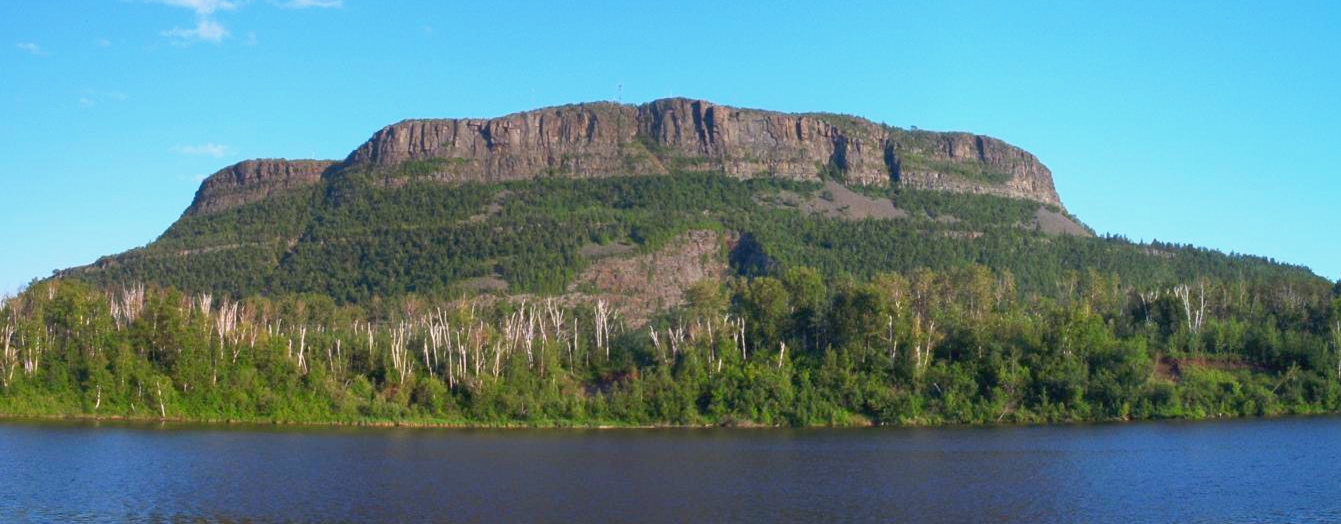
The Sugarloaf is a mountain in Ontario, Canada, with its summit at about 740 ft (226 m) above sea level. It stands inside Western Lake Superior Conservation Reserve. No mapped trail reaches the top in OpenStreetMap, so plan the approach with local maps or a guide. The nearest town is Thunder Bay, about 21 miles south of the summit. The location and elevation come from OpenStreetMap and the Copernicus 90 m elevation model. Check local access rules and conditions before you go.
Conditions and forecast
Daily highs and lows, wind and the chance of precipitation at the summit for the next 7 days, from the Open-Meteo model.
- Summit elevation
- 743 ft
We don't know of a mapped trail or route to the summit of The Sugarloaf. Plan the approach with local maps, a guidebook or a local guide, and check conditions before you go.
Questions about The Sugarloaf
How tall is The Sugarloaf?
743 ft (226 m).
Is there a trail to the top of The Sugarloaf?
We don't know of a mapped trail or route to the summit. Plan the approach with local maps, a guidebook or a local guide.
- Ishpeming Point1,372 ft · Michigan1 route19 mi away
- Mount Rose904 ft · Minnesota8 routes21 mi away
- Mount Ojibway1,146 ft · Michigan2 routes31 mi away
- Eagle Mountain2,296 ft · Minnesota1 route61 mi away
- Oberg Mountain1,552 ft · Minnesota2 routes77 mi away
- Mount Bohemia1,459 ft · Michigan2 routes77 mi away
 Mount McKaySummit · ~28 min drivePhoto: Vidioman, CC BY-SA 3.0 (via Wikimedia Commons)
 Mount JosephineSummit · ~33 min drivePhoto: Subhrajit rc, CC BY-SA 4.0 (via Wikimedia Commons)
- Mount MollieSummit · ~17 min drive
- Ishpeming PointSummit · ~32 min drive
- Mount RoseSummit · ~36 min drive
- The Sleeping GiantSummit · ~42 min drive
- Pine MountainSummit · ~44 min drive
- Mount OjibwaySummit · ~54 min drive
- Mount EdnaSummit · ~1h 3m drive
- Mount MarnySummit · ~1h 4m drive
Also worth it near here
 Mink Mountain TrailHiking · ~9 min drivePhoto: Sharon Mollerus, CC BY 2.0 (via Flickr)
 Little Trout Bay Boat LaunchBoat launch · ~14 min drivePhoto: Sharon Mollerus, CC BY 2.0 (via Wikimedia Commons)
- Lake SuperiorLake fishing · ~22 min drive
- Ontario Ice and MixedRock climbing · ~24 min drive
- Sun DownCross-country skiing · ~27 min drive
Map and trail data © OpenStreetMap contributors
