Barnet Trail
- 0.9 mi
- one way
- 250 ft
- climb
- Point to point
- route
- May–Sep
- best months
Barnet Trail is a 0.9-mile mountain bike trail in British Columbia, Canada, inside Burnaby Mountain Conservation Area. It runs between about 120 ft and 290 ft above sea level, with roughly 250 ft of climbing one way. It is mapped as a named route, with its sections joined into one trail here. The nearest town is Belcarra, about 1.9 miles south of the start. Peaks within about 3 miles include Burnaby Mountain, Belcarra Mountain and Woodhaven Hill. For camping, North Twin Campground and Mount Seymour Group Campsite are within about 6 miles. There are 8 other mapped trails within about 3 miles, so you can combine or extend the outing. Distances, elevations and the trail shape here come from OpenStreetMap and the Copernicus 90 m elevation model. Trail access for bikes, closures and conditions change, so check locally before you ride.
Local outfitters
- Dig Deep Tours42 mi away
Not on Roamze yet. Their page has how to reach them.
- Nearby · Lower Griffen · Spur 4 · Golf Course Trail
Best time to go · May–Sep
Best time to visit Barnet Trail
Best months: May–September. Best months have typical highs of 55–85 °F, lows of 30 °F or warmer (32 °F where the station doesn't record snow), at most one snowy day and no more than 12 wet days.
Jan
45° / 34°
18 wet
Feb
48° / 35°
16 wet
Mar
52° / 38°
17 wet
Apr
58° / 42°
14 wet
May
64° / 47°
11 wet
Jun
69° / 52°
10 wet
Jul
73° / 55°
6 wet
Aug
73° / 55°
6 wet
Sep
67° / 50°
9 wet
Oct
57° / 44°
15 wet
Nov
50° / 38°
19 wet
Dec
44° / 34°
19 wet
Typical high / low (°F) and days with rain or snow, 1991–2020. Measured at Blaine, WA, 22 mi away at 60 ft. This station doesn't record snowfall. Source: NOAA NCEI U.S. Climate Normals 1991–2020.
Keep exploring — more rides worth the drive
 Photo: Shaundd, CC BY-SA 4.0 (via Wikimedia Commons)
Lower Griffen
~13 min drive
A 0.8-mile mountain bike trail in British Columbia, Canada.
 Photo: Jeff Hitchcock, CC BY 3.0 (via Wikimedia Commons)
Spur 4
~14 min drive
A 4.9-mile mountain bike trail in British Columbia, Canada.
RIDE
Golf Course Trail
~7 min drive
An out-and-back mountain bike trail in British Columbia, Canada.
RIDE
Severed D
~8 min drive
An out-and-back mountain bike trail in British Columbia, Canada.
RIDE
Twin Bridges Trail
~11 min drive
A 1.3-mile mountain bike trail in British Columbia, Canada.
RIDE
Bridle Trail
~8 min drive
An out-and-back mountain bike trail in British Columbia, Canada.
RIDE
Suicide Branch
~14 min drive
A 1.3-mile mountain bike trail in British Columbia, Canada.
RIDE
Old Buck Trail
~7 min drive
An out-and-back mountain bike trail in British Columbia, Canada.
RIDE
C-Buster
~8 min drive
An out-and-back mountain bike trail in British Columbia, Canada.
RIDE
Sticks and Stones
~8 min drive
A 0.7-mile mountain bike trail that makes a loop in British Columbia, Canada.
Also worth it near here
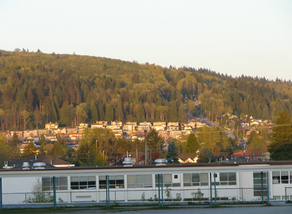 Photo: User:Flying Penguin, CC BY-SA 3.0 (via Wikimedia Commons)
Burnaby Mountain
Next door
HIKE
Ocean 1974
~2 min drive
 Photo: BillB2000, CC BY-SA 3.0 (via Wikimedia Commons)
Cates Park boat ramp
~4 min drive
 Photo: Ruth Hartnup from Vancouver, Canada, CC BY 2.0 (via Wikimedia Commons)
Jug Island Beach
~5 min drive
BED
North Twin Campground
~8 min drive
Conditions and forecast
Daily highs and lows, wind and the chance of precipitation at Barnet Trail for the next 7 days, from the Open-Meteo model.
Map and trail data © OpenStreetMap contributors
