Police Outpost Provincial Park
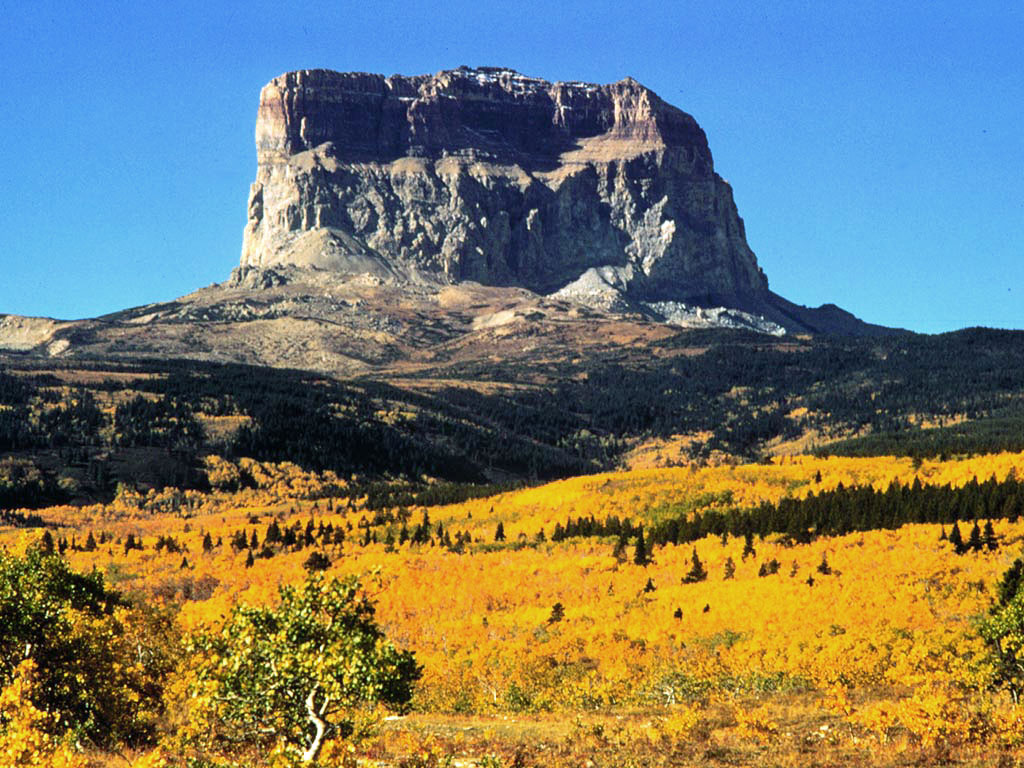
 Photo: Qwexcxewq, CC BY 4.0 (via Wikimedia Commons)
- May–Sep
- best months
Police Outpost Provincial Park is a national park in Alberta, Canada, covering about 500 acres (2 km²). For camping, there is Police Outpost Campground. The nearest town is Cardston, about 15 miles southwest of the park's centre. It was established in 1970. It is classed as a provincial park of Canada. It is managed as an IUCN category II protected area. Administratively, it is in Cardston County. These details come from Wikidata. The boundary comes from OpenStreetMap. Check the park's own rules, fees and opening hours before you go.
Conditions and forecast
Daily highs and lows, wind and the chance of precipitation at Police Outpost Provincial Park for the next 7 days, from the Open-Meteo model.
Park size
523 acres
 Waterton Lakes National ParkState park · ~42 min drivePhoto: Kenneth Hynek from Edmonton, Canada, CC BY 2.0 (via Wikimedia Commons)
 St. Mary Reservoir Provincial Recreation AreaState park · ~51 min drivePhoto: Tiado, CC BY-SA 3.0 (via Wikimedia Commons)
 Akamina-Kishinena Provincial ParkState park · ~58 min drivePhoto: Unknown authorUnknown author or not provided, Public domain (via Wikimedia Commons)
 Head-Smashed-In Buffalo JumpState park · ~1h 25m drivePhoto: Ken Thomas, Public domain (via Wikimedia Commons)
- Outpost Wetlands Natural AreaState park · ~1 min drive
- Payne Lake Provincial Recreation AreaState park · ~18 min drive
- Woolford Provincial ParkState park · ~30 min drive
- Ross Lake Natural AreaState park · ~47 min drive
- Oldman Dam Provincial Recreation AreaState park · ~1h 18m drive
- West Castle Wetlands Ecological ReserveState park · ~1h 23m drive
Best time to visit Police Outpost Provincial Park
Best months: May–September. Best months have typical highs of 55–85 °F, lows of 30 °F or warmer (32 °F where there's no snowfall data), at most one snowy day and no more than 12 wet days.
Jan
29° / 15°
6 wet
Feb
33° / 17°
5 wet
Mar
39° / 22°
7 wet
Apr
48° / 29°
7 wet
May
57° / 37°
9 wet
Jun
65° / 45°
10 wet
Jul
73° / 51°
7 wet
Aug
73° / 51°
7 wet
Sep
63° / 43°
7 wet
Oct
50° / 34°
5 wet
Nov
35° / 23°
5 wet
Dec
27° / 14°
6 wet
Typical high / low (°F) and days with rain or snow, 1981–2010. Modelled for the 1 km square this place sits in (average height 4,580 ft), not measured at a weather station. We don't have this place's elevation, so higher spots nearby can run cooler. Snowfall days aren't in this data. Source: CHELSA 1 km climate model (1981–2010) and CRU TS 4.09 wet days. Data: CHELSA V2.1 climatologies (Karger et al. 2017), WSL (CC0 1.0); CRU TS 4.09 (Harris et al. 2020), University of East Anglia Climatic Research Unit. Contains public sector information licensed under the Open Government Licence v3.0. (Open Government Licence v3.0).

Map and trail data © OpenStreetMap contributors
