Watering Hole (Johnson Creek)
Illinois
Free — you'll pick up right here.
1.1 mi
Distance
170 ft
Gain
23 min
Time
No verdict for this trail
We won't guess. Here is exactly what we do and don't know.
What we do know
Inside Shawnee National Forest
2 managing-area boundaries mapped — agency alerts for them feed this page automatically.
Boundary data
What's missing
No access route mapped
We don't yet know which road reaches this trailhead, so we can't tell you if it's gated.
Nobody's filed a report here yet — be the first.
Why you'll love it
Here's your day, mapped
Watering Hole (Johnson Creek)
Suggested plan · check conditions before you go
Meals
Gear for the day
Elevation & route
- Distance
- 1.1 mi
- Elevation gain
- 170 ft
- Elevation loss
- 170 ft
- Highest point
- 610 ft
- Lowest point
- 525 ft
Photos
Directions & GPX
Permits & access
- Managing agency
- Forest Service
- Bikes
- Not allowed
- Horses
- Allowed
- Surface
- Natural
Source for bikes, horses, surface: USDA Forest Service National Forest System Trails (EDW)
About this trail
Watering Hole (Johnson Creek) is a short out-and-back trail in Illinois managed by the Forest Service. The trail is 1.10 miles long with 39 feet of elevation gain and 97 feet of elevation loss.
Facts about this trail
The climb
- High point
- 610 ft
- Total climbing
- 170 ft
- Total descent
- 170 ft
- Steepest stretch
- 6% grade around mile 0.2 on the way out
- Length (round trip)
- 1.1 mi
- Shape
- Out and back
Most of the climbing comes late, so save something for the end.
Source: Roamze elevation profile and trail geometry (DEM samples along the mapped route)
When to go
Typical monthly averages (not a forecast) from the Carbondale Southern Il Ap, IL weather station, 15 mi away. High / low in °F.
- Jan42° high25° low
- Feb47° high28° low
- Mar57° high36° low
- Apr68° high45° low
- May77° high55° low
- Jun86° high64° low
- Jul88° high67° low
- Aug87° high65° low
- Sep81° high56° low
- Oct70° high45° low
- Nov56° high35° low
- Dec46° high28° low
Where it is
- Mississippi Bluffs Ranger District · Ranger district
- Shawnee National Forest · National forest
- Managed by
- Forest Service
Conditions
Active alerts for Shawnee National Forest as of Oct 9, 2026:
information · posted Aug 24, 2026
Trail Segment Closed - Lincoln Memorial
caution · posted Aug 24, 2026
information · posted Aug 24, 2026
information · posted Aug 24, 2026
critical · posted Aug 24, 2026
09-08-25-04 Restrictions for the Use of Natural Areas
information · posted Aug 24, 2026
information · posted Aug 24, 2026
09-08-25-03 Shawnee Wilderness and Watersheds
information · posted Aug 24, 2026
Failing Culvert on Oakwood Bottoms Road FSR # 786
caution · posted Aug 24, 2026
River Pigs timber sale area active-use caution
information · posted Aug 24, 2026
Source: USFS forest alerts
Nearby
- Johnson Creek CampgroundCamping0.2 mi
- Gum RidgeHiking0.2 mi
- Deer Run TrailHiking0.5 mi
- Kinkaid Lake TrailHiking0.6 mi
- Johnson Creek - PrimitiveCamping0.9 mi
- 45 Degree WallRock climbing3.7 mi
- Warm-Up WallRock climbing3.7 mi
- Cemetery WallRock climbing3.7 mi
Source: Roamze catalog (indexable pages within 10 miles, PostGIS distance)
Add to a trip & share
Keep exploring — more trails worth the drive
 Photo: Curtis Abert, CC BY 2.0 (via Flickr)
Kinkaid Lake Trail
~9 min drive
29.44-mile out-and-back trail in Illinois with 3,607 ft elevation gain/loss.
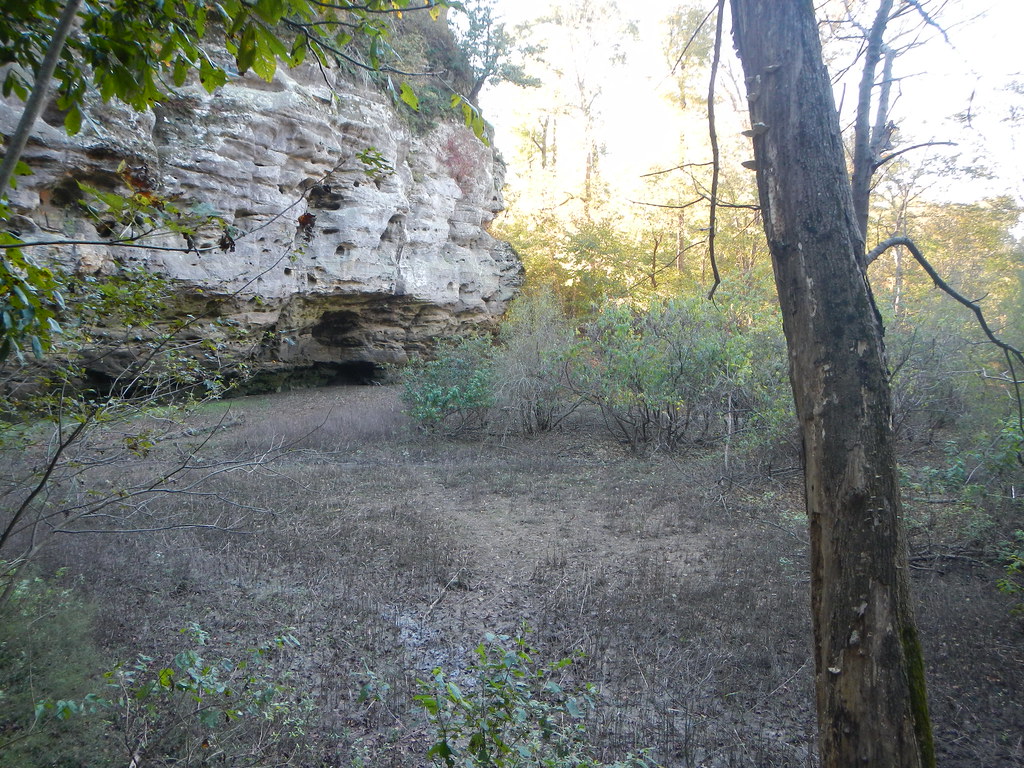 Photo: Curtis Abert, CC BY 2.0 (via Flickr)
Little Grand Canyon
~21 min drive
2.22-mile out-and-back trail in Illinois with 406 ft elevation gain.
 Photo: Curtis Abert, CC BY 2.0 (via Flickr)
Little Grand Canyon
~21 min drive
3.64-mile out-and-back trail in Illinois with 1,255 ft elevation gain
 Photo: Curtis Abert, CC BY 2.0 (via Flickr)
Inspiration Point
~30 min drive
0.82-mile out-and-back trail in Illinois with 235 ft elevation gain.
 Photo: USDAgov, Public Domain Dedication (CC0) (via Flickr)
Adt - Illinois (South) - J - Seg 3
~23 min drive
114.57-mile point-to-point trail in Illinois with 521 ft elevation gain.
 Photo: Curtis Abert, CC BY 2.0 (via Flickr)
King Hollow
~31 min drive
3.92-mile out-and-back trail in Illinois with 217 ft gain.
 Photo: Gary Lee Todd, Ph.D., Public Domain Dedication (CC0) (via Flickr)
Fernlands Nature Trail
~30 min drive
0.88-mile out-and-back hike in Illinois with 112 ft elevation gain.
Photo: Curtis Abert, CC BY 2.0 (via Flickr)001M5
~31 min drive
Easy 2.78-mile out-and-back trail in Illinois.
Wilkinson Trail
~16 min drive
3.22-mile out-and-back trail in Missouri with 859 ft gain.
Gum Ridge
~0 min drive
Easy 1.36-mile out-and-back trail in Illinois.
