Table Mountain Campground
At a glance
Table Mountain Campground is a Forest Service campground in the San Gabriel Mountains National Monument Ranger District of Angeles National Forest in California. It sits at about 6,000 feet, and the nearest town is Wrightwood, about 3.6 miles away. The site is a simple base for overnight stays. Amenities include vault toilets, and a fee is charged for use. The closest neighbor is Table Mountain (Angeles), another campground just 0.2 miles away, and the Table Mountain Trail starts about 0.3 miles off. For comfortable weather, late spring and early fall are the sweet spots. Typical averages from the nearby Wrightwood weather station show May highs around 69°F and September highs around 75°F, with lows in the upper 30s to mid 40s. That station sits about 1,200 feet lower than the campground, so temperatures here run cooler. Hikers can also reach the Big Pines Nature Trail and the Blue Ridge trail, both about 0.7 miles away. For a longer outing, Mount San Antonio (Mt. Baldy) is about 7.3 miles off.
- best months
- Apr–Oct
Where it is: San Gabriel Mountains National Monument Ranger District · Angeles National Forest
Near: Rancho Cucamonga
Reserve a site
Reserve on Recreation.govYou book with Recreation.gov. Roamze doesn't take a cut.
Best time to visit Table Mountain Campground
Best months: April–October. Best months have typical highs of 55–85 °F, lows of 30 °F or warmer (32 °F where the station doesn't record snow), at most one snowy day and no more than 12 wet days.
Jan
48°
26°
5 wet
Feb
48°
25°
8 wet
Mar
54°
29°
6 wet
Apr
60°
32°
4 wet
May
69°
39°
2 wet
Jun
78°
44°
1 wet
Jul
83°
53°
2 wet
Aug
82°
51°
2 wet
Sep
75°
46°
2 wet
Oct
64°
37°
3 wet
Nov
55°
29°
4 wet
Dec
47°
25°
5 wet
Typical high / low (°F) and days with rain or snow, 1991–2020. Measured at Wrightwood, CA, 3.6 mi away at 6,000 ft. The station sits about 1,200 ft lower than this place, so expect it a little cooler here. This station doesn't record snowfall. Source: NOAA NCEI U.S. Climate Normals 1991–2020.
Been here? Tell people how it was.
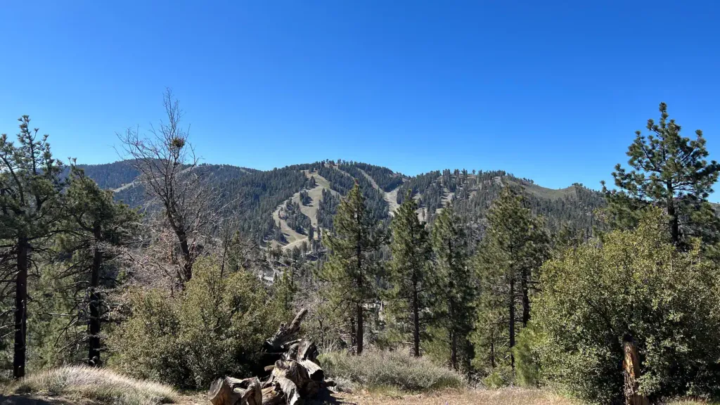 Table Mountain (angeles)CampingPhoto: Recreation.gov (RIDB) / public domain0.2 mi
- Table Mountain TrailHiking0.3 mi
- Big Pines Nature TrailHiking0.7 mi
- Blue RidgeHiking0.7 mi
- AppletreeCamping1.4 mi
- Peavine CampgroundCamping1.5 mi
- Mount San Antonio (Mt. Baldy)Rock climbing7.3 mi
- Other RoutesRock climbing7.9 mi
- Mountain OakCamping~4 min drive
- Deer Group CampCamping~16 min drive
- Table Mountain (angeles)CampingNext door
- AppletreeCamping~2 min drive
- Blue RidgeCamping~3 min drive
- Mt. Oak CampgroundCamping~4 min drive
- Jackson Flat CampgroundCamping~4 min drive
- Jackson Flat GroupCamping~5 min drive
- Cabin FlatCamping~5 min drive
- Little Fish ForkCamping~9 min drive
Also worth it near here
 Big Pines Nature TrailMountain bikingPhoto: Rennett Stowe from USA, CC BY 2.0 (via Wikimedia Commons)~1 min drive
 Mountain HighDownhill skiingPhoto: Mtf612 at English Wikipedia, Public domain (via Wikimedia Commons)~2 min drive
 Lightning Ridge Nature TrailHikingPhoto: simonov, CC BY-SA 2.0 (via Flickr)~3 min drive
 Mount Baden-PowellSummitPhoto: The original uploader was Jakerome at English Wikipedia./ Simonov, CC BY-SA 2.0 (via Wikimedia Commons)~8 min drive
Conditions and forecast
Caution todayAgency alerts are in effect for this areaUSFS · checked 8 h agoDaily highs and lows, wind and the chance of precipitation at Table Mountain Campground for the next 7 days, from the Open-Meteo model.
Ask about this place
Questions about Table Mountain Campground: conditions, access, timing. Answers say when something isn't known.
- At 7,200 ft
- San Gabriel Mountains National Monument Ranger DistrictAngeles National Forest
Table Mountain Campground
Book on Recreation.gov
