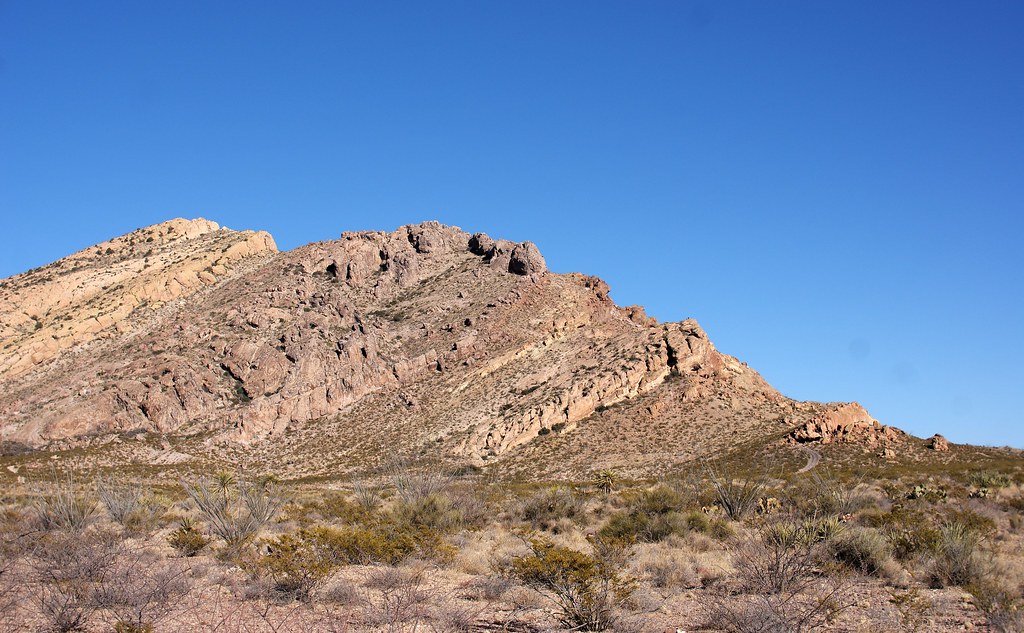
Sneed's Cory
 Photo: VisitElPaso, CC BY 2.0 (via Flickr)
At a glance
Sneed's Cory is a climbing area in Franklin Mountains State Park in Texas, managed by State Park and Recreation. It sits within the park's network of trails and climbing spots, and several short hikes start within a mile of it. Spring and fall are the most comfortable times to visit. Typical averages from a nearby weather station show April highs around 79°F and October highs around 78°F, while June and July average in the mid-90s. That station sits about 1,100 feet lower than the park, so temperatures at the climbing area run cooler. The area has 14 routes, mostly sport climbs with a few mixed routes. Grades range from 5.6 to 5.12a, with Terra-Tex at the top. Spirit is the easiest at 5.6, and Mean People Suck and Skin Diver are both around 5.10+. Tom Mays Park, another climbing area, is less than a mile away. Hidden Canyon, upper/west Indian Springs Canyon is about 2 miles off, and Mammoth Rock and Thunderbird are both within 4 miles.
14 routes · 5.6 – 5.12a · Sport · Mixed
- best months
- Oct–Apr
Where it is: Franklin Mountains State Park
Near: El Paso
Best time to visit Sneed's Cory
Best months: October–April. Best months have typical highs of 55–85 °F, lows of 30 °F or warmer (32 °F where the station doesn't record snow), at most one snowy day and no more than 12 wet days.
Jan
57°
34°
2 wet
Feb
63°
39°
2 wet
Mar
70°
45°
1 wet
Apr
79°
51°
1 wet
May
88°
60°
1 wet
Jun
95°
70°
2 wet
Jul
94°
73°
5 wet
Aug
92°
72°
5 wet
Sep
87°
66°
4 wet
Oct
78°
54°
3 wet
Nov
66°
41°
2 wet
Dec
56°
34°
2 wet
Typical high / low (°F) and days with rain or snow, 1991–2020. Measured at La Tuna 1 S, TX, 6.7 mi away at 3,870 ft. The station sits about 1,100 ft lower than this place, so expect it a little cooler here. Source: NOAA NCEI U.S. Climate Normals 1991–2020.
Been here? Tell people how it was.
- Agave LoopHiking0.1 mi
- Beginner's LoopHiking0.5 mi
- Nature TrailHiking0.5 mi
- Tom Mays TrailHiking0.6 mi
- Tom Mays ParkRock climbing0.9 mi
- Hidden Canyon, upper/west Indian Springs CanyonRock climbing2.2 mi
 Mammoth RockRock climbingPhoto: uıɐɾ ʞ ʇɐɯɐs, CC BY-SA 2.0 (via Flickr)3.6 mi
- ThunderbirdRock climbingPhoto: uıɐɾ ʞ ʇɐɯɐs, CC BY-SA 2.0 (via Flickr)3.8 mi
- Mammoth RockRock climbingPhoto: uıɐɾ ʞ ʇɐɯɐs, CC BY-SA 2.0 (via Flickr)~6 min drive
- ThunderbirdRock climbingPhoto: uıɐɾ ʞ ʇɐɯɐs, CC BY-SA 2.0 (via Flickr)~6 min drive
 New Year BoulderRock climbingPhoto: uıɐɾ ʞ ʇɐɯɐs, CC BY-SA 2.0 (via Flickr)~13 min drive
 Pena BlancaRock climbingPhoto: uıɐɾ ʞ ʇɐɯɐs, CC BY-SA 2.0 (via Flickr)~38 min drive
- The GardenRock climbingPhoto: uıɐɾ ʞ ʇɐɯɐs, CC BY-SA 2.0 (via Flickr)~38 min drive
- Hybrid WallRock climbingPhoto: uıɐɾ ʞ ʇɐɯɐs, CC BY-SA 2.0 (via Flickr)~38 min drive
 Split & Malice BouldersRock climbingPhoto: aafromaa, CC BY 2.0 (via Flickr)~47 min drive
 West MountainRock climbingPhoto: aafromaa, CC BY 2.0 (via Flickr)~47 min drive
 Between the SheetsRock climbingPhoto: aafromaa, CC BY 2.0 (via Flickr)~47 min drive
- Tom Mays ParkRock climbing~2 min drive
Conditions and forecast
Daily highs and lows, wind and the chance of precipitation at Sneed's Cory for the next 7 days, from the Open-Meteo model.
Ask about this place
Questions about Sneed's Cory: conditions, access, timing. Answers say when something isn't known.
