Schoolhouse Campground
Arizona
Schoolhouse Campground
Free — you'll pick up right here.
Conditions: Blocked
for sup, todayAn agency closure order is in effect for this area; weather is good
2 factors · 2 sources
Newest 16 h ago · oldest 16 h
problem: Agency alerts
14 active alerts in Tonto National Forest; most severe: Lower Sycamore Temporary Target Shooting Prohibition Order For Public Health and Safety
USFSPosted Oct 17 · checked 16 h ago
clear: Weather
Clouds, high 94°F / low 78°F, 6% precip — 86/100 for sup
OpenWeather16 h ago
Been out here in the last few days? One report keeps this current for everyone.
Here's your day on the water, mapped
Schoolhouse Campground
Suggested plan · check conditions before you go
Photos
Directions & GPX
Permits & access
- Managing agency
- Forest Service
About this water
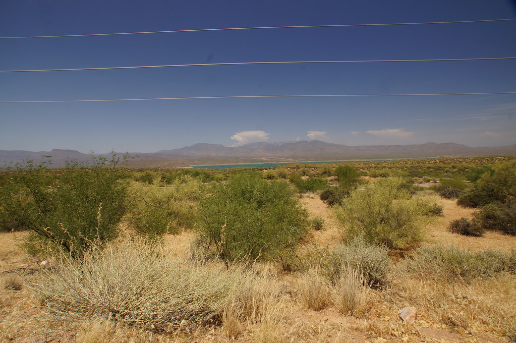
Overview Schoolhouse Campground is located in close proximity to the eastern shores of Roosevelt Lake with an elevation of 2,100 feet. Roosevelt is Arizona's largest lake offering a number of great water based recreation opportunites such as fishing, motorized and non-motorized boating, and lakeside hiking. Recreation Schoolhouse Campground offers easy access to Roosevelt Lake with a paved boat ramp. This provides excellent opportunities for boating, kayaking, canoeing, and other water-based recreation activites. Fishing is another popular activity where anglers fish for Largemouth and Small mouth Bass; Crappie; Sunfish; Channel and Flathead Catfish. Other activities in this area include, hiking, biking, wildlife viewing, and photography. Facilities This campground offers 40 campsites within Mesquite Loop, which can accomidate RVs, trailers, and multi-vehicle parking. Each individual campsite has the capacity to hold 10 individuals and 3 vehicles, while the double campsites can hold up to 20 individuals with 6 vehicles. Most sites offer pull through parking, a shade ramada, picnic tables, and campfire rings with grills. This site also offers fully accessible campsites with paved parking and stand-up grills. Other amentities include a paved boat launch area for motorized and non-motorized boating, and vault toilets. Water is not available at this recreational area. Natural Features The campground loop provides spacious sites perfect for RVs and trailers with mesquite trees throughout, and views of the mountains and native Sonoran Desert plants and wildlife. This is a small campground ideal for individuals or families looking for a quiet area to get away. Nearby Attractions Two National Scenic Byways (AZ Hwy 88 Apache Trail and AZ Hwy 288 Spines to Pines Highway). Roosevelt Dam, Tonto National Monument, the Arizona Trail, endless miles of jeep trails, Towns of Payson and Globe, Superstition, Sierra Ancha, and Four Peaks Wilderness'. Don't forget to stop by the Tonto Basin Environmental Center learn about the history of the area.
Add to a trip & share
Keep exploring — more water worth the drive
 Photo: Richard N Horne, CC BY-SA 4.0 (via Wikimedia Commons)
Tonto Creek
~55 min drive
Tonto Creek is a 65-mile paddling stretch near Payson, Arizona. It is intermittent and may run dry in some seasons. USGS models an average flow of about 159 cfs and a gradient of about 67.2 feet per mile. Land along it is managed by the U.S. Forest Service.
Schoolhouse Boating Site
~0 min drive
A worthwhile stop near Arizona.
Shores Recreation Site
~1h 19m drive
A worthwhile stop near Arizona.
Cholla Campground
~21 min drive
A worthwhile stop near Arizona.
 Photo: Richard N Horne, CC BY-SA 4.0 (via Wikimedia Commons)
East Verde River
~1h 25m drive
East Verde River is a 52-mile paddling stretch near Payson, Arizona. It flows year-round. USGS models an average flow of about 66 cfs and a gradient of about 70.6 feet per mile. Land along it is managed by the U.S. Forest Service.
Grapevine Boating Site
~4 min drive
A worthwhile stop near Arizona.
Salome Creek
~22 min drive
Salome Creek is a 23-mile paddling stretch near Young, Arizona. It is intermittent and may run dry in some seasons. USGS models an average flow of about 33 cfs and a gradient of about 144.7 feet per mile. Land along it is managed by the U.S. Forest Service.
Windy Hill Boating Site
~8 min drive
A worthwhile stop near Arizona.
Cherry Creek
~41 min drive
Cherry Creek is a 60-mile paddling stretch near Young, Arizona. It is ephemeral and may run dry in some seasons. USGS models an average flow of about 39 cfs and a gradient of about 70.6 feet per mile. Land along it is managed by the U.S. Forest Service.
Salt River Rafter Boat Ramp
~10 min drive
Salt River Rafter Boat Ramp is a boat launch in Arizona.