Otter Creek, Tamarisk Point Rec Site
- May–Sep
- best months
Clear today
Weather is good · OpenWeather · checked 33 min ago
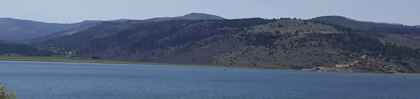
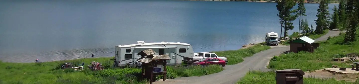
Otter Creek has an activity for almost everyone. The cold, clear water of this large reservoir offers year-round fishing for rainbow trout. For wildlife watchers, numerous waterfowl, raptors, deer, antelope, and elk abound. If you re an ATV rider, you ll want to try the Paiute ATV trail, which can be accessed from here. The primary activities are fishing and boating although it also serves as a regional staging site for extended and day trips into the surrounding National Forest, Utah State Lands and BLM managed lands by horse, foot, and vehicle. The Richfield Field Office manages day use facilities, dispersed and primitive camping facilities, and fishing access to the Reservoir at Fisherman's Beach, Tamarisk Point, and South Point along the west side of the reservoir. There is no potable water but picnic tables and pit toilets are available. Otter Creek Reservoir is located at the southeastern corner of Paiute County near the town of Antimony. A Utah State Park is located at the south end and provides well developed facilities, while the Richfield BLM maintains several semi-primitive sites along the west side of the lake and dispersed use is available on the east side of the reservoir. The main attraction is fishing and camping. The lands are sagebrush steppe. The Parker Mountains are located to the east, Monroe Mountain and Kingston canyon to the west of the lake, and the Sevier Plateau is to the southwest.
Local outfitters
- Piute Trail RV Park & Stan's Merc15 mi away
- Big Rock Candy Mountain26 mi away
Not on Roamze yet. Their page has how to reach them.
Best time to go · May–Sep
Best time to visit Otter Creek, Tamarisk Point Rec Site
Best months: May–September. Best months have typical highs of 55–85 °F, lows of 30 °F or warmer (32 °F where the station doesn't record snow), at most one snowy day and no more than 12 wet days.
Jan
40° / 8°
4 wet
Feb
44° / 13°
5 wet
Mar
52° / 20°
6 wet
Apr
58° / 25°
6 wet
May
68° / 33°
6 wet
Jun
79° / 39°
4 wet
Jul
85° / 46°
7 wet
Aug
83° / 45°
8 wet
Sep
76° / 36°
6 wet
Oct
65° / 25°
4 wet
Nov
52° / 15°
4 wet
Dec
40° / 6°
4 wet
Typical high / low (°F) and days with rain or snow, 1991–2020. Measured at Angle, UT, 3.2 mi away at 6,410 ft. This station doesn't record snowfall. Source: NOAA NCEI U.S. Climate Normals 1991–2020.

Keep exploring — more waters worth the drive
SEE
Otter Creek, Fishermans Beach Rec Site
~3 min drive
SEE
Piute Reservoir
~21 min drive
Piute Reservoir is a 2,226-acre reservoir near Kingston, Utah, at about 5,974 feet.
SEE
Hay Lakes
~28 min drive
Hay Lakes is a 9-acre lake near Escalante, Utah, at about 9,802 feet. It is managed by the U.S. Forest Service.
SEE
Lake Philo
~31 min drive
Lake Philo is a 27-acre lake near Escalante, Utah, at about 9,911 feet. It is managed by the U.S. Forest Service.
SEE
Upper Box Creek Reservoir
~32 min drive
Upper Box Creek Reservoir is a 68-acre reservoir near Marysvale, Utah, at about 8,822 feet. It is managed by the U.S. Forest Service.
SEE
Lower Box Creek Reservoir
~32 min drive
Lower Box Creek Reservoir is a 22-acre reservoir near Marysvale, Utah, at about 8,453 feet. It is managed by the U.S. Forest Service.
SEE
Barney Lake
~34 min drive
Barney Lake is a 15-acre lake near Marysvale, Utah, at about 10,120 feet. It is managed by the U.S. Forest Service.
SEE
Blue Lake
~36 min drive
SEE
Flat Lake
~36 min drive
Flat Lake is a 7-acre lake near Escalante, Utah, at about 9,618 feet. It is managed by the U.S. Forest Service.
SEE
Flat Lake
~36 min drive
