Atlantic White Cedar Swamp Trail
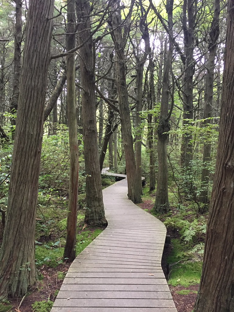 Photo: btwashburn, CC BY 2.0 (via Flickr)
At a glance
The Atlantic White Cedar Swamp Trail is an easy hike of about 1.9 miles in Cape Cod National Seashore, managed by the National Park Service in Massachusetts. The route is a point-to-point walk with a total elevation gain of 135 feet, and the steepest stretch comes around the 1-mile mark, where the grade reaches about 6 percent. Summer is the most comfortable time to go. Typical averages from a nearby weather station in Chatham show July highs around 79°F with lows near 64°F, while winter highs stay in the upper 30s. The trail makes a good pairing with camping. Le Count Beach House is about 0.7 miles away, and Sunrise House and Ocean View House are each about a mile off. For more walking, the Favorite Audubon Trail and Bay View Trail are both about 2.2 miles away.
- one way
- 1.9 mi
- climb
- 135 ft
- high point
- 91 ft
- route
- Point to point
- time
- About 45 minutes
- best months
- Jun–Aug
Where it is: Cape Cod National Seashore
Near: Barnstable Town
Best time to visit Atlantic White Cedar Swamp Trail
Best months: June–August. Best months have typical highs of 55–85 °F, lows of 30 °F or warmer (32 °F where the station doesn't record snow), at most one snowy day and no more than 12 wet days.
Jan
39°
26°
14 wet
Feb
40°
26°
12 wet
Mar
44°
31°
13 wet
Apr
52°
39°
13 wet
May
62°
48°
13 wet
Jun
71°
57°
12 wet
Jul
79°
64°
11 wet
Aug
78°
64°
12 wet
Sep
71°
58°
13 wet
Oct
61°
47°
14 wet
Nov
52°
39°
13 wet
Dec
44°
31°
14 wet
Typical high / low (°F) and days with rain or snow, 1991–2020. Measured at Chatham Muni Ap, MA, 15.5 mi away at 68 ft. This station doesn't record snowfall. Source: NOAA NCEI U.S. Climate Normals 1991–2020.
Been here? Tell people how it was.
- Le Count Beach HouseCamping0.7 mi
- Sunrise HouseCamping1 mi
- Ocean View HouseCamping1 mi
- Favorite Audubon TrailHiking2.2 mi
- Bay View TrailHiking2.2 mi
 Great Island TrailHikingPhoto: niklas.tenhaef1, CC BY-SA 2.0 (via Flickr)4.1 mi
 Herring River Overlook Conservation Land and TrailHikingPhoto: niklas.tenhaef1, CC BY-SA 2.0 (via Flickr)4.3 mi
- Nauset MiddleSchool BoulderRock climbing9 mi
 Cliff Pond TrailHikingPhoto: clembore, CC BY-SA 2.0 (via Flickr)~18 min drive
- Province Lands Bike TrailHiking~27 min drive
- Great Island TrailHikingPhoto: niklas.tenhaef1, CC BY-SA 2.0 (via Flickr)~7 min drive
- Little Cliff Pond TrailHikingPhoto: clembore, CC BY-SA 2.0 (via Flickr)~19 min drive
- Herring River Overlook Conservation Land and TrailHikingPhoto: niklas.tenhaef1, CC BY-SA 2.0 (via Flickr)~7 min drive
 ORV Beach TrailHikingPhoto: clembore, CC BY-SA 2.0 (via Flickr)~41 min drive
- Great Island TrailHiking~8 min drive
 Craddock TrailHikingPhoto: Magicpiano, CC BY-SA 4.0 (via Wikimedia Commons)~47 min drive
 Doane Rock LoopHikingPhoto: pedrik, CC BY 2.0 (via Flickr)~9 min drive
Conditions and forecast
Daily highs and lows, wind and the chance of precipitation at Start for the next 7 days, from the Open-Meteo model.
Ask about this place
Questions about Atlantic White Cedar Swamp Trail: conditions, access, timing. Answers say when something isn't known.
Map and trail data © OpenStreetMap contributors
