Mount Davidson
 Photo: Pi.1415926535, CC BY-SA 4.0 (via Wikimedia Commons)
At a glance
Mount Davidson is a summit in San Francisco County, California, rising to about 931 feet. The nearest town is Daly City, about 2.6 miles away. Late summer into early fall is the most comfortable time to visit. Typical averages from a nearby weather station in San Francisco show September and October highs around 70°F with only a day or two of rain each month, while winter months bring highs near 58°F and about 11 wet days. The summit sits close to several climbing areas, including Unnatural Act Cave, The at 0.6 miles and Main Cliff Band at 0.7 miles. Steep Ravine Trail is about 0.9 miles away, and Sutro Tower Trail, a mountain biking route, is about 1.2 miles off.
- summit
- 931 ft
- best months
- Jan–Dec
Near: Daly City · 2.6 mi
Best time to visit Mount Davidson
Best months: Year-round. Best months have typical highs of 55–85 °F, lows of 30 °F or warmer (32 °F where the station doesn't record snow), at most one snowy day and no more than 12 wet days.
Jan
58°
47°
11 wet
Feb
60°
48°
11 wet
Mar
62°
49°
11 wet
Apr
63°
50°
7 wet
May
64°
51°
4 wet
Jun
67°
53°
2 wet
Jul
66°
54°
1 wet
Aug
68°
55°
1 wet
Sep
70°
56°
1 wet
Oct
70°
54°
4 wet
Nov
64°
51°
8 wet
Dec
58°
47°
11 wet
Typical high / low (°F) and days with rain or snow, 1991–2020. Measured at San Francisco Dwtn, CA, 2.7 mi away at 150 ft. The station sits about 800 ft lower than this place, so expect it a little cooler here. This station doesn't record snowfall. Source: NOAA NCEI U.S. Climate Normals 1991–2020.
Been here? Tell people how it was.
We don't know of a mapped trail or route to the summit of Mount Davidson. Plan the approach with local maps, a guidebook or a local guide, and check conditions before you go.
 Mount Sutro913 ft · California2 routes1.4 mi awayPhoto: Hourann Bosci from Perth, Australia, CC BY-SA 2.0 (via Wikimedia Commons)
 San Bruno Mountain1,310 ft · California2 routes3.7 mi awayPhoto: Derrick Coetzee (User:Dcoetzee), CC0 (via Wikimedia Commons)
- Cattle Hill821 ft · California1 route9.1 mi away
- San Pedro Mountain1,063 ft · California1 route12 mi away
- Peak Mountain1,829 ft · California1 route12 mi away
- West Point1,810 ft · California1 route14 mi away
 The Unnatural Act CaveRock climbingPhoto: Joe Passe, CC BY-SA 2.0 (via Flickr)0.6 mi
- Main Cliff BandRock climbingPhoto: Joe Passe, CC BY-SA 2.0 (via Flickr)0.7 mi
 Glen CanyonRock climbingPhoto: Joe Passe, CC BY-SA 2.0 (via Flickr)0.7 mi
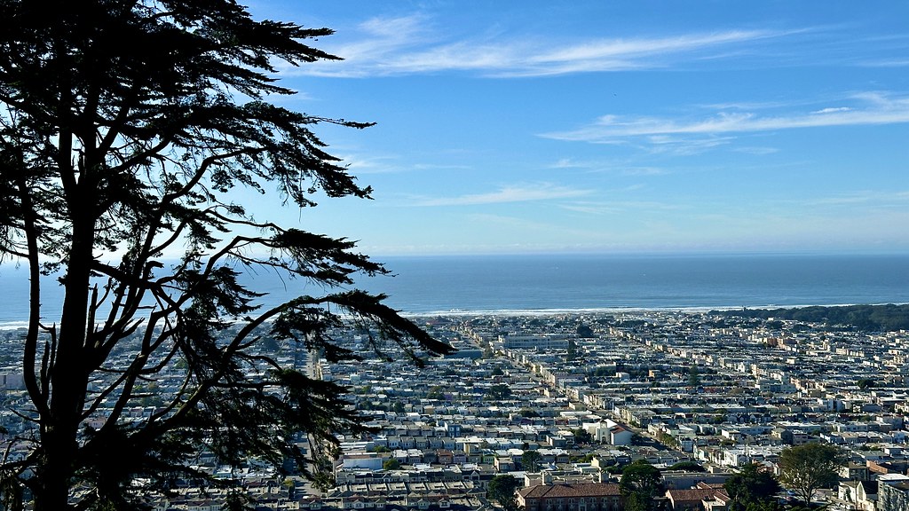 Steep Ravine TrailHikingPhoto: lamblukas, CC BY 2.0 (via Flickr)0.9 mi
- Sutro Tower TrailMountain biking1.2 mi
 Historic TrailHikingPhoto: ABIJXY, CC BY 3.0 (via Wikimedia Commons)1.2 mi
- Aquatic Park Cove, Black Point Overnight Anchoring, Sailing Vessels only (auxiliary engine OK)Pier fishing5.1 mi
- Esplenade BeachCamping6.2 mi
- Mount SutroSummitPhoto: Hourann Bosci from Perth, Australia, CC BY-SA 2.0 (via Wikimedia Commons)~2 min drive
 Mount OlympusSummitPhoto: Pi.1415926535, CC BY-SA 3.0 (via Wikimedia Commons)~3 min drive
 Bernal HeightsSummitPhoto: The original uploader was Octoferret at English Wikipedia., CC BY-SA 2.5 (via Wikimedia Commons)~4 min drive
 Strawberry HillSummitPhoto: WorldIslandInfo.com, CC BY 2.0 (via Wikimedia Commons)~4 min drive
- San Bruno MountainSummitPhoto: Derrick Coetzee (User:Dcoetzee), CC0 (via Wikimedia Commons)~6 min drive
 Bay View HillSummitPhoto: Doc Searls from Santa Barbara, USA, CC BY-SA 2.0 (via Wikimedia Commons)~6 min drive
 Stony HillSummitPhoto: Clyde Charles Brown, CC BY-SA 4.0 (via Wikimedia Commons)~7 min drive
 North PeakSummitPhoto: Clyde Charles Brown, CC BY-SA 4.0 (via Wikimedia Commons)~21 min drive
 Albany HillSummitPhoto: Coro at English Wikipedia, CC BY-SA 3.0 (via Wikimedia Commons)~23 min drive
 Montara MountainSummitPhoto: Mike Weston from La Honda, CA, CC BY 2.0 (via Wikimedia Commons)~25 min drive
Also worth it near here
- The Unnatural Act CaveRock climbingPhoto: Joe Passe, CC BY-SA 2.0 (via Flickr)~1 min drive
- Steep Ravine TrailHikingPhoto: lamblukas, CC BY 2.0 (via Flickr)~2 min drive
- Sutro Tower TrailMountain biking~2 min drive
 Huntington FallsWaterfallPhoto: King of Hearts, CC BY-SA 4.0 (via Wikimedia Commons)~4 min drive
Conditions and forecast
Daily highs and lows, wind and the chance of precipitation at the summit for the next 7 days, from the Open-Meteo model.
Questions about Mount Davidson
How tall is Mount Davidson?
931 ft (284 m).
Is there a trail to the top of Mount Davidson?
We don't know of a mapped trail or route to the summit. Plan the approach with local maps, a guidebook or a local guide.
Ask about this place
Questions about Mount Davidson: conditions, access, timing. Answers say when something isn't known.
