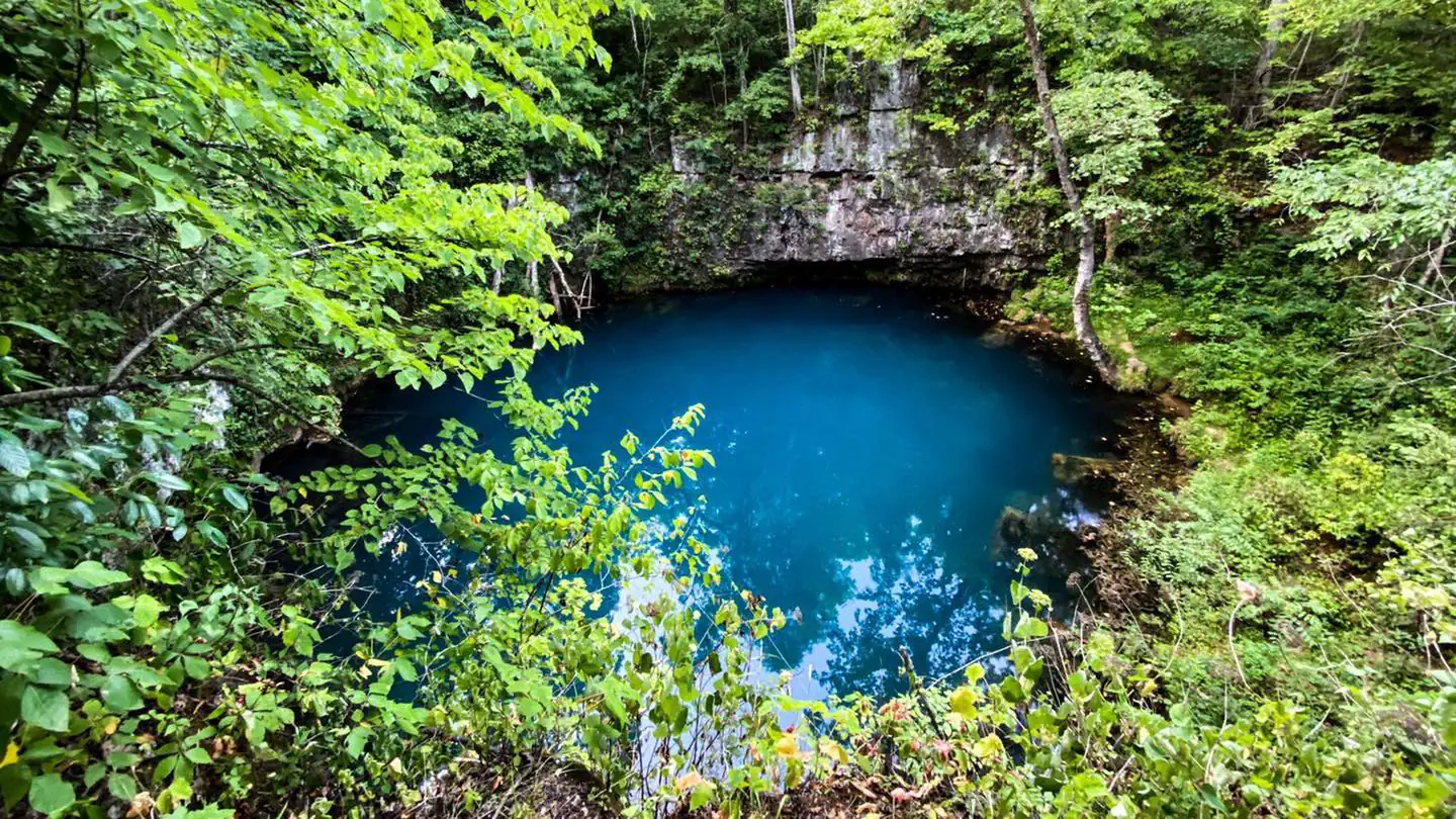
Meramec River
- Easy
- difficulty
- Mar–Jun, Sep–Nov
- best months
The Meramec River is a river in Missouri, managed by the Missouri Department of Conservation and St. Louis County Parks. It lies about half a mile from the community of Pettys Hill, and the route to it is rated easy. Spring and fall are the most comfortable times to visit. Typical averages from a nearby weather station show October highs around 70°F with lows near 46°F, and May highs around 77°F. July is the warmest month, with typical highs near 89°F. Several trails sit close by. Gray Trail is about 1.2 miles away, and Brown Trail and River Scene Trail are each about 1.3 miles off. Climbers can find Chubb Trail Crack Wall roughly 3.2 miles away.
- Gray TrailHiking1.2 mi
- Brown TrailHiking1.3 mi
 River Scene TrailHikingPhoto: pasa47, CC BY 2.0 (via Flickr)1.3 mi
 Chubb Trail Crack WallRock climbingPhoto: Fredlyfish4, CC BY-SA 3.0 (via Wikimedia Commons)3.2 mi
- EM: Frisco BoulderRock climbing3.2 mi
- EM: Kirkwood BouldersRock climbing4.3 mi
 Bonhomme CreekCanoeingPhoto: Palisades1, CC BY-SA 4.0 (via Wikimedia Commons)8.9 mi
- Creve Coeur CreekCanoeing8.9 mi
Source: Roamze catalog (indexable pages within 10 miles, PostGIS distance)
- Paul Goessling LakeLake fishing · ~20 min drive
- Mononame 207 ReservoirLake fishing · ~25 min drive
- Vatterott LakeLake fishing · ~27 min drive
- Busch Area Lake Number 51Lake fishing · ~28 min drive
- Lake TishomingoLake fishing · ~29 min drive
- August A Busch Lake Number 16Lake fishing · ~29 min drive
- BaratHaven LakeLake fishing · ~30 min drive
- Ash Disposal PondLake fishing · ~30 min drive
- August A Busch Lake Number 31Lake fishing · ~30 min drive
- Von Der Rosa Number 2 ReservoirLake fishing · ~31 min drive
Also worth it near here
 Riverscene TrailMountain biking · ~2 min drivePhoto: Kbh3rd, CC BY 3.0 (via Wikimedia Commons)
- River Scene TrailHiking · ~2 min drivePhoto: pasa47, CC BY 2.0 (via Flickr)
- Meramec LandingBoat launch · ~3 min drive
- Chubb Trail Crack WallRock climbing · ~5 min drivePhoto: Fredlyfish4, CC BY-SA 3.0 (via Wikimedia Commons)
Best time to visit Meramec River
Best months: March–June and September–November. Best months have typical highs of 55–85 °F, lows of 30 °F or warmer (32 °F where the station doesn't record snow), at most one snowy day and no more than 12 wet days.
Jan
40° / 22°
7 wet
Feb
45° / 25°
7 wet
Mar
56° / 35°
10 wet
Apr
67° / 46°
11 wet
May
77° / 56°
12 wet
Jun
85° / 65°
9 wet
Jul
89° / 69°
8 wet
Aug
87° / 67°
7 wet
Sep
81° / 58°
6 wet
Oct
70° / 46°
8 wet
Nov
56° / 36°
8 wet
Dec
45° / 27°
8 wet
Typical high / low (°F) and days with rain or snow, 1991–2020. Measured at St Charles 7 Ssw, MO, 9.6 mi away at 450 ft. This station doesn't record snowfall. Source: NOAA NCEI U.S. Climate Normals 1991–2020.