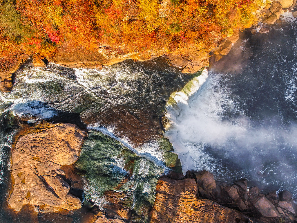
Cumberland Falls
 Photo: ChrisKuehl, Public domain (via Wikimedia Commons)
At a glance
Cumberland Falls is a waterfall in Kentucky's Daniel Boone National Forest, within the Stearns Ranger District. It sits at about 770 feet, roughly 11 miles from the town of Whitley City. The falls make an easy anchor for a short outing. Cumberland Falls Trail #6 starts just 0.1 mile away, and Eagle Creek Falls Trail is about 0.2 mile off. The CCC Memorial Trail #4 and Camper's Path #5 are both within a mile, so it's simple to string a few trails together in one visit. Fall is the most comfortable time to go. Typical averages from a nearby weather station in Williamsburg show October highs around 70°F with lows near 44°F, and September and October bring the fewest wet days of the year. Lake Cumberland - Stearns, about 8 miles away, offers fishing, and Rockcastle Campground, about 8.5 miles away, is the closest place to camp.
- elevation
- 769 ft
- best months
- Apr–Jun, Aug–Nov
Where it is: Stearns Ranger District · Daniel Boone National Forest
Near: Williamsburg
Best time to visit Cumberland Falls
Best months: April–June and August–November. Best months have typical highs of 55–85 °F, lows of 30 °F or warmer (32 °F where the station doesn't record snow), at most one snowy day and no more than 12 wet days.
Jan
45°
25°
12 wet
Feb
49°
27°
12 wet
Mar
59°
33°
13 wet
Apr
69°
41°
11 wet
May
76°
52°
12 wet
Jun
84°
61°
11 wet
Jul
87°
63°
11 wet
Aug
85°
62°
9 wet
Sep
79°
55°
7 wet
Oct
70°
44°
8 wet
Nov
58°
33°
10 wet
Dec
49°
28°
12 wet
Typical high / low (°F) and days with rain or snow, 1991–2020. Measured at Williamsburg, KY, 13 mi away at 940 ft. This station doesn't record snowfall. Source: NOAA NCEI U.S. Climate Normals 1991–2020.
Been here? Tell people how it was.
Routes to Cumberland Falls
 Cumberland Falls Trail #6HikingPhoto: US Forest Service - Southern Region, Public Domain Mark (via Flickr)0.1 mi
- Eagle Creek Falls TrailHikingPhoto: US Forest Service - Southern Region, Public Domain Mark (via Flickr)0.2 mi
- CCC Memorial Trail #4Hiking0.4 mi
- Camper's Path #5Hiking0.6 mi
 Anvil Branch Trail #11HikingPhoto: US Forest Service - Southern Region, Public Domain Mark (via Flickr)0.6 mi
- Blue Bend Loop TrailHiking1.2 mi
- Lake Cumberland - StearnsLake fishing8.2 mi
- Rockcastle CampgroundCamping8.5 mi
 Eagle FallsWaterfallPhoto: Kysailor at English Wikipedia, CC BY-SA 3.0 (via Wikimedia Commons)Next door
- Dog Slaughter FallsWaterfall~4 min drive
- Amos FallsWaterfall~8 min drive
- The FallsWaterfall~50 min drive
- Jock FallsWaterfall~51 min drive
- Double FallsWaterfall~56 min drive
- Seventy Six FallsWaterfall~1h 15m drive
- Northrup FallsWaterfall~1h 16m drive
- Magendanz FallsWaterfall~1h 16m drive
- Anglin FallsWaterfall~1h 19m drive
Conditions and forecast
Daily highs and lows, wind and the chance of precipitation at Cumberland Falls for the next 7 days, from the Open-Meteo model.
Ask about this place
Questions about Cumberland Falls: conditions, access, timing. Answers say when something isn't known.
