
Aviator
Arizona
Free — you'll pick up right here.
0.4 mi
Distance
158 ft
Gain
We don't cover this trail yet
No agency boundary, access route or field report is mapped to it — so there is no verdict, and we won't guess. We'll tell you the moment this trail has something to say.
Covered nearby
Trails within 25 miles where we do have a current picture.
Nobody's filed a report here yet — be the first.
Why you'll love it
Here's your day, mapped
Aviator
Suggested plan · check conditions before you go
Meals
Gear for the day
Elevation & route
- Distance
- 0.4 mi
- Elevation gain
- 158 ft
Photos
Directions & GPX
Permits & access
- Managing agency
- Forest Service
About this trail
Aviator is a short out-and-back trail in Arizona managed by the Forest Service. The route gains 158 feet of elevation over 0.84 miles.
Facts about this trail
The climb
- Length (round trip)
- 0.8 mi
- Shape
- Out and back
Source: Roamze elevation profile and trail geometry (DEM samples along the mapped route)
Where it is
- Santa Catalina Ranger District · Ranger district
- Coronado National Forest · National forest
Source: USFS EDW boundaries
Conditions
Active alerts for Santa Catalina Ranger District as of Oct 9, 2026:
critical · posted Sep 3, 2026
Tanque Verde Falls Camping Closure
information · posted Aug 24, 2026
Sabino and Bear Canyon Closure Order 03-05-03-25-002
information · posted Aug 24, 2026
information · posted Aug 24, 2026
Bear Wallow Riparian Area Closure
information · posted Aug 24, 2026
Tanque Verde Fall Camping Closure
information · posted Aug 24, 2026
Rose Canyon Lake restriction to being in or on the lake
information · posted Aug 24, 2026
Source: USFS forest alerts
Nearby
- Bellota Trail #15Hiking0.1 mi
- Molino Basin Trail #11Hiking0.1 mi
- Molino Basin BouldersRock climbing0.1 mi
- Business Time WallRock climbing0.1 mi
- Sun Spot CragsRock climbing0.1 mi
- Molino BasinCamping0.2 mi
- MolinoCamping0.5 mi
- Molino Basin GroupCamping0.5 mi
Source: Roamze catalog (indexable pages within 10 miles, PostGIS distance)
Add to a trip & share
Keep exploring — more trails worth the drive
Photo: theojones2, Public Domain Dedication (CC0) (via Flickr)Bellota Trail #15
~0 min drive
A 10.57-mile out-and-back trail in Arizona that connects to the Arizona National Scenic Trail system.
Photo: theojones2, Public Domain Dedication (CC0) (via Flickr)Molino Basin Trail #11
~0 min drive
A 2.75-mile out-and-back trail in Arizona connecting to the Arizona Trail and Sycamore Reservoir Trail system.
 Photo: Tanque Verde, CC BY 2.0 (via Flickr)
Babad Do'ag
~4 min drive
4.94-mile out-and-back trail in Arizona with 1,295 ft of elevation gain.
 Photo: Tanque Verde, CC BY 2.0 (via Flickr)
Converse Trail
~12 min drive
1.2-mile out-and-back hike in Arizona with 11 ft of elevation gain.
Photo: Tanque Verde, CC BY 2.0 (via Flickr)Milagrosa
~5 min drive
7.48-mile out-and-back trail in Arizona with 922 ft gain.
 Photo: theojones2, Public Domain Dedication (CC0) (via Flickr)
Bug Springs Trail
~4 min drive
8.80-mile out-and-back trail in Arizona with 250 ft of elevation gain.
 Photo: 666isMONEY ☮ ♥ & ☠, CC BY 2.0 (via Flickr)
Rose Canyon Lake
~6 min drive
0.32-mile out-and-back trail to Rose Canyon Lake in Arizona.
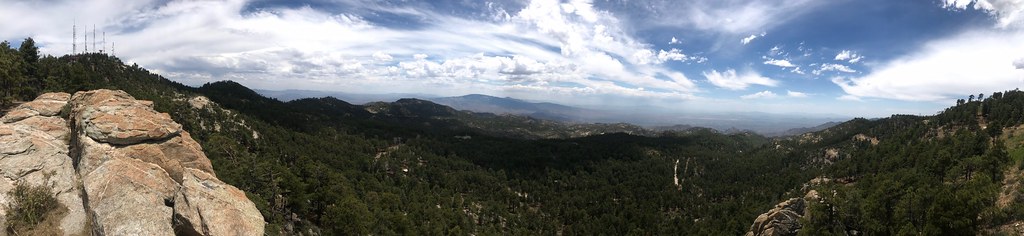 Photo: 666isMONEY ☮ ♥ & ☠, CC BY 2.0 (via Flickr)
Palisade
~8 min drive
12.74-mile out-and-back trail in Arizona with 1,161 ft elevation gain.
 Photo: 666isMONEY ☮ ♥ & ☠, CC BY 2.0 (via Flickr)
Blue Dot Trail
~10 min drive
2.06-mile out-and-back trail in Arizona with 865 ft gain and 3,640 ft max elevation.
 Photo: Katja Schulz from Washington, D. C., USA, CC BY 2.0 (via Wikimedia Commons)
Guthrie
~7 min drive
1.70-mile out-and-back trail in Arizona with 405 ft gain.
Also worth it near here


