 Photo: Unknown author, Public domain (via Wikimedia Commons)
Wyoming · Paddling
Paddling in Yellowstone National Park, Wyoming
14 spotsUpdated weeklyFree to access
View on mapPaddling · 14 spots
Featured spots
Photo: Unknown author, Public domain (via Wikimedia Commons)Canoeing
Fall River
Yellowstone National Park, Wyoming
 Photo: Wing-Chi Poon, CC BY-SA 2.5 (via Wikimedia Commons)
Canoeing
Firehole River
Yellowstone National Park, Wyoming
 Photo: Jo Suderman, Public domain (via Wikimedia Commons)
Canoeing
Gardner River
Yellowstone National Park, Wyoming
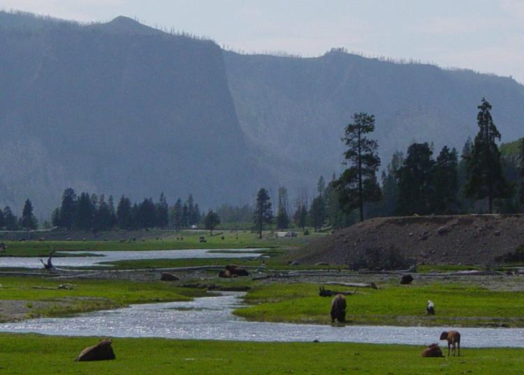 Photo: Daniel Mayer, CC BY-SA 3.0 (via Wikimedia Commons)
Canoeing
Gibbon River
Yellowstone National Park, Wyoming
 Photo: NPS, Public domain (via Wikimedia Commons)
Canoeing
Heart River
Yellowstone National Park, Wyoming
All spots · 14 spots

Canoeing
Beaverdam Creek
Yellowstone National Park, Wyoming
Canoeing
Broad Creek
Yellowstone National Park, Wyoming
Canoeing
Cache Creek
Yellowstone National Park, Wyoming

Canoeing
Cougar Creek
Yellowstone National Park, Wyoming
Canoeing
Grayling Creek
Yellowstone National Park, Wyoming
 Photo: J. Schmidt, Public domain (via Wikimedia Commons)
Canoeing
Lamar River
Yellowstone National Park, Wyoming
 Photo: Jan Kronsell, Public domain (via Wikimedia Commons)
Canoeing
Lewis River
Yellowstone National Park, Wyoming
 Photo: Yellowstone National Park, Public domain (via Wikimedia Commons)
Canoeing
Little Firehole River
Yellowstone National Park, Wyoming

Canoeing
Mountain Creek
Yellowstone National Park, Wyoming
Keep exploring — more water worth the drive
Photo: Daniel Mayer, CC BY-SA 3.0 (via Wikimedia Commons)Gibbon River
~23 min drive
Gibbon River is a 23-mile paddling stretch near Yellowstone National Park, Wyoming. It flows year-round. USGS models an average flow of about 127 cfs and a gradient of about 41.0 feet per mile. Land along it is managed by the National Park Service.
Lewis Lake
~31 min drive
Lewis Lake is a boat launch in Wyoming.
Big Springs Grp. Area - Island Park
~60 min drive
A worthwhile stop near Idaho.
Photo: Wing-Chi Poon, CC BY-SA 2.5 (via Wikimedia Commons)Firehole River
~28 min drive
Firehole River is a 12-mile paddling stretch near Yellowstone National Park, Wyoming. It flows year-round. USGS models an average flow of about 309 cfs and a gradient of about 89.3 feet per mile. Land along it is managed by the National Park Service.
Big Springs Boat Ramp
~1h 1m drive
A worthwhile stop near Idaho.
Flat Rock
~1h 7m drive
A worthwhile stop near Idaho.
Photo: Yellowstone National Park, Public domain (via Wikimedia Commons)Little Firehole River
~31 min drive
Little Firehole River is an 8.4-mile paddling stretch near Yellowstone National Park, Wyoming. It is intermittent and may run dry in some seasons. USGS models an average flow of about 90 cfs and a gradient of about 83.5 feet per mile. Land along it is managed by the National Park Service.
Lonesomehurst Boating Site
~1h 2m drive
A worthwhile stop near Montana.
Upper Coffee Pot
~1h 9m drive
A worthwhile stop near Idaho.
Photo: NPS, Public domain (via Wikimedia Commons)Heart River
~38 min drive
Heart River is a 4.6-mile paddling stretch near Yellowstone National Park, Wyoming. It flows year-round. USGS models an average flow of about 101 cfs and a gradient of about 39.9 feet per mile. Land along it is managed by the National Park Service.
Mc Connell Boating Site
~1h 3m drive
A worthwhile stop near Montana.
Warm River
~1h 22m drive
A worthwhile stop near Idaho.
Also worth it near here
 Photo: G. Edward Johnson, CC BY 3.0 (via Wikimedia Commons)
Yellowstone Natural Bridge
~8 min drive
 Photo: Yellowstone National Park from Yellowstone NP, USA, Public domain (via Wikimedia Commons)
Bridge Bay Campground
~10 min drive
Lake Yellowstone Hotel and Cabins
~13 min drive
Black Dragon's Caldron
~14 min drive
 Photo: Tony Hisgett from Birmingham, UK, CC BY 2.0 (via Wikimedia Commons)
Upper Falls of the Yellowstone River
~21 min drive
