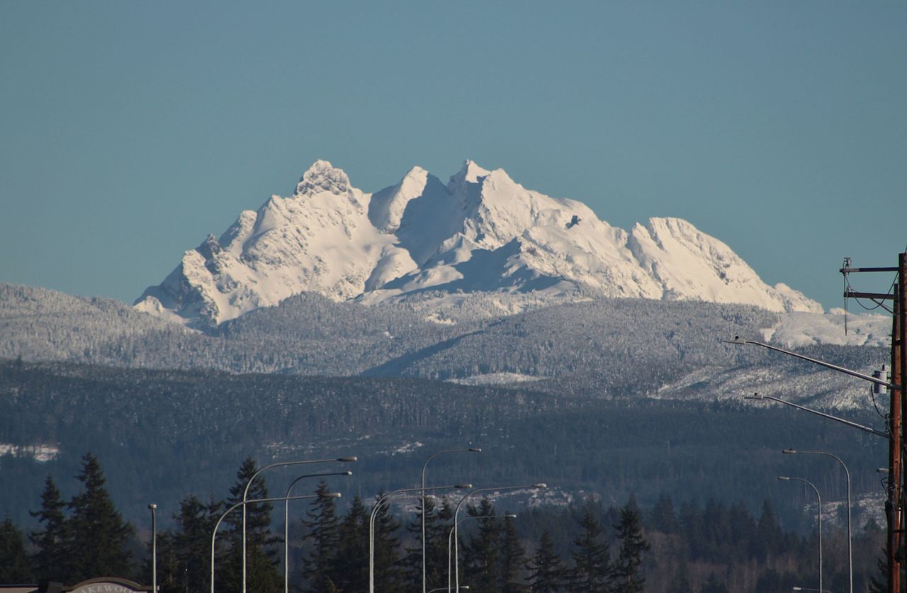
Three Fingers
About
Three Fingers is a summit of about 6,852 feet in Snohomish County, Washington, inside the Boulder River Wilderness. The peak lies within the Darrington Ranger District of Mt. Baker-Snoqualmie National Forest, which the Forest Service manages, and the nearest town is Verlot, about 6 miles away. The Three Fingers summit trail starts less than a mile from the peak, and the Waterfall Basin climbing area is about 0.7 miles away. Farther out, the Eight-Mile Creek Trail is about 2 miles off, and Clear Creek Campground offers a place to stay roughly 6 miles away.
Summit Facts
Summit elevation
6,852 ft
Land manager
Forest Service
Elevation from USGS 3D Elevation Program terrain data (about 10 m resolution).
Location
Three Fingers
Washington
Name and location: U.S. Geological Survey, Geographic Names Information System (GNIS). Elevation: USGS 3D Elevation Program. View the GNIS record.
Facts about this place
Where it is
- Boulder River Wilderness · Wilderness
- Darrington Ranger District · Ranger district
- Mt. Baker-Snoqualmie National Forest · National forest
- Nearest town
- Verlot, Washington · 5.7 mi
- Managed by
- Forest Service
Source: Wilderness.net boundaries; USFS EDW boundaries; USGS PAD-US 4.1; USGS GNIS populated places
Conditions
Active alerts for Darrington Ranger District as of Oct 9, 2026:
critical · posted Aug 24, 2026
Source: USFS forest alerts
Nearby
- Waterfall BasinRock climbing0.7 mi
- Three Fingers summit trailHiking0.8 mi
- Eight-Mile Creek TrailHiking2.2 mi
- DarringtonRock climbing2.5 mi
- Copper CreekCanoeing2.6 mi
- Gerkman CreekCanoeing3 mi
- Clear Creek CampgroundCamping6.3 mi
- Esswine Group CampCamping6.7 mi
Source: Roamze catalog (indexable pages within 10 miles, PostGIS distance)
