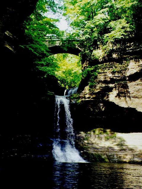
Matthiessen State Park
About
Matthiessen State Park is a 1,915-acre state park in north-central Illinois, about 2.5 miles from the town of Oglesby. The land is managed by the State Department of Natural Resources. Late spring and early fall are the most comfortable times to go. Typical averages from a nearby weather station in Peru, Illinois, show May highs around 73°F and September highs around 77°F, with July the warmest month at about 84°F. Several climbing areas sit close by: A: Starting Area is about 1.5 miles away, B: Broken Bridge Area about 1.7 miles, and Lehigh Park about 1.9 miles. Anglers can reach fishing on the Illinois River roughly 2.9 miles from the park.
Park size
1,915 acres
Location
Matthiessen State Park
Illinois
Data source: USGS PAD-US 4.1 (Protected Areas Database, public domain)
Facts about this place
When to go
Best time to go: Apr–Oct. The mildest months here, with typical highs of 61–84°F and lows of 38–63°F.
Typical monthly averages (not a forecast) from the Peru, IL weather station, 6.4 mi away. High / low in °F.
- Jan30° high14° low
- Feb34° high18° low
- Mar48° high27° low
- Apr61° high38° low
- May73° high49° low
- Jun81° high59° low
- Jul84° high63° low
- Aug82° high61° low
- Sep77° high53° low
- Oct64° high41° low
- Nov48° high30° low
- Dec36° high20° low
Where it is
- Matthiessen State Park · State park
- Nearest town
- Oglesby, Illinois · 2.5 mi
- Managed by
- State Department of Natural Resources
Nearby
- A: Starting AreaRock climbing1.5 mi
- B: Broken Bridge AreaRock climbing1.7 mi
- Lehigh ParkRock climbing1.9 mi
- Illinois RiverRiver fishing2.9 mi
Source: Roamze catalog (indexable pages within 10 miles, PostGIS distance)
