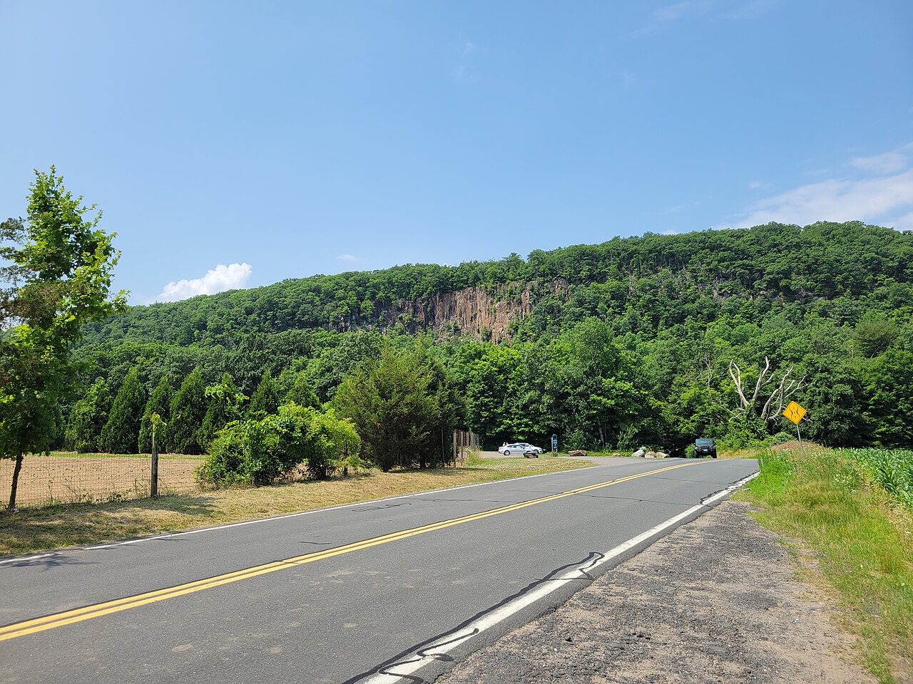
Manitook Mountain
About
Manitook Mountain is a summit in Capitol County, Connecticut, rising to about 633 feet. The nearest town is Salmon Brook, about 2.7 miles away. September is a comfortable time to visit. Typical averages from a nearby weather station run a high of about 75°F and a low of about 52°F, with only around nine wet days in the month. Several other outings lie within a short drive. The Yellow Trail is about 3 miles away and the Evergreen Trail about 3.6 miles. Stony Brook offers canoeing at about 4.3 miles, and Diamond Ledge has rock climbing at about 4.7 miles.
Summit Facts
Summit elevation
633 ft
Elevation from USGS 3D Elevation Program terrain data (about 10 m resolution).
Location
Manitook Mountain
Connecticut
Name and location: U.S. Geological Survey, Geographic Names Information System (GNIS). Elevation: USGS 3D Elevation Program. View the GNIS record.
Facts about this place
When to go
Best time to go: May–Oct. The mildest months here, with typical highs of 62–84°F and lows of 40–61°F.
Typical monthly averages (not a forecast) from the Westfield 3 Sw, MA weather station, 6.9 mi away. High / low in °F.
- Jan33° high16° low
- Feb37° high17° low
- Mar45° high25° low
- Apr58° high35° low
- May70° high46° low
- Jun78° high56° low
- Jul84° high61° low
- Aug82° high59° low
- Sep75° high52° low
- Oct62° high40° low
- Nov49° high31° low
- Dec38° high22° low
Nearby
- Yellow TrailHiking3 mi
- Evergreen TrailHiking3.6 mi
- Old Messenger Road Corridor TrailHiking3.8 mi
- Stony BrookCanoeing4.3 mi
- Diamond ClusterRock climbing4.7 mi
- Diamond LedgeRock climbing4.7 mi
- Diamond Ledge BoulderingRock climbing4.8 mi
- Muddy BrookCanoeing5.2 mi
Source: Roamze catalog (indexable pages within 10 miles, PostGIS distance)
