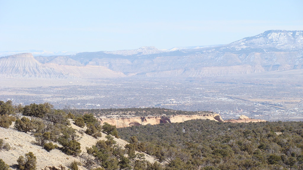
Fallen Rock Climbs
6 trad routes at Fallen Rock Climbs in Colorado, covering 6 difficulty grades.
 Photo: iagoarchangel, CC BY-SA 2.0 (via Flickr)
- 6 routes
- 5.10c – 5.12a
- Trad
Is Fallen Rock Climbs open right now?
Alert in the area
The National Park Service lists an alert for Colorado National Monument.
Year-round Fire Restrictions in Effect
Park alert covering Colorado National Monument · NPS · Colorado National Monument
As of · Source: NPS · Colorado National Monument. Agencies don't list every closure — check before you go.
Best time to visit Fallen Rock Climbs
Best months: April–May and September–October. Best months have typical highs of 55–85 °F, lows of 30 °F or warmer (32 °F where the station doesn't record snow), at most one snowy day and no more than 12 wet days.
Jan
39° / 21°
6 wet · 4 snow
Feb
45° / 25°
5 wet · 3 snow
Mar
56° / 34°
6 wet · 2 snow
Apr
63° / 39°
6 wet · 1 snow
May
74° / 49°
6 wet
Jun
87° / 58°
4 wet
Jul
93° / 65°
6 wet
Aug
90° / 62°
7 wet
Sep
80° / 54°
7 wet
Oct
66° / 41°
6 wet
Nov
50° / 31°
6 wet · 2 snow
Dec
39° / 22°
6 wet · 4 snow
Typical high / low (°F) and days with rain or snow, 1991–2020. Measured at Colorado Nm, CO, 4.8 mi away at 5,781 ft. Source: NOAA NCEI U.S. Climate Normals 1991–2020.
Fallen Rock Climbs is a climbing area within Colorado National Monument, managed by the National Park Service. It sits in the Colorado National Monument unit of the National Park Service, about 4.8 miles from a weather station in the monument that serves as a reference point for typical averages in the area. Spring and fall are the most comfortable times to visit. Typical averages from that station show May highs around 74°F and October highs around 66°F, while July peaks near 93°F and winter highs stay near 39°F with a few snowy days each month from December through February. A fee is charged for climbing here, as noted in the National Park Service's records. The Astro Bunny Area is just 0.2 miles away and Ute Canyon is 0.4 miles off, both within easy reach for a combined day of climbing and hiking. Otto's Trail and the Liberty Cap Trail are a little farther out, at about 1.8 and 2.3 miles.
Routes (6)
Facts about this crag
Keep exploring — more climbs worth the drive
 Photo: daveynin, CC BY 2.0 (via Flickr)
Kissing Couple area
~6 min drive
Kissing Couple area is a Colorado climbing crag with 5 routes and 3 difficulty grades.
Photo: daveynin, CC BY 2.0 (via Flickr)Colorado National Monument
~7 min drive
18 routes at Colorado National Monument range from 8 difficulty grades, mixed and trad climbing.
Photo: daveynin, CC BY 2.0 (via Flickr)Independence Monument
~7 min drive
Independence Monument in Colorado has 7 climbing routes on rock.
 Photo: daveynin, CC BY 2.0 (via Wikimedia Commons)
Organ Pipe Spire and Pipe Organ Spire
~8 min drive
7 trad routes at Organ Pipe Spire and Pipe Organ Spire in Colorado.
 Photo: iagoarchangel, CC BY-SA 2.0 (via Flickr)
Monument Canyon
~8 min drive
Monument Canyon in Colorado has 30 climbing routes across 17 difficulty grades, featuring bouldering pads, mixed, sport, and trad styles.
 Photo: Navin75, CC BY-SA 2.0 (via Flickr)
Fruita Canyon
~8 min drive
Fruita Canyon in Colorado has 11 traditional climbing routes across 8 difficulty grades.
 Photo: Cerahammond, CC BY-SA 4.0 (via Wikimedia Commons)
No Thoroughfare Canyon
~8 min drive
No Thoroughfare Canyon in Colorado has 15 climbing routes.
 Photo: daveynin, CC BY 2.0 (via Flickr)
Astro Bunny Area
~0 min drive
Astro Bunny Area in Colorado has 5 traditional climbing routes across 4 difficulty grades.
 Photo: iagoarchangel, CC BY-SA 2.0 (via Flickr)
Ute Canyon
~1 min drive
Ute Canyon in Colorado offers 5 trad climbing routes across 4 difficulty grades.
 Photo: iagoarchangel, CC BY-SA 2.0 (via Flickr)
The Gypsies
~4 min drive
Gypsies, The in Colorado has 7 traditional climbing routes across 4 grades.