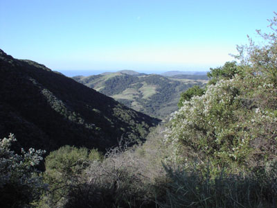
Gaviota State Park
About
Gaviota State Park is a 2,710-acre state park in California, about 9 miles from the town of Buellton. The land is managed by the state park agency, and the park holds one campground within its boundaries. Spring and fall are the most comfortable times to visit. Typical averages from the nearby Cachuma Lake weather station show April highs around 76°F and November highs around 75°F, while July and August average in the low 90s. Several trails start close by. Woodland Trail and Hollister Trail are each about half a mile away, and Ortega Trail is about 0.6 miles off. Tunnel View Trail is roughly a mile away.
Park size
2,710 acres
Inside this park
Campgrounds
Location
Gaviota State Park
California
Data source: USGS PAD-US 4.1 (Protected Areas Database, public domain)
Facts about this place
When to go
Best time to go: Oct–May. The mildest months here, with typical highs of 67–84°F and lows of 33–43°F.
Typical monthly averages (not a forecast) from the Cachuma Lake, CA weather station, 16 mi away. High / low in °F, and days with snow.
- Jan67° high34° low
- Feb68° high35° low
- Mar71° high38° low
- Apr76° high39° low
- May80° high43° low
- Jun86° high45° low
- Jul92° high48° low
- Aug93° high49° low
- Sep91° high47° low
- Oct84° high43° low
- Nov75° high38° low
- Dec67° high33° low
Where it is
- Gaviota State Park · State park
- Nearest town
- Buellton, California · 9.1 mi
- Managed by
- State Park and Recreation
Nearby
- Woodland TrailHiking0.5 mi
- Hollister TrailHiking0.5 mi
- Ortega TrailHiking0.6 mi
- Beach to Backcountry TrailHiking0.7 mi
- Las Cruces TrailHiking1 mi
- Tunnel View TrailHiking1.1 mi
- Yucca TrailHiking1.2 mi
- Trespass TrailHiking2.4 mi
Source: Roamze catalog (indexable pages within 10 miles, PostGIS distance)
