
Hardin Ridge Trail
Indiana
Free — you'll pick up right here.
4.2 mi
Distance
427 ft
Gain
1h 34m
Time
No verdict for this trail
We won't guess. Here is exactly what we do and don't know.
What we do know
Inside Hoosier National Forest
2 managing-area boundaries mapped — agency alerts for them feed this page automatically.
Boundary data
What's missing
No access route mapped
We don't yet know which road reaches this trailhead, so we can't tell you if it's gated.
Nobody's filed a report here yet — be the first.
Why you'll love it
Here's your day, mapped
Hardin Ridge Trail
Suggested plan · check conditions before you go
Meals
Gear for the day
Elevation & route
- Distance
- 4.2 mi
- Elevation gain
- 427 ft
- Elevation loss
- 427 ft
- Highest point
- 785 ft
- Lowest point
- 581 ft
Photos
Directions & GPX
Permits & access
- Bikes
- Allowed
- Horses
- Not allowed
Source for bikes, horses: USDA Forest Service National Forest System Trails (EDW)
About this trail
Hardin Ridge Trail is a scenic out-and-back hike through Indiana's rugged terrain, offering hikers a chance to explore the state's natural ridgeline features. This 4.15-mile trail showcases the rolling topography and forest ecosystems characteristic of Indiana's interior highlands, with steady elevation changes that provide a moderate workout without excessive difficulty.
Facts about this trail
The climb
- Starts at
- 639 ft
- High point
- 785 ft
- Total climbing
- 427 ft
- Total descent
- 427 ft
- Steepest stretch
- 11% grade around mile 0.3 on the way out
- Length (round trip)
- 4.2 mi
- Shape
- Out and back
Source: Roamze elevation profile and trail geometry (DEM samples along the mapped route)
When to go
Typical monthly averages (not a forecast) from the Bedford 5 Wnw, IN weather station, 11 mi away. High / low in °F.
- Jan39° high23° low
- Feb43° high26° low
- Mar54° high35° low
- Apr65° high45° low
- May73° high54° low
- Jun81° high63° low
- Jul84° high66° low
- Aug84° high64° low
- Sep77° high57° low
- Oct66° high46° low
- Nov53° high36° low
- Dec43° high28° low
Where it is
- Brownstown Ranger District · Ranger district
- Hoosier National Forest · National forest
Source: USFS EDW boundaries
Conditions
Active alerts for Hoosier National Forest as of Oct 10, 2026:
critical · posted Sep 29, 2026
caution · posted Aug 24, 2026
Tipsaw Trail Bridge Closed Temporarily
caution · posted Aug 24, 2026
Section of Tower Ridge Road temporarily closed for safety
information · posted Aug 24, 2026
caution · posted Aug 24, 2026
caution · posted Aug 24, 2026
Seasonal Cave Closure in Effect
caution · posted Aug 24, 2026
Hoosier National Forest fire, camping, motor vehicle use, trail use, occupancy and use prohibitions
caution · posted Aug 24, 2026
Acts Prohibited within the Charles C. Deam Wilderness
information · posted Aug 24, 2026
Mano Point boat launch is sedimented in
caution · posted Aug 24, 2026
Source: USFS forest alerts
Nearby
- H.R. Pine LoopCamping0.3 mi
- H.R. White Oak LoopCamping0.7 mi
- Pine Loop campgroundCamping0.7 mi
- H.R. Bluegill LoopCamping0.9 mi
- Ted T. Turtle Interpretive TrailHiking0.9 mi
- Turkey Trot TrailHiking1.2 mi
- Lakeside TrailHiking2.8 mi
- Unlikely WallRock climbing4.2 mi
Source: Roamze catalog (indexable pages within 10 miles, PostGIS distance)
Add to a trip & share
Keep exploring — more trails worth the drive
Photo: usfs_Eastern_Region, Public Domain Mark (via Flickr)Ted T. Turtle Interpretive Trail
~1 min drive
1.26-mile out-and-back hike in Indiana with 161 ft elevation gain
 Photo: usfs_Eastern_Region, Public Domain Mark (via Flickr)
Peninsula Trail
~10 min drive
5.11-mile out-and-back hike in Indiana with 232 ft gain.
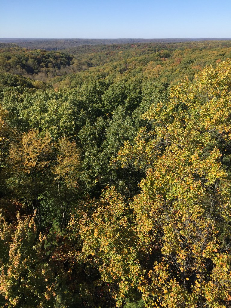 Photo: usfs_Eastern_Region, Public Domain Mark (via Flickr)
Sycamore Trail
~13 min drive
9.60-mile out-and-back trail in Indiana with 622 ft elevation gain
Hickory Ridge 4
~14 min drive
4.22-mile loop trail in Indiana with 340 ft elevation gain.
Photo: usfs_Eastern_Region, Public Domain Mark (via Flickr)Turkey Trot Trail
~2 min drive
3.74-mile out-and-back trail in Indiana with 819 ft elevation gain.
 Photo: usfs_Eastern_Region, Public Domain Mark (via Flickr)
Martin Hollow Trail
~10 min drive
5.28-mile out-and-back trail in Indiana with 325 ft elevation gain.
Grubb Ridge Trail
~6 min drive
Challenging 14.55-mile out-and-back ridge hike in Indiana.
Hickory Ridge 1
~16 min drive
3.04-mile out-and-back trail in Indiana with 43 ft of elevation gain.
Photo: usfs_Eastern_Region, Public Domain Mark (via Flickr)Patton Cave Trail
~8 min drive
1.74-mile out-and-back trail in Indiana with 671 ft elevation gain
Photo: usfs_Eastern_Region, Public Domain Mark (via Flickr)Axsom Branch Trail
~11 min drive
5.21-mile out-and-back trail in Indiana with 698 ft elevation gain.
