Jackson Campground On The Applegate River
Oregon
Jackson Campground On The Applegate River
Free — you'll pick up right here.
No verdict for this water
We won't guess. Here is exactly what we do and don't know.
What we do know
Inside Rogue River-Siskiyou National Forests
2 managing-area boundaries mapped — agency alerts for them feed this page automatically.
Boundary data
What's missing
No access route mapped
We don't yet know which road reaches this trailhead, so we can't tell you if it's gated.
Nobody's filed a report here yet — be the first.
Here's your day on the water, mapped
Jackson Campground On The Applegate River
Suggested plan · check conditions before you go
Photos
Directions & GPX
Permits & access
- Managing agency
- Forest Service
- Fee
- Please see the recreation.gov rules & regulation policies. These policies are system-wide, and not specific to each facility. We are NOT staffed to handle or manage cancellations and/or changes via telephone. Please do not call or leave any messages for these issues. Please NOTE: In Southern Oregon, we unfortunately get difficult conditions due to forest fire smoke. The USFS has the difficult decisions as to whether to temporarily close these facilities, or for them to remain open. If the facilities are closed, refunds will be honored. If the facilities remain open, the sites will be maintained, and reservations will be honored. If you have any specific questions regarding cancellations/changes or mofications to your existing reservation, it will be evaluated on a case-by-case basis. Please email us at applegatelake@gmail.com.
About this water
Overview Jackson Campgrounds are located on the beautiful Applegate River in the Applegate Valley near Ruch, Medford, Grants Pass and historic Jacksonville.Recreation Jackson Campground sits on the shores of the Applegate River, a popular recreation site located north of the Red Buttes Wilderness Area. Visitors enjoy swimming, cycling, boating, canoeing, fishing and hiking the various trails near the river. Nearby is the inactive Bigfoot trap, found at the beginning of the trail, built in 1974 by the North American Wildlife Research Team. The trap was inspired by a miner who lived near the Applegate River who claimed to have found 18-inch-long, human-like tracks in his garden. The organization operated the trap, keeping it baited with carcasses for six years, but caught only bears and a hiker. Facilities The campground has eight tent only campsites, two dry RV sites and one group site. Campsites are located along the Applegate River. Camp trailers are not recommended due to tight corners and short campsite spur lengths. The day use area is adjacent to campground. Drinking water and clean bathroom with flush toilets are available. There are NO showers. Kayak and paddle board rentals are available at nearby Applegate Lake, $45for 3-hrs or $60 all-day. There is also a boat ramp offered at the Lake. Please note, there is a two-night minimum when you desire to reserve a Friday or Saturday night.Natural Features The unique character of the landscapes comprising the area has led to the designation of over 340,000 acres of the forest as wilderness, and over 200 miles of streams as National Wild and Scenic Rivers. The forest itself is composed of two distinct geological provinces, the Cascade Range and the Siskiyou Mountains. The Cascade Range is dominated by snow-c apped volcanic peaks like the 9,495-foot Mt. McLoughlin, located within the Sky Lakes Wilderness. The Siskiyou area embodies the most complex and treasured plant communities in the Pacific Northwest. World-class wild rivers, biological diversity, remarkable fisheries and complex watersheds all define the Siskiyou. Diverse landscapes provide habitat for a wide range of wildlife, from spotted owls and bull elk to salamanders and Sandhill cranes. Nearby Attractions Stop by historic Jacksonville while in the area or enjoy special events like the Britt Festival. The nearby Rogue River National Recreation Trail, stretching 40 miles between Grave Creek and Big Bend, offers some of southwestern Oregon's most scenic landscapes and rewarding hiking experiences. This hiking-only trail follows the north bank of the Rogue River as it winds its way toward the Pacific Ocean. Applegate Lake is minutes away and has an 18-mile trail that winds through the forest around it. Mountain biking, hiking, trail running and more for all levels is abundant and visitors swim in the river and or lake from early to sunset which is 930 PM for most of the summer here. Visitors also enjoy Crater Lake National Park and learning about its unique natural and cultural history. At 1,943 feet deep, Crater Lake is the deepest lake in the United States and one of the ten deepest lakes in the world.
Add to a trip & share
Keep exploring — more water worth the drive
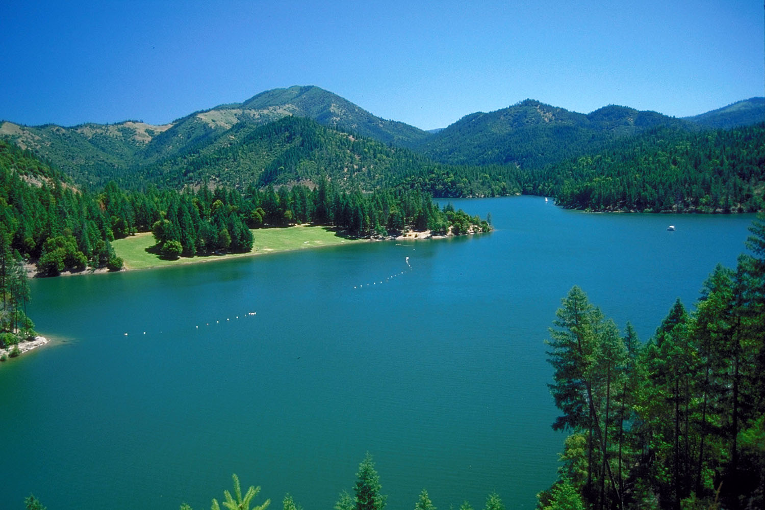 Photo: Bill Johnson, U.S. Army Corps of Engineers, Public domain (via Wikimedia Commons)
Applegate River
~16 min drive
Applegate River is a 4-mile paddling stretch near Seiad Valley, California. It flows year-round. USGS models an average flow of about 437 cfs and a gradient of about 142.1 feet per mile. Land along it is managed by the U.S. Forest Service.
French Gulch Boating Site
~8 min drive
A worthwhile stop near Oregon.
Sarah Totten Campground
~39 min drive
A worthwhile stop near California.
HART-TISH PARK at APPLEGATE LAKE
~7 min drive
A worthwhile stop near Oregon.
 Photo: ZabMilenko at English Wikipedia, Public domain (via Wikimedia Commons)
Bear Creek
~32 min drive
Bear Creek is a 16-mile paddling stretch near Talent, Oregon. It is intermittent and may run dry in some seasons. USGS models an average flow of about 165 cfs and a gradient of about 29.7 feet per mile.
Seattle Creek Boating Site
~37 min drive
A worthwhile stop near California.
Carberry Creek
~11 min drive
Carberry Creek is a 6.7-mile paddling stretch near Jacksonville, Oregon. It flows year-round. USGS models an average flow of about 145 cfs and a gradient of about 69.3 feet per mile. Land along it is managed by the U.S. Forest Service.
Lazy Acres Boat Ramp
~38 min drive
Lazy Acres Boat Ramp is a boat launch in Oregon.
Little Applegate River
~21 min drive
Little Applegate River is a 13-mile paddling stretch near Jacksonville, Oregon. It flows year-round. USGS models an average flow of about 71 cfs and a gradient of about 198.2 feet per mile. Land along it is managed by the U.S. Forest Service.
Fleming Boat Ramp
~38 min drive
Fleming Boat Ramp is a boat launch in Oregon.


