
Dutch John Resort At Flaming Gorge
Fishing business nearby (~5 mi away) — hasn't claimed their Roamze page yet
Free — you'll pick up right here.
Watch this water
Sign up to watch it — saving subscribes you to gate, closure and report changes.
Utah
We won't guess. Here is exactly what we do and don't know.
What we do know
Inside Ashley National Forest
2 managing-area boundaries mapped — agency alerts for them feed this page automatically.
Boundary data
What's missing
No access route mapped
We don't yet know which road reaches this trailhead, so we can't tell you if it's gated.
Nobody's filed a report here yet — be the first.
Why you'll love it
Green River Float-In Campsites
AI-suggested draft · review before you go
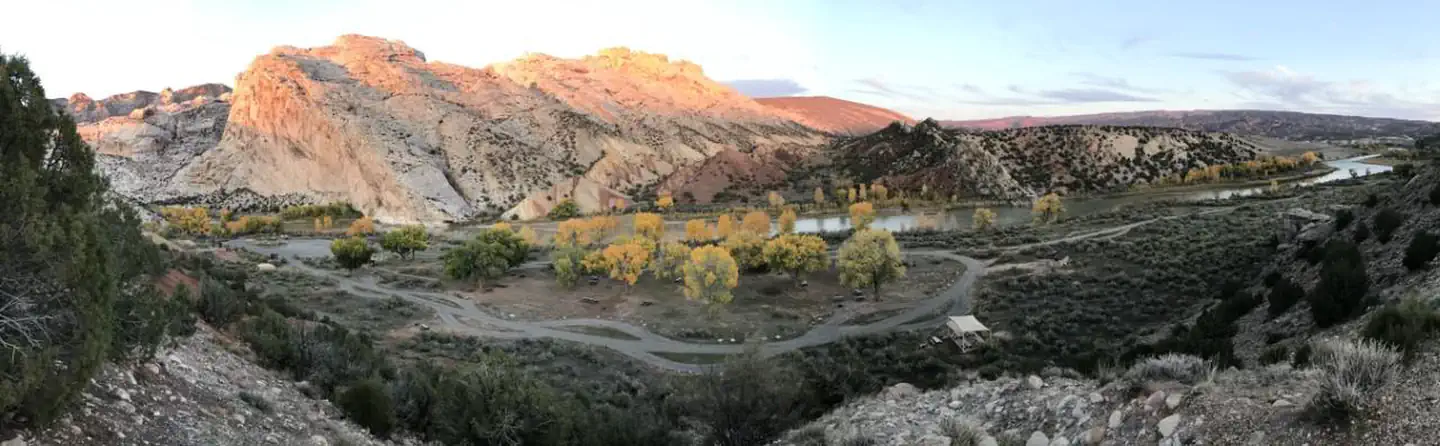
Overview Take a step back in time and traverse the same scenic wonders that explorers such as John Wesley Powell and William Ashley once explored. The Green River provides spectacular fishing and river-running opportunities, as well as unique geology, outlaw history and Native American rock art. So come to navigate the waters and cast a rod in an adventure the whole family can enjoy. The Green River Float-In Campsites contain 17 sites for river goers to camp along the mighty Green River. Some of these sites can be reached on foot but most of these sites can only be reached by boat. Recreation Section "A" (Flaming Gorge Dam to Little Hole Boat Launch) Section "A" of the Green River begins just below the Flaming Gorge Dam and proceeds seven miles through a narrow, breathtaking canyon to the Little Hole take-out. The towering red canyon cliffs, ponderosa pine, glassy clear water, abundant trout and rapids (class I and II) make section "A" of the Green River world famous. The Little Hole National Recreation Trail allows foot access to all seven miles of this stretch of river. Section "B" (Little Hole to Browns Park) It's a little more remote but that means there are fewer people, if that's the experience you're looking for. Limited access in this section allows for healthy brown trout populations to thrive. There are 17 river camps in section "B" that can be accessed only by hiking or floating in. Section "C" (Browns Park to the Utah/Colorado Border) Section "C" is the longest of the three sections. It meanders through the high desert valley of Browns Park to the Colorado state line, with wide open features and a lot of flat water. It's considered the best place to catch a football size trout on a dry fly, but it is also said to be the most challenging for fishing. The Green River offers excellent fishing for rainbow, brown and cutthroat trout. For more information on fishing the Green River, please visit Utah's Department of Wildlife Resources website . Facilities All of the river camps are equipped with a picnic table, campfire ring with benches, tent pads and a blind for a portable toilet. No potable water is available. Vault toilets can be found near Cottonwood Camp and Red Creek Camp. Float-in distance from Boat Launch Areas to Campsite: Stonefly I & II (river left) Distance From Spillway Launch: 8.2 miles Distance From Little Hole Launch: 1 mile Accessible by Foot: Yes Sand (river left) Distance From Spillway Launch: 8.3 miles Distance From Little Hole Launch: 1.1 miles Accessible by Foot: Yes Bootleg (river left) Distance From Spillway Launch: 8.42 miles Distance From Little Hole Launch: 1.22 miles Accessible by Foot: Yes Cats Paw (river left) Distance From Spillway Launch: 8.55 miles Distance From Little Hole Launch: 1.35 miles Accessible by Foot: Yes Cottonwood (river left) Distance From Spillway Launch: 8.75 miles Distance From Little Hole Launch: 1.55 miles Accessible by Foot: Yes Grasshopper I & II (river right) Distance From Spillway Launch: 9.35 miles Distance From Little Hole Launch: 2.15 miles Accessible by Foot: No Jackson Creek (river right) Distance From Spillway Launch: 9.65 miles Distance From Little Hole Launch: 2.45 miles Accessible by Foot: No Cicada (river right) Distance From Spillway Launch: 9.9 miles Distance From Little Hole Launch: 2.7 miles Accessible by Foot: No Trails End (river left) Distance From Spillway Launch: 10 miles Distance From Little Hole Launch: 2.8 miles Accessible by Foot: Yes Big Pine I & II (river left) Distance From Spillway Launch: 10.5 miles Distance From Little Hole Launch: 3.3 miles Accessible by Foot: No Pugmire Pocket (river right) Distance From Spillway Launch: 10.75 miles Distance From Little Hole Launch: 3.55 miles Accessible by Foot: No Red Creek I & II (river right) Distance From Spillway Launch: 11.6 miles Distance From Little Hole Launch: 4.4 miles Accessible by Foot: No Treetop (river right) Distance From Spillway Launch: 12.2 miles Distance From Little
Trout Creek Guard Station
~37 min drive
A worthwhile stop near Utah.
Arch Dam Campground
~9 min drive
A worthwhile stop near Utah.
Stateline Cove Campground
~28 min drive
A worthwhile stop near Wyoming.
Hideout Canyon Boat-In Campground
~30 min drive
A worthwhile stop near Utah.
Jones Hole National Fish Hatchery
~45 min drive
A worthwhile stop near Utah.
Mustang Ridge Campground
~11 min drive
A worthwhile stop near Utah.
Summit Springs Guard Station
~39 min drive
A worthwhile stop near Utah.
Deer Run Campground
~12 min drive
A worthwhile stop near Utah.
Jarvies Boat In Group
~15 min drive
A worthwhile stop near Utah.
Lodgepole At Flaming Gorge
~18 min drive
A worthwhile stop near Utah.
Local operators near Dutch Johnoffering guided trips. You book directly with them — Roamze doesn’t take a cut.
Dutch John Resort At Flaming Gorge
Fishing business nearby (~5 mi away) — hasn't claimed their Roamze page yet
