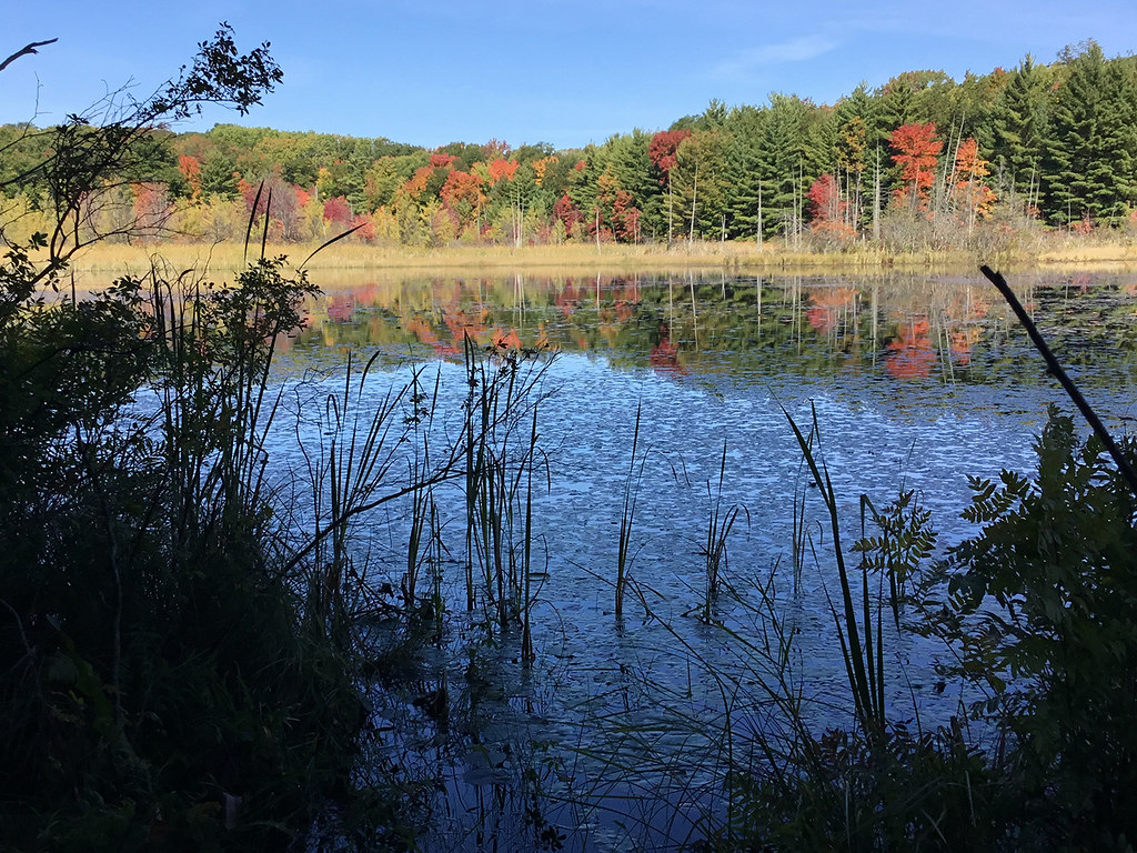
Minnie Pond Campground
Michigan
Free — you'll pick up right here.
No verdict for this campground
We won't guess. Here is exactly what we do and don't know.
What we do know
Inside Huron-Manistee National Forest
2 managing-area boundaries mapped — agency alerts for them feed this page automatically.
Boundary data
What's missing
No access route mapped
We don't yet know which road reaches this trailhead, so we can't tell you if it's gated.
Nobody's filed a report here yet — be the first.
Here's your stay, mapped
Minnie Pond Campground
Suggested plan · check conditions before you go
Gear for the day
Meals
Photos
About this campground
This site is located on Minnie Pond on a human-made impoundment. Ducks, geese and heron frequent the area. This is a popular area for small and large game and waterfowl hunting. A foot bridge on Mena Creek connects the campground to the day use area. The day use area is located on the side of the creek. No ORV's are allowed in the campground or on the access road to the campground.
Campsite info
- Season
- May 1 - October 31
Directions & GPX
Facts about this campground
Where it is
- White Cloud Ranger District · Ranger district
- Huron-Manistee National Forest · National forest
- Managed by
- Forest Service
Conditions
Active alerts for Huron-Manistee National Forest as of Oct 9, 2026:
Safety Awareness for Upper Manistee River Levels, Wednesday Oct. 7, 2026
critical · posted Oct 5, 2026
Lumberman's Monument to close Tuesdays and Wednesdays starting Tuesday September 15, 2026
information · posted Sep 11, 2026
USE CAUTION - KNOW BEFORE YOU GO!
caution · posted Sep 2, 2026
'Do Not Eat' Advisory for Fish
caution · posted Aug 24, 2026
Au Sable National Scenic River Camping Restrictions
information · posted Aug 24, 2026
Restricting Motorized Vehicles Use of Roads, Trails, and Off Road Areas
information · posted Aug 24, 2026
Possession, Storage or Transportation of Alcohol and Drugs
information · posted Aug 24, 2026
information · posted Aug 24, 2026
Restrictions for Violating Posted Regulations
information · posted Aug 24, 2026
Restrictions For The Au Sable River
information · posted Aug 24, 2026
Source: USFS forest alerts
Nearby
- Birch Grove TrailHiking1.9 mi
- Benton Lake CampgroundCamping3 mi
- Loda Lake Wildflower TrailHiking3.5 mi
- Nichols Lake South CampgroundPier fishing6.6 mi
- Nichols Lake CampgroundCamping6.6 mi
- Highbanks CampgroundCamping9.9 mi
Source: Roamze catalog (indexable pages within 10 miles, PostGIS distance)
Add to a trip & share
Keep exploring — more campsites worth the drive
Nichols Lake South Campground
~11 min drive
A worthwhile stop near Michigan.
Benton Lake Campground
~5 min drive
A worthwhile stop near Michigan.
Sites 30 - 62
~7 min drive
Sites 30 - 62 is a campground in Michigan at about 953 feet.
Sites 17 - 27
~7 min drive
Sites 17 - 27 is a campground in Michigan at about 958 feet.
Sites 1 - 16
~7 min drive
Sites 1 - 16 is a campground in Michigan at about 964 feet.
Indian Lake Campground
~8 min drive
Indian Lake Campground is a campground in Michigan at about 916 feet, with 6 sites. It is managed by the U.S. Forest Service.
Shelley Lake Campground
~13 min drive
Shelley Lake Campground is a campground in Michigan at about 964 feet, with 8 sites. It is managed by the U.S. Forest Service.
Walkup Lake Campground
~13 min drive
Walkup Lake Campground is a campground in Michigan at about 832 feet. It is managed by the U.S. Forest Service.
White Cloud City Campground
~14 min drive
White Cloud City Campground is a campground in Michigan at about 861 feet.
Kenosha Lake
~17 min drive
Kenosha Lake is a campground in Michigan.