Jeanette Lake
COOK,, Minnesota
Free — you'll pick up right here.
Conditions: Blocked
for campground, todayAn agency closure order is in effect for this area; weather is good
2 factors · 2 sources
Newest 18 h ago · oldest 19 h
problem: Agency alerts
11 active alerts in Superior National Forest; most severe: Post Wildfire Closures, Effective October 1, 2026
USFSPosted Oct 1 · checked 19 h ago
clear: Weather
Clouds, high 61°F / low 33°F, 0% precip — 97/100 for campground
OpenWeather18 h ago
Been out here in the last few days? One report keeps this current for everyone.
Campsite availability
Live from Recreation.gov for Jeanette Lake.
Here's your stay, mapped
Jeanette Lake
Suggested plan · check conditions before you go
Gear for the day
Meals
Photos
About this campground
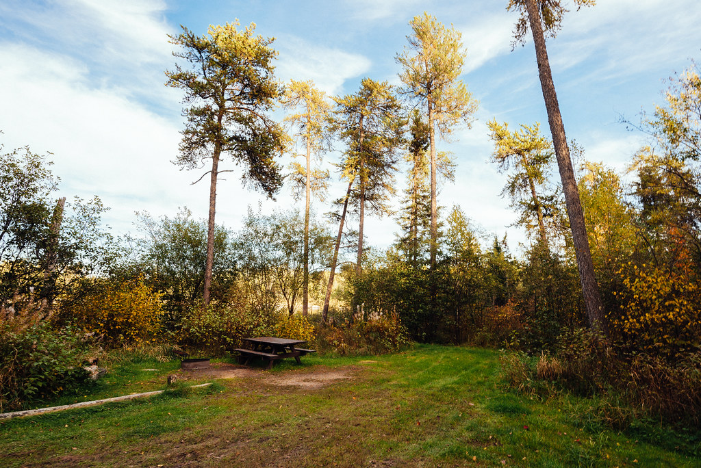
Overview Jeanette Lake Campground is a small, single-loop campground on a peninsula reaching out onto the glacier-carved Lake Jeanette in Superior National Forest. Originally built by the Civilian Conservation Corps in the 1930s, this sweet, picturesque campground is well worth the drive. The facility provides sites that are usually accessible to RVs and tent trailers along with tent-only and hike-in sites. Superior National Forest, located in northeastern Minnesota's arrowhead region, is comprised of three million acres. The forest spans 150 miles along the United States-Canada border. Visitors can find recreation opportunities year-round, including travel in the famous Boundary Waters Canoe Area Wilderness. Recreation The winding shoreline and islands make the 638-acre Lake Jeanette a great place to explore in a canoe or kayak. Fishing opportunities include walleye, northern pike and perch. The campground provides access to the Astrid Lake Hiking Trail for those who want to stretch their legs. The surrounding national forest offers a wide variety of recreational opportunities, including hiking in secluded woodlands and canoeing in pristine lakes and rivers. View recreation guides and maps of hiking trails and canoe routes in the national forest. Facilities There are 12 sites total with six reservable standard sites, 4 First Come First Serve standard sites, and two First Come First Serve tent-only sites. Most sites have a view of the lake and some are located on the lakeshore. The campsites are close together providing fair privacy, except for walk-in sites which enjoy excellent privacy. The walk-in tent sites have an additional backcountry latrine nearby (campers may want to bring toilet paper). Lake Jeanette also has six dispersed backcountry sites that are first-come, first-served and accessible only by boat. Natural Features Lake Jeanette is not the largest or most isolated lake in the national forest, but it feels like it is both. Created long ago by a massive glacier, this lake is considered by many to be a special location. The campground is wooded with a pleasant mix of hardwoods, pine and spruce providing shade for most sites. The understory of fern, wildflowers and grass is kept under control by mowing, giving the campground a manicured appearance. Glacial "erratics" (massive boulders) left behind by the receding glacier give the campground character and a place for moss to grow. Nearby Attractions Possible day trips from the campground include Voyageurs National Park, Crane Lake and Vermillion Falls. Numerous outdoor recreation opportunities lie within Superior National Forest's 77 lake accesses, 13 fishing piers, 10 swimming beaches and 22 picnic areas. The forest is also home to three scenic byways and the Boundary Waters Canoe Area Wilderness. Additional sites of interest
Directions & GPX
Facts about this campground
When to go
Typical monthly averages (not a forecast) from the Cook 8ne, MN weather station, 20 mi away. High / low in °F.
- Jan15° high-5° low
- Feb21° high-2° low
- Mar35° high11° low
- Apr48° high26° low
- May63° high40° low
- Jun72° high51° low
- Jul77° high56° low
- Aug75° high54° low
- Sep65° high46° low
- Oct50° high34° low
- Nov34° high20° low
- Dec21° high4° low
Where it is
- Lacroix Ranger District · Ranger district
- Superior National Forest · National forest
- Boundary Waters Canoe Area Mining Protection Area Mineral Reserve Area · Public land
- Managed by
- Forest Service
Conditions
Active alerts for Lacroix Ranger District as of Oct 9, 2026:
critical · posted Aug 24, 2026
Source: USFS forest alerts
Nearby
- Lake Jeanette CgCamping0.2 mi
- NIGH CREEK SPUR AHiking0.7 mi
- NorwayHiking0.8 mi
- Astrid NighHiking1.7 mi
- Hunting Shack River RouteCanoeing2 mi
- Astrid Lake AreaLake fishing2.5 mi
- Echo Lake CgCamping9.4 mi
- Echo Lake (minn)Camping9.4 mi
Source: Roamze catalog (indexable pages within 10 miles, PostGIS distance)
Add to a trip & share
Keep exploring — more campsites worth the drive
Echo Lake (minn)
~16 min drive
A worthwhile stop near Minnesota.
Nigh Lake Site 1
~2 min drive
A worthwhile stop near Minnesota.
Lake Jeanette Site 10
~2 min drive
A worthwhile stop near Minnesota.
Astrid Lake Site 1
~3 min drive
A worthwhile stop near Minnesota.
Picket Lake Site 3
~10 min drive
A worthwhile stop near Minnesota.
Vermilion River Site 5
~17 min drive
A worthwhile stop near Minnesota.
Vermilion River Site 4
~17 min drive
A worthwhile stop near Minnesota.
Vermilion River Site 3
~19 min drive
A worthwhile stop near Minnesota.
Vermilion River Site 2
~21 min drive
A worthwhile stop near Minnesota.
Crane Lake Site 3
~21 min drive
A worthwhile stop near Minnesota.