Free — you'll pick up right here.
Watch this water
Sign up to watch it — saving subscribes you to gate, closure and report changes.
California
Ellery Creek
No verdict for this water
We won't guess. Here is exactly what we do and don't know.
What we do know
Inside Shasta-Trinity National Forest
2 managing-area boundaries mapped — agency alerts for them feed this page automatically.
Boundary data
What's missing
No access route mapped
We don't yet know which road reaches this trailhead, so we can't tell you if it's gated.
Nobody's filed a report here yet — be the first.
Why you'll love it
Here's your day on the water, mapped
Ellery Creek
AI-suggested draft · review before you go
Gear for the day
Photos
Directions & GPX
About this water
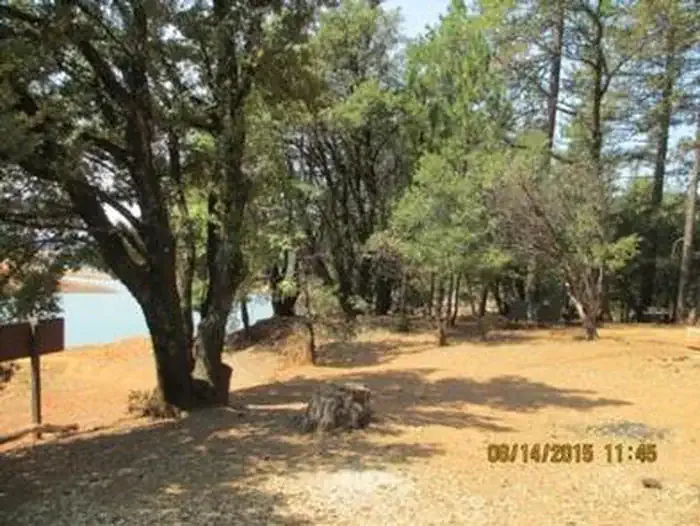
Overview Ellery Creek is located on the McCloud Arm of Shasta Lake. The campground is terraced, providing views of the lake from all of the lower sites and some of the upper sites. At certain water levels, boats can be moored on the shore within sight of the campground, making Ellery Creek a very popular place to camp among boaters.Recreation A public boat ramp is located approximately 4 miles away at Hirz Bay, but informal mooring is allowed at Ellery Creek if the water levels are sufficient. This area is popular for water skiing and jet skiing. Lake Shasta offers excellent fishing for trout, catfish, Chinook salmon, crappie, bluegill, white sturgeon, brown bullhead and bass.Facilities Each site offers fair to good privacy and sufficient shade provided by the deciduous trees in the campground. There are two sets of vault toilets and water spigots throughout the camp. Each site has lockers for food, picnic tables, fire rings with grills, paved parking spurs and tent pads. There are no showers available or electric/water hookups for trailers. All sites at this campground can accommodate small trailers as well as tents.Natural Features Shasta-Trinity is the largest national forest in California with a diverse landscape encompassing five wilderness areas, hundreds of mountain lakes and 6,278 miles of streams and rivers. Lake Shasta sits at an elevation of 1,067 feet, with 365 miles of shoreline punctuated by steep mountains blanketed in manzanita and evergreens. A snow-capped Mount Shasta, the second-tallest mountain in the Cascade Range, looms in the distance. Lakeside sites at Ellery Creek offer excellent views and access to the water. Wildlife is abundant in the area. Nearby Attractions The Lake Shasta Caverns are also located on the McCloud Arm of Shasta Lake in an area know as the Grey Rocks. Tours are given daily at this privately owned facility. The nearby Hirz Mountain Lookout offers panoramic views of Mt. Shasta, Mt. Lassen and the surrounding area at an elevation of 3,500 feet. The nearest store is 21 miles away in Lakehead.
Add to a trip & share
Keep exploring — more waters worth the drive
Dekkas Rock
~5 min drive
A worthwhile stop near California.
Nelson Point
~12 min drive
A worthwhile stop near California.
Whiskey Creek Group Picnic Area (Whiskeytown NRA)
~42 min drive
A worthwhile stop near California.
Alpine View Campground
~47 min drive
A worthwhile stop near California.
Pine Point (Shasta Lake, CA)
~1 min drive
A worthwhile stop near California.
Bailey Cove
~14 min drive
A worthwhile stop near California.
DRY CREEK GROUP CAMPGROUND (Whiskeytown NRA)
~46 min drive
A worthwhile stop near California.
Ackerman Campground
~50 min drive
A worthwhile stop near California.
Moore Creek
~4 min drive
A worthwhile stop near California.
Lakeshore East
~14 min drive
A worthwhile stop near California.
