Juan Bautista de Anza National Historic Trail
AZ,CA

About Juan Bautista de Anza National Historic Trail
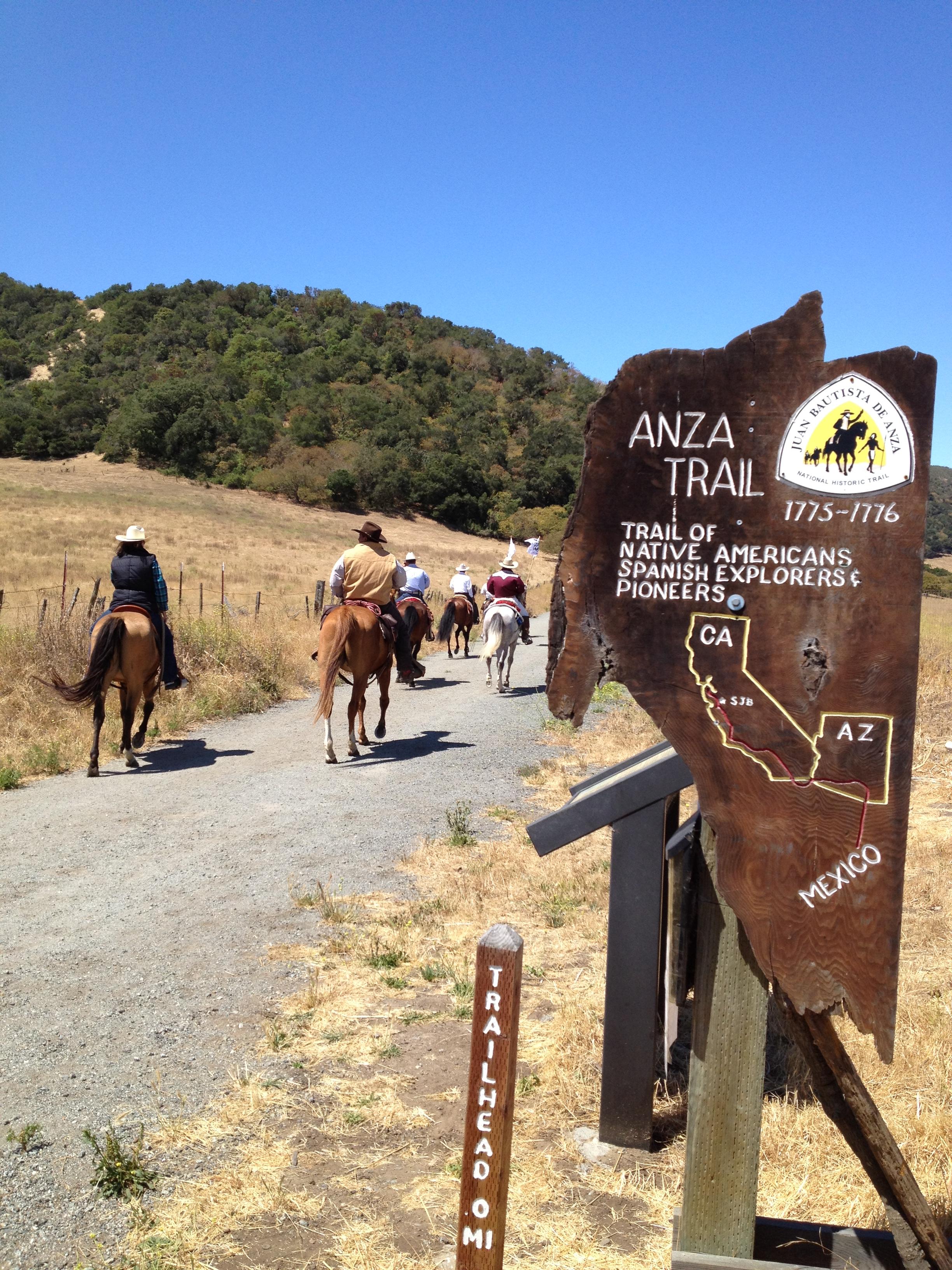
The Juan Bautista de Anza National Historic Trail covers over 1200 miles through the homelands of 70+ Tribal communities. It follows the historic route of the 1775-76 Spanish colonizing expedition from Sonora, Mexico to San Francisco, CA. Whether urban or rural, the trail offers adventure, diverse cultural perspectives, and an opportunity to experience history.
Things To Do
Showing 6 of 7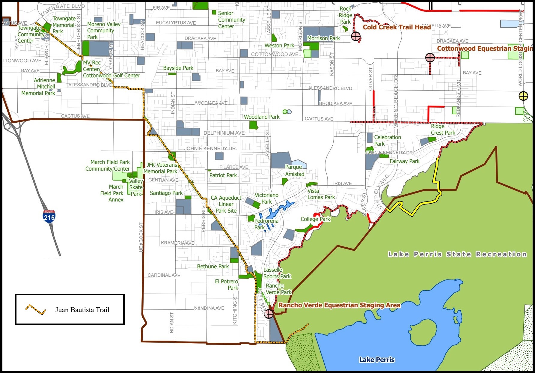
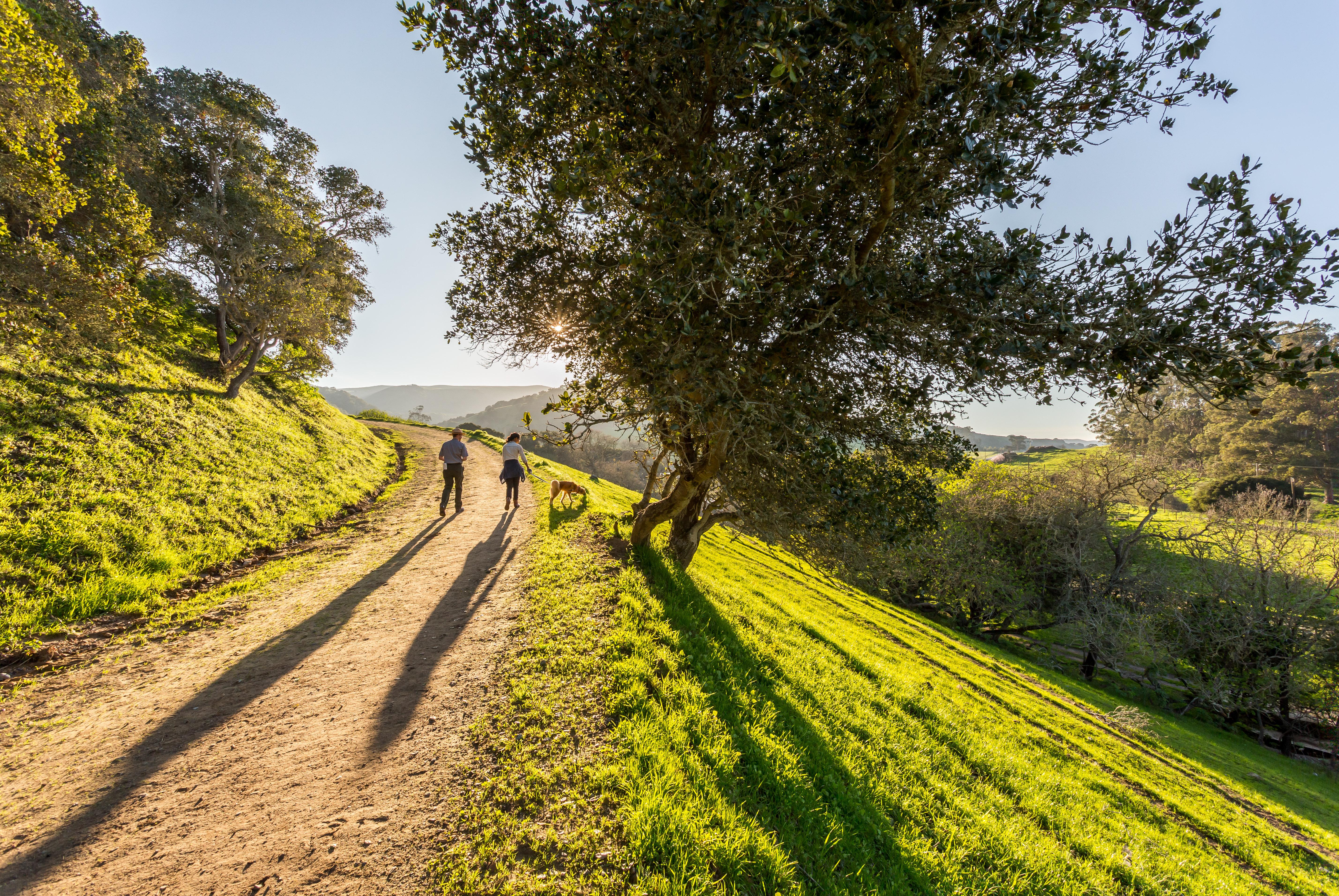
Hike the Anza Trail through Moreno Valley
Enjoy an easy 8-mile out-and-back urban trail through Moreno Valley. This multi-use paved path starts at a city park and ends at a California state recreation area.
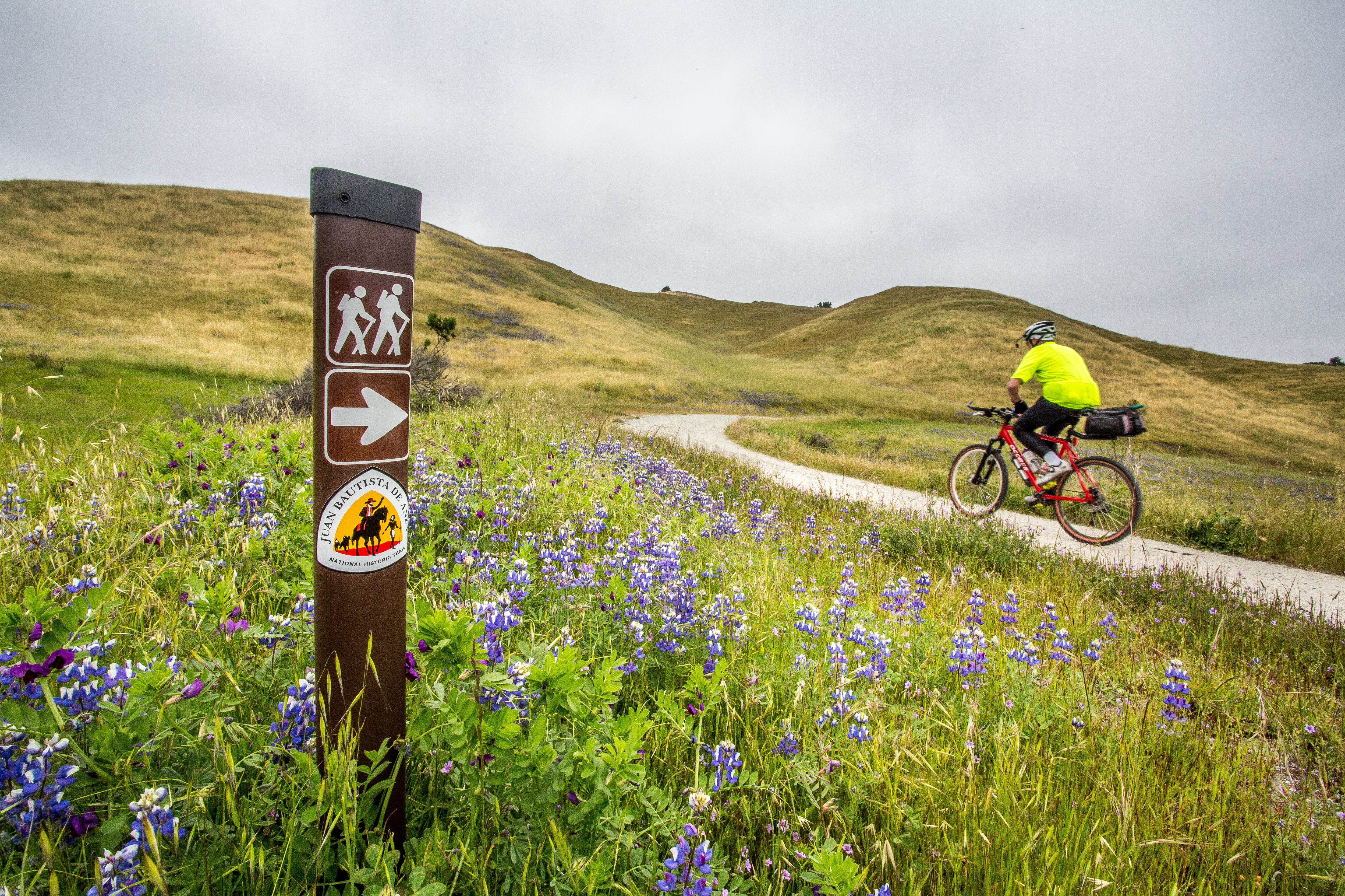
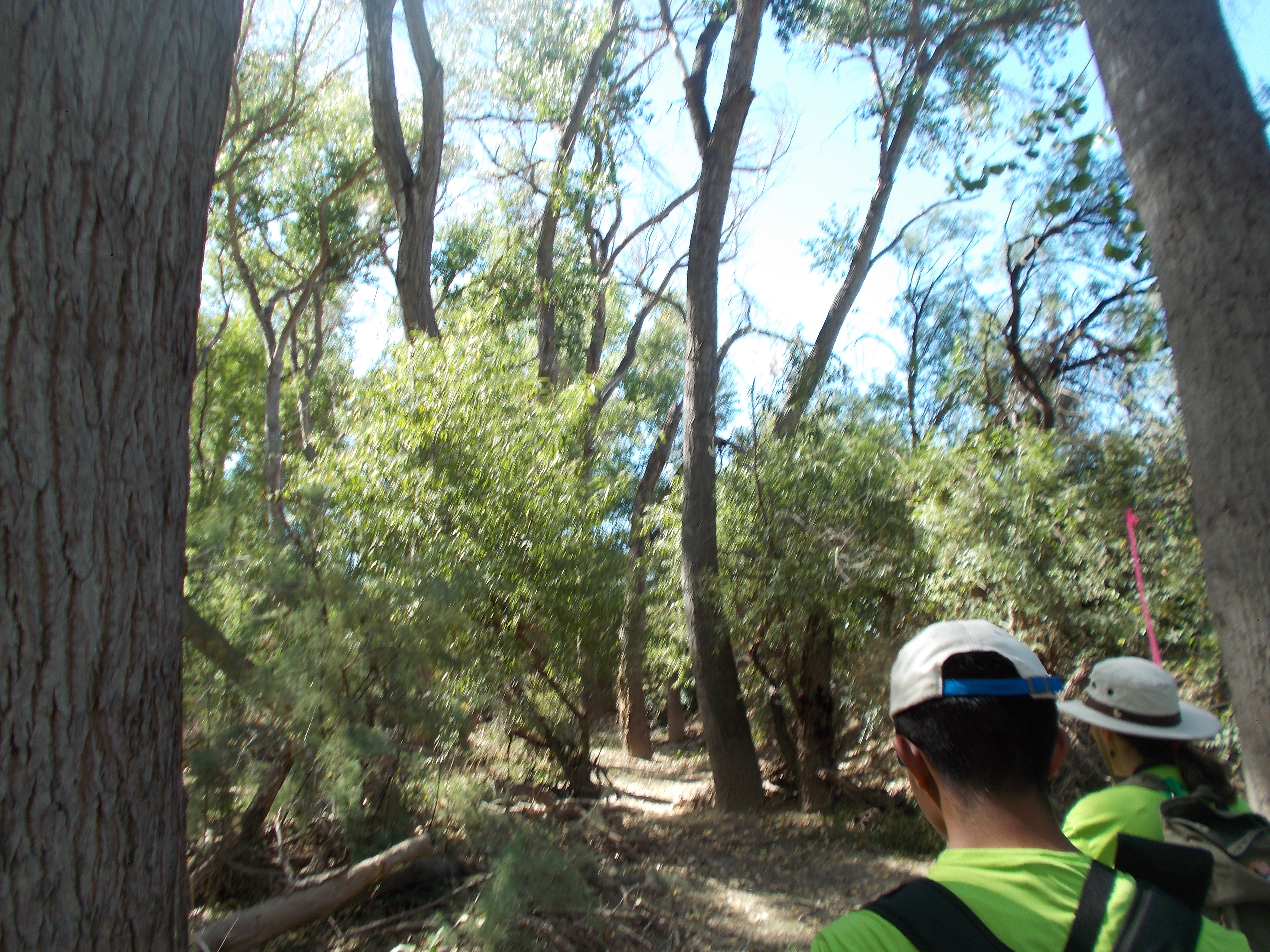
Hike, cycle, or ride through Fort Ord National Monument
Hike or ride a strenuous 4.5-mile segment that crosses the majestic grasslands of Fort Ord National Monument. The Monument segment is anchored by the Creekside Terrace Trailhead and the Badger Hills Trailhead where restrooms, maps, and interpretive displays are provided. The Creekside Terrace Trailhead has potable water.
Hike the Arrowhead Loop Trail
Explore part of the Anza Recreational Retracement Trail by hiking this challenging 4-mile one-way loop through Coyote Valley Open Space Preserve in Santa Clara, CA.
Hike the Delta de Anza/Mokelumne Loop
Enjoy a moderate 5.62-mile loop by taking the Mokelumne Coast-to-Crest Trail to the Delta de Anza Trail. This paved loop passes through or near several schools and community parks and provides access to Contra Loma Regional Park and Black Diamond Mines Regional Preserve. The trail has several steep inclines and is not recommended for people who use a wheelchair.
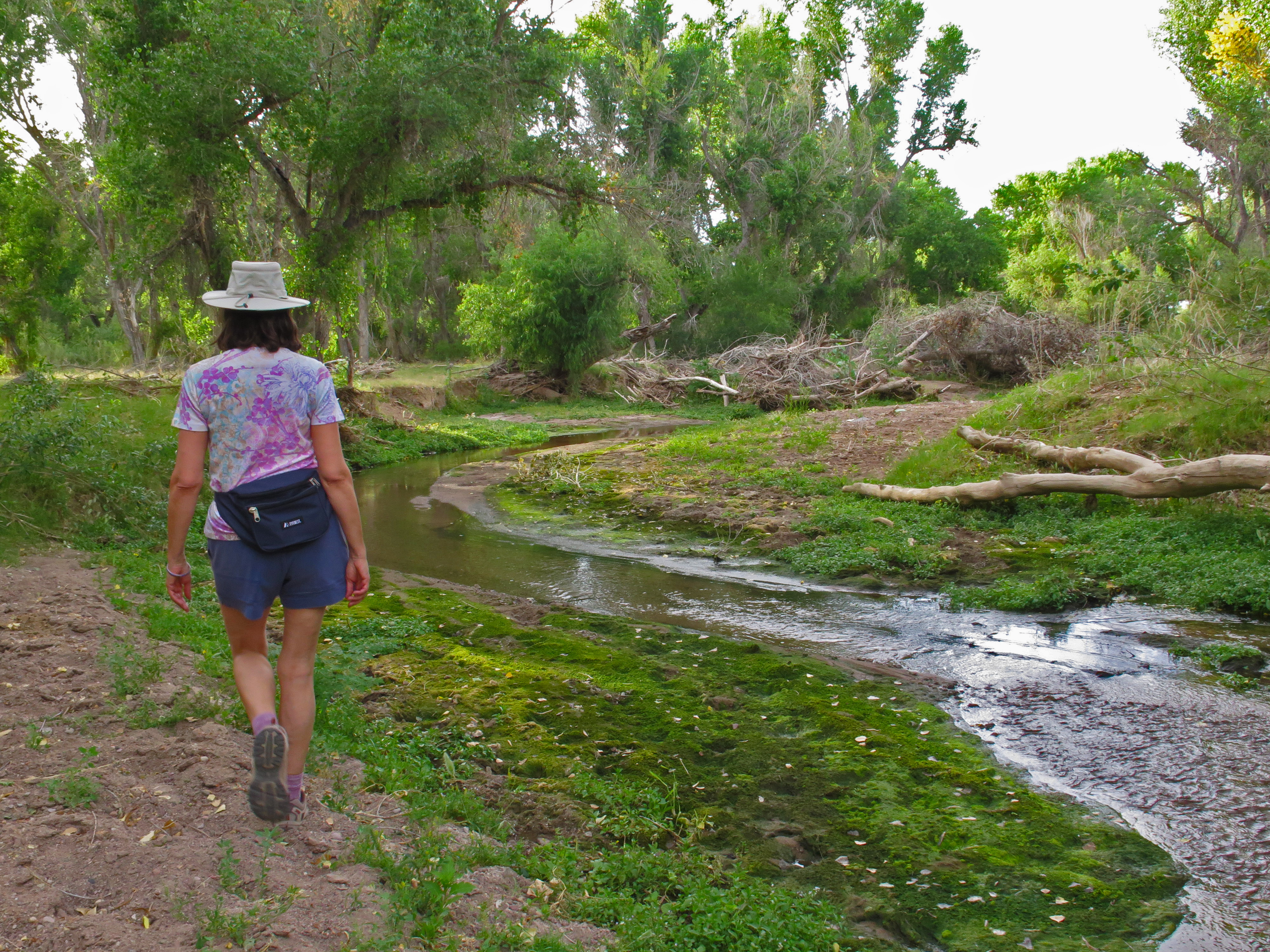
Hike the Santa Cruz River
The Santa Cruz River forms a ribbon of life in the Pimería Alta. Whether walking to its edge or along its length, visitors will encounter the fundamental building blocks of nature and human civilization.
Hike the Anza Trail from Tumacácori to Tubac, AZ
Hike through shady cottonwood galleries and mesquite bosques along this six-mile stretch of the Anza Trail between Tumacácori National Historic Park and Tubac Presidio State Historic Park.
Available Activities
Weather
The 1,200-mile Anza Trail connects historic, cultural, and recreation sites from Nogales, AZ, to the San Francisco Bay Area. To learn more, visit http://www.nps.
gov/juba. Each site along the Anza Trail is managed independently. Contact individual sites for hours, directions, and other details.
Getting There
Details listed are for the Richmond, California administrative office of the Anza Trail (administrative office is not currently open to the public). The 1,210-mile Anza Trail connects historic, cultural, and recreation sites from Nogales, AZ, to the San Francisco Bay Area that reveal the legacy of our Spanish colonial heritage. Each site along the Anza Trail is managed independently.
Contact individual sites for hours, directions, and other details.
Plan Your Visit
Let Roamze help you plan the perfect trip to Juan Bautista de Anza National Historic Trail with AI-powered itineraries.
Start PlanningHours
Administrative Staff Hours
Hours listed are for the Richmond, California administrative office of the Anza Trail (admin office not currently open to public). The 1,200-mile Anza Trail connects historic, cultural, and recreation sites from Nogales, AZ, to the San Francisco Bay Area that reveal the legacy of our Spanish colonial heritage. To learn more, visit http://www.nps.gov/juba. Each site along the Anza Trail is managed independently. Contact individual sites for hours, directions, and other details.
