Rolling Creek
- 12.8 mi
- round trip
- 2,398 ft
- climb
- 10,659 ft
- high point
- Out and back
- route
- Jun–Sep
- best months
Is Rolling Creek open right now?
Alert in the area
The Forest Service lists 8 alerts for Pike and San Isabel National Forests.
FSR 286, Radical Hill, is closed due to washouts and unsafe conditions
Agency alert covering Pike and San Isabel National Forests · USFS · Pike and San Isabel National Forests
Interlaken Hotel Tree Hazards
Agency alert covering Pike and San Isabel National Forests · USFS · Pike and San Isabel National Forests
Sharpe Fire Update
Agency alert covering Pike and San Isabel National Forests · USFS · Pike and San Isabel National Forests
Turquoise Lake Road (County Road 4) Closure
Agency alert covering Pike and San Isabel National Forests · USFS · Pike and San Isabel National Forests
Downed and weakened trees on South Platte Ranger District
Agency alert covering South Platte Ranger District · USFS · South Platte Ranger District
As of · Source: USFS · Pike and San Isabel National Forests. Agencies don't list every closure — check before you go.
Rolling Creek is a hard hike in the Lost Creek Wilderness, within the South Platte Ranger District of the Pike and San Isabel National Forests in Colorado. The Forest Service manages the land, and the route is a 12.8-mile out-and-back with about 2,400 feet of elevation gain. It starts at roughly 8,200 feet and climbs to about 10,660 feet. Horses are allowed on the trail, and it has a natural surface. Bikes are not. Summer is the most comfortable time to go. A nearby weather station records typical July averages of a high around 74°F and a low near 47°F. That station sits well below the trail's high point, so temperatures up top run cooler. The Castle climbing area is about a mile away. Green Mountain Campground and the Guano Rock climbing area are each about 2.7 miles off. The Colorado Trail passes about 3 miles away.
Go with a guide
- Mineral Belt Trail Guided WalkNexPM AI · $25 per person · 48 mi away
- Lostfork Basecamp18 mi away
- The CastleRock climbing1 mi
- Green Mountain CampgroundCamping2.7 mi
- Guano RockRock climbing2.7 mi
- Colorado TrailMountain biking3 mi
- MouacheHiking3.9 mi
- Meadows Group CampgroundCamping4 mi
- Lost CreekCanoeing4.8 mi
- Craig CreekCanoeing5.5 mi
Source: Roamze catalog (indexable pages within 10 miles, PostGIS distance)
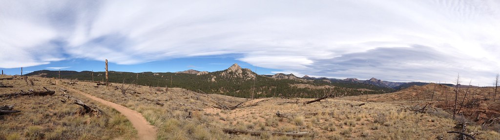 TramwayHiking · ~9 min drivePhoto: rb06, CC BY 2.0 (via Flickr)
- Morrison CreekHiking · ~10 min drivePhoto: rb06, CC BY 2.0 (via Flickr)
- Green MountainHiking · ~8 min drive
- BaldyHiking · ~10 min drivePhoto: rb06, CC BY 2.0 (via Flickr)
- Charlies Cutoff 729Hiking · ~10 min drive
- Gashouse GulchHiking · ~9 min drive
- Buck GulchHiking · ~9 min drive
- CHARLIE'S CUTOFFHiking · ~10 min drive
- Mccurdy ParkHiking · ~11 min drive
- Strawberry JackHiking · ~10 min drive
Best time to visit Rolling Creek
Best months: June–September. Best months have typical highs of 55–85 °F, lows of 30 °F or warmer (32 °F where the station doesn't record snow), at most one snowy day and no more than 12 wet days.
Jan
33° / 9°
Feb
34° / 11°
Mar
41° / 17°
Apr
47° / 23°
May
57° / 31°
Jun
69° / 41°
Jul
74° / 47°
Aug
71° / 45°
Sep
65° / 38°
Oct
54° / 27°
Nov
42° / 18°
Dec
33° / 12°
Typical high / low (°F) and days with rain or snow, 1991–2020. Measured at Divide 4nw, CO, 25.7 mi away at 9,134 ft. The station sits about 1,500 ft lower than this place, so expect it a little cooler here. This station doesn't record snowfall. Source: NOAA NCEI U.S. Climate Normals 1991–2020.

