Sleeping Indian Turnout
About
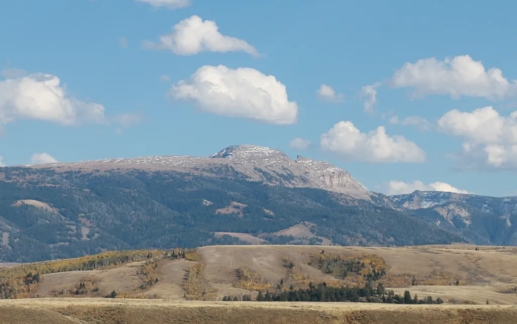
Sleeping Indian turnout along US Highway 89/26/191 gives you sweeping views of both the Teton and Gros Ventre Range. The Gros Ventre Mountains—impressive in their own right—surround the southeast portion of the valley. One peak in the range stands out prominently. Nicknamed "Sleeping Indian", Sheep Mountain is in full view from this turnout. Name Origin The Sleeping Indian is a nickname for Sheep Mountain. Facing east, the long ridge climbs south from the Gros Ventre River rising above tree line as if a person is lying down. Further south, the ridge rises more steeply as a series of limestone cliffs forming the person's crossed arms. A notch forms the neck and chin while the face slopes to the south. Steep limestone cliffs wrap around the face. Some visualize this quite easily; some do not. History In 1925, a large landslide occurred on the north end of Sheep Mountain, damming the Gros Ventre River and forming Lower Slide Lake. In 1927, the natural dam partially failed and a torrent of water flooded across the valley. Six people were killed in Kelly and water was 3 feet deep in Wilson at the base of Teton Pass.
Trail information
Photos
Location
Sleeping Indian Turnout
Wyoming
NPS / public domain
