Potholes Turnout
About
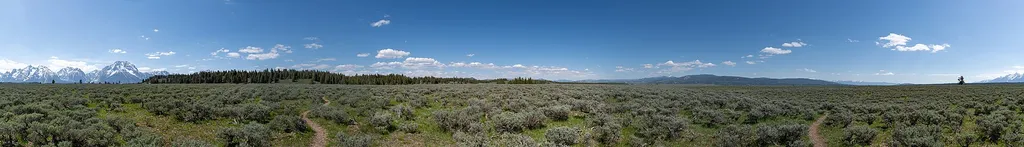
This odd stand of conifer trees took root in a depression within the sagebrush flats. Locals called these depressions "potholes" while other regions of the country call these features "kettles." As ice-age glaciers retreated, blocks of ice dropped from the glacier's face onto the valley floor. Sediment carried by meltwater buried the ice. Later, the ice melted leaving behind a depression. Water may pond in pothole, and spring runoff and wind may carry sediment into the hole. With time, a pothole develops a micro-ecosystem supporting trees and accompanying wildlife-providing a shady respite from the exposure of the sagebrush flats. Name Origin Potholes, also known as kettles, are depressions in the glacial outwash plain. A pothole forms when an ice chunk breaks off a retreating glacier and lands on the plain. Run-off sediments deposit around the ice and may bury the ice. After the ice melts, a depression is left behind. This depression forms a micro-environment trapping moisture and dust allowing trees to take root.
Trail information
Photos
Location
Potholes Turnout
Wyoming
Hansueli Krapf — Wikimedia Commons (CC BY-SA 4.0)
