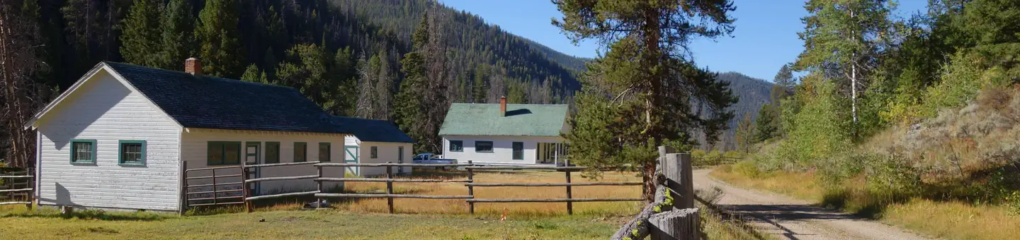
Idaho · Fishing
Fishing in challis, Idaho
Challis sits at the confluence of the Salmon River and Challis Creek in central Idaho, and the fishing around town reflects that geography — this is river country first, with a handful of alpine lakes worth the extra effort to reach.
7 spotsUpdated dailyFree to access
View on mapFishing · 7 spots
Featured spots
All spots · 7 spots
Challis sits at the confluence of the Salmon River and Challis Creek in central Idaho, and the fishing around town reflects that geography — this is river country first, with a handful of alpine lakes worth the extra effort to reach. The Salmon-Cobalt and Challis-Yankee Fork Ranger Districts manage most of the public water here, which means access is generally good if you know where to look. River anglers have several developed put-in points to work from, including Bayhorse Recreation Site and Cottonwood Recreation Site along the Salmon River corridor, while Yellowjacket Guard Station opens up water further into the backcountry. For lake fishing, White Goat Lake and Bull Spring offer a different pace — smaller water, less pressure, and the kind of quiet that's hard to find closer to the highway. The Salmon River in this stretch runs cold and clear through a high desert canyon, and the fish here are wild rather than heavily stocked, so expect technical fishing rather than easy limits. A standard Idaho fishing license is required for all waters in the area, and some backcountry lakes may involve significant hiking. This is a region that rewards anglers who do a little homework before they go.
Frequently asked questions
What species can I expect to catch fishing around Challis?
The Salmon River and its tributaries in this area hold chinook salmon (in season), steelhead, and resident trout including rainbow and bull trout. The alpine lakes like White Goat Lake and Bull Spring typically hold trout as well. Check Idaho Fish and Game regulations before you go, since salmon and steelhead seasons and bag limits change year to year and sometimes mid-season.
When is the best time of year to fish near Challis?
Summer through early fall is the most reliable window for river fishing, once spring runoff settles and the Salmon River drops to fishable levels — typically late June through September. Early mornings and evenings are consistently more productive than midday, especially in July and August when water temperatures climb. For backcountry lakes like White Goat Lake, access may be snow-limited until late June or July depending on the year.
How do I access Bayhorse Recreation Site and Cottonwood Recreation Site?
Both sites are along the Salmon River corridor and are managed under the Challis-Yankee Fork Ranger District. They offer developed river access points, which makes them good starting spots if you're unfamiliar with the area. Road conditions on some forest routes can be rough, so a high-clearance vehicle is worth having if you plan to explore beyond the main highway.
Is the fishing around Challis suitable for beginners?
The developed recreation sites like Bayhorse and Cottonwood are accessible and manageable for newer anglers. The Salmon River itself can be technical — the fish are wild and the water is clear, which means they're spooky and presentation matters. Beginners will have a better time at the lake sites like Bull Spring, where the fishing tends to be more forgiving.
Do I need a guide, or can I fish these waters independently?
All the sites listed are on public land managed by the Forest Service, so independent access is straightforward for most of them. A guide is not required, but if you're targeting salmon or steelhead on the Salmon River for the first time, local knowledge about current runs and holding water makes a real difference. Yellowjacket Guard Station and the backcountry lake approaches are best attempted with a topo map and some trip planning.
Keep exploring — more waters worth the drive
Yellowjacket Guard Station
~33 min drive
A worthwhile stop near Idaho.
Bloody Dick Cabin
~1h 22m drive
A worthwhile stop near Montana.
Salmon River: Stanley Basin
~1h 24m drive
Moderate
Sheep Trail Campground
~1h 24m drive
A worthwhile stop near Idaho.
White Goat Lake
~11 min drive
A worthwhile stop near Idaho.
Trap Creek Campground
~1h 25m drive
A worthwhile stop near Idaho.
Bull Spring
~22 min drive
A worthwhile stop near Idaho.
Elk Creek Campground (sawtooth Nf)
~1h 24m drive
A worthwhile stop near Idaho.
Grouse Creek Lake
~50 min drive
A worthwhile stop near Idaho.
Iron Lake Campground
~19 min drive
A worthwhile stop near Idaho.
Heart Lake
~52 min drive
A worthwhile stop near Idaho.
Cottonwood Recreation Site
~20 min drive
A worthwhile stop near Idaho.
