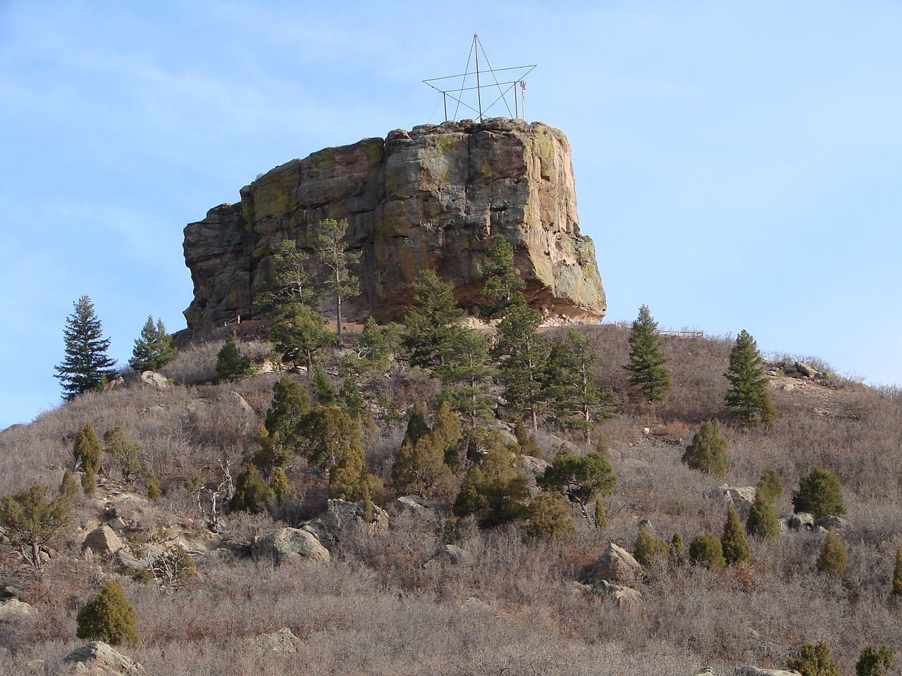
Hiking in Castle Rock, Colorado

Castle Rock sits at the southern edge of the Denver metro, and its trail system punches well above what you'd expect from a town this size.
47 spotsUpdated weeklyFree to access
View on mapHiking · 47 spots
Featured spots
Photo: Shogun_X, CC BY-SA 2.0 (via Flickr)Out & backHiking
Canyon View Nature Trail
Castle Rock, Colorado
 Photo: gregor_y, CC BY-SA 2.0 (via Flickr)
Hiking
Chuck's Loop Trail
Castle Rock, Colorado
 Photo: Patrick McKay, CC BY-SA 3.0 (via Wikimedia Commons)
Hiking
Columbine Open Space North loop
Castle Rock, Colorado
 Photo: glennharper, CC BY-SA 2.0 (via Flickr)Out & back
Hiking
Gold Loop Trail
Castle Rock, Colorado
Photo: glennharper, CC BY-SA 2.0 (via Flickr)Out & backHiking
Gold Loop Trail
Castle Rock, Colorado
All spots · 47 spots
 Out & back
Hiking
Access Path owned by Castle Rock
Castle Rock, Colorado
 Out & back
Hiking
Arterial path
Castle Rock, Colorado
 Lollipop
Hiking
Blue Loop Trail
Castle Rock, Colorado
 Out & back
Hiking
Blue Loop Trail
Castle Rock, Colorado
 Loop
Hiking
Blue Loop Trail
Castle Rock, Colorado
Out & backHiking
Bob's Trail
Castle Rock, Colorado
Out & backHiking
Cobblestone Overlook Trail
Castle Rock, Colorado
Hiking
Coyote Run Loop
Castle Rock, Colorado
LoopHiking
Cyclocross Course Trail
Castle Rock, Colorado
Hiking
Dawson Butte Trail
Castle Rock, Colorado
Out & backHiking
Founder's Vista Trail
Castle Rock, Colorado
LoopHiking
Green Loop Trail
Castle Rock, Colorado
Hiking
Green Loop Trail
Castle Rock, Colorado

Hiking
Gus' Gultch Trail
Castle Rock, Colorado
 Photo: jaygannett, CC BY-SA 2.0 (via Flickr)
Hiking
Hidden Mesa - Mesa Rim Loop
Castle Rock, Colorado
Out & backHiking
John Emerson Summit Trail
Castle Rock, Colorado
 Out & back
Hiking
Juniper Tree Trail
Castle Rock, Colorado
Photo: Shogun_X, CC BY-SA 2.0 (via Flickr)Out & backHiking
Lake Gulch Trail
Castle Rock, Colorado
Photo: gregor_y, CC BY-SA 2.0 (via Flickr)Out & backHiking
Legacy Trail
Castle Rock, Colorado
Out & backHiking
Loop Path
Castle Rock, Colorado
Out & backHiking
Lucas' Trail
Castle Rock, Colorado
Out & backHiking
Madge Trail
Castle Rock, Colorado
LoopHiking
Memmen Ridge Open Space Trail
Castle Rock, Colorado
Out & backHiking
Memmen Ridge Open Space Trail
Castle Rock, Colorado
Castle Rock sits at the southern edge of the Denver metro, and its trail system punches well above what you'd expect from a town this size. The 132 hiking listings here range from the flat, paved 1-Mile Sidewalk Loop to more sustained efforts like the John Emerson Summit Trail, with a solid middle tier of color-coded loop trails — Red, Blue, Green, Gold, and Yellow — that wind through open space and scrubby ponderosa terrain. Mitchell Creek Canyon Trail and Madge Trail offer some of the more scenic canyon walking in the area, while Memmen Ridge Open Space Trail and Rosemary's Ridge Trail push into higher, more exposed ground with wider views. Most trails are well-marked and maintained by the town's parks department, which means trailheads are generally easy to find and parking is reasonable outside of weekend midmornings. The terrain is high plains transitioning into foothills — expect rocky singletrack, some loose gravel on descents, and afternoon thunderstorms in summer that roll in fast. Elevation here sits above 6,200 feet, so visitors coming from lower altitudes should plan for the adjustment. Whether you have 45 minutes or half a day, there's a realistic option on this list for you.
Frequently asked questions
What are the easiest trails in Castle Rock for beginners or families with young kids?
The Gold Loop Trail, Chuck's Loop Trail, Red Loop Trail, and Mitchell Creek Canyon Trail are all listed as easy difficulty and are good starting points. The 1-Mile Sidewalk Loop is also a low-barrier option if you want a flat, paved route with minimal elevation change.
When is the best time of day to hike in Castle Rock?
Early morning is your best bet, especially from June through August. Castle Rock sits above 6,200 feet and gets intense afternoon sun, and summer thunderstorms typically build by early afternoon. Starting by 7 or 8 a.m. gets you off exposed ridgelines like Memmen Ridge and Rosemary's Ridge before conditions deteriorate.
Are the trails hikeable year-round?
Most of them are, but winter conditions vary. Snow and ice on rocky singletrack — common on trails like Mitchell Creek Trail and the color-coded loop trails — make microspikes worth carrying from November through March. Spring can also bring muddy, soft conditions that damage trail surfaces, so check local trail status before heading out after a wet stretch.
Do I need a permit or pass to hike in Castle Rock?
The town-managed open space trails, including Memmen Ridge Open Space Trail and the loop trail system, are generally free to access with no permit required. Parking at busier trailheads can fill up on weekend mornings, so arriving early is a practical workaround rather than a permit issue.
What gear should I bring for a half-day hike here?
Bring more water than you think you need — the altitude and dry Colorado air accelerate dehydration. Sun protection is essential even on overcast days. Trekking poles help on the rockier descents found on trails like Newlin's Gold Trail and One-Way Uphill. A light rain layer in your pack is smart from May through September given how quickly afternoon storms develop.
Keep exploring — more trails worth the drive
Photo: glennharper, CC BY-SA 2.0 (via Flickr)Gold Loop Trail
~4 min drive
1.24-mile out-and-back trail in Colorado with 375 ft elevation gain.
Photo: gregor_y, CC BY-SA 2.0 (via Flickr)Chuck's Loop Trail
~4 min drive
1.62-mile loop trail in Colorado with 200 ft elevation gain.
Photo: gregor_y, CC BY-SA 2.0 (via Flickr)Legacy Trail
~4 min drive
1.28-mile out-and-back hike in Colorado with 425 ft elevation gain
Photo: glennharper, CC BY-SA 2.0 (via Flickr)Red Loop Trail
~4 min drive
1.72-mile trail in Colorado with 200 ft elevation gain.
Photo: glennharper, CC BY-SA 2.0 (via Flickr)Gold Loop Trail
~5 min drive
0.72-mile out-and-back trail in Colorado with 212 ft elevation gain.
Photo: jaygannett, CC BY-SA 2.0 (via Flickr)Hidden Mesa - Mesa Rim Loop
~5 min drive
1.68-mile loop on Hidden Mesa with 200 ft elevation gain.
Photo: jaygannett, CC BY-SA 2.0 (via Flickr)Pleasant Pass Trail
~5 min drive
1.24-mile hike in Colorado with 400 ft elevation gain.
Photo: gregor_y, CC BY-SA 2.0 (via Flickr)Mitchell Creek Canyon Trail
~5 min drive
1.10-mile trail in Colorado with 300 ft gain, crosses creeks and slippery rocks
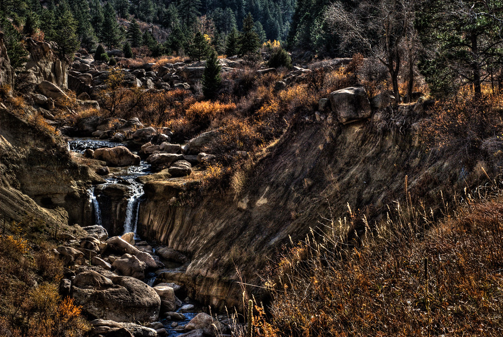 Photo: mason bryant, CC BY-SA 2.0 (via Flickr)
Cherry Creek Trail
~8 min drive
1.54-mile out-and-back trail in Colorado with 321 ft elevation gain
Photo: mason bryant, CC BY-SA 2.0 (via Flickr)Inner Canyon Trail
~10 min drive
0.66-mile out-and-back hike in Colorado with 250 ft elevation gain.
Photo: mason bryant, CC BY-SA 2.0 (via Flickr)Rimrock Trail
~10 min drive
1.30-mile trail in Colorado with 200 ft elevation gain.
Photo: Shogun_X, CC BY-SA 2.0 (via Flickr)Inner Canyon Trail
~11 min drive
0.6-mile out-and-back trail in Colorado with 298 ft gain.