Many Parks Curve
About
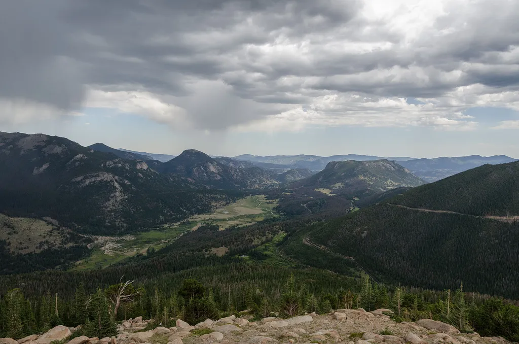
Get panoramic views of Rocky Mountain National Park! Along the Trail Ridge Road, use this pull out to see a scenic vista of ‘many parks’, meaning low-land meadows. Moraine Park, Upper Beaver Meadows, and Horseshoe Park meadows are visible with a backdrop of Deer Mountain and Longs Peak. Help keep wildlife wild. Never approach or feed wildlife. Animals that learn people are a source of food can become aggressive or stop hunting or foraging on their own. Keep your distance - it's the law! You could be hurt or issued a fine. Note: Trail Ridge Road closes from here west to Colorado River Trailhead mid-October to Memorial Day. Extreme weather can change the status of Trail Ridge Road at any time—be ready to adjust your travel plans if needed, and always check the weather before you start your drive. Altitude Warning: Altitude sickness affects many visitors every year. Symptoms include headache, nausea, fatigue, dizziness, vomiting, and even unconsciousness. Altitude can also aggravate pre-existing conditions like heart and lung disease. Take your time, drink water, eat, and rest. The only cure for altitude sickness is to go down to a lower altitude.
Trail information
Photos
Location
Many Parks Curve
Colorado
DXR — Wikimedia Commons (CC BY-SA 4.0)
